Property Record
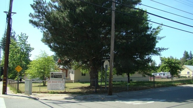
6637 Grant Ave, Carmichael, CA 95608


Property Detail
6637 Grant Ave
260-0120-034
S 198 FT OF E 293 FT TRACT 101 CARMICHAEL COLONY
Religious
Sacramento
RD-2 (NPA)
California
B and X Area of moderate flood hazard, usually the area between the limits of the 100-year and 500-year floods.
101
2024
1.33 AC
2025
Carmichael/Fair Oaks
007801
Sacramento
5,560 SF
Sacramento-Roseville-Folsom, CA
NEARBY LISTINGS FOR SALE OR LEASE
-
-
View all Carmichael listings for sale on LoopNet.com
DEMOGRAPHICS near 6637 Grant Ave
1 mile
3 mile
5 mile
2025 Total Population
11,185
133,019
344,548
2030 Population
11,273
134,253
347,926
Pop Growth 2025-2030
+ 0.79%
+ 0.93%
+ 0.98%
Average Age
43
42
41
2025 Total Households
4,692
52,887
133,628
HH Growth 2025-2030
+ 0.79%
+ 0.96%
+ 0.99%
Median Household Inc
$101,771
$90,062
$85,115
Avg Household Size
2.30
2.40
2.50
2025 Avg HH Vehicles
2.00
2.00
2.00
Median Home Value
$697,976
$541,288
$499,831
Median Year Built
1973
1971
1973
Nearby Places
Map Layers
Map Styles
 Street
 Aerial
Layers
 Traffic
 Biking
Places
Listings with unknown addresses are not visible on the map
- Restaurants
- Banks
- Shops
- Fitness
- Groceries
PUBLIC TRANSPORTATION
AIRPORT
Sacramento International
Drive
Walk
Distance
Sacramento International
34 min
20.9 mi
Freight Ports
Port of Stockton
Drive
Walk
Distance
Port of Stockton
75 min
59.6 mi
Nearby Properties
Address
Land Use
TOTAL SIZE
Lot Size
Zoning
Address
Land Use
TOTAL SIZE
Lot Size
Zoning
512,630 SF
37.68 AC
SPA (NPA)
Address
Land Use
TOTAL SIZE
Lot Size
Zoning
7.94 AC
RD-25
Address
Land Use
TOTAL SIZE
Lot Size
Zoning
212,037 SF
17.20 AC
BP
Address
Land Use
TOTAL SIZE
Lot Size
Zoning
145,334 SF
8.84 AC
RD-20
Address
Land Use
TOTAL SIZE
Lot Size
Zoning
75,700 SF
4.02 AC
RD-40
Address
Land Use
TOTAL SIZE
Lot Size
Zoning
21,890 SF
0.50 AC
SC
Address
Land Use
TOTAL SIZE
Lot Size
Zoning
99,408 SF
3.53 AC
BP
Address
Land Use
TOTAL SIZE
Lot Size
Zoning
12,548 SF
14.36 AC
RD-30
Address
Land Use
TOTAL SIZE
Lot Size
Zoning
140,102 SF
3.30 AC
RD-20
Address
Land Use
TOTAL SIZE
Lot Size
Zoning
89,098 SF
4.93 AC
RD-40
Address
Land Use
TOTAL SIZE
Lot Size
Zoning
72,119 SF
2.38 AC
BP (NPA)
Address
Land Use
TOTAL SIZE
Lot Size
Zoning
112,244 SF
3.55 AC
GC
Address
Land Use
TOTAL SIZE
Lot Size
Zoning
1,484 SF
4.94 AC
RD-20
Address
Land Use
TOTAL SIZE
Lot Size
Zoning
218,823 SF
10.77 AC
HDR
Address
Land Use
TOTAL SIZE
Lot Size
Zoning
115,593 SF
6.31 AC
OPMU
Address
Land Use
TOTAL SIZE
Lot Size
Zoning
85,320 SF
4 AC
SPA
Address
Land Use
TOTAL SIZE
Lot Size
Zoning
90,972 SF
2.36 AC
RD-40
Address
Land Use
TOTAL SIZE
Lot Size
Zoning
105,703 SF
4.75 AC
RD-30 BP
Address
Land Use
TOTAL SIZE
Lot Size
Zoning
195,702 SF
3.66 AC
GC
Address
Land Use
TOTAL SIZE
Lot Size
Zoning
2.43 AC
GC
Address
Land Use
TOTAL SIZE
Lot Size
Zoning
135,053 SF
6.66 AC
LC SC RD-4
Address
Land Use
TOTAL SIZE
Lot Size
Zoning
137,939 SF
5.25 AC
CMU (FBSP)
Address
Land Use
TOTAL SIZE
Lot Size
Zoning
157,500 SF
12.91 AC
OPMU
Address
Land Use
TOTAL SIZE
Lot Size
Zoning
110,533 SF
4.17 AC
RD-5 RD-40
Address
Land Use
TOTAL SIZE
Lot Size
Zoning
64,250 SF
2.38 AC
OPMU
Address
Land Use
TOTAL SIZE
Lot Size
Zoning
166,300 SF
8.04 AC
RD-40 RD-2
Address
Land Use
TOTAL SIZE
Lot Size
Zoning
4 AC
M-2 (NPA)
Address
Land Use
TOTAL SIZE
Lot Size
Zoning
103,414 SF
5.01 AC
RD-30
Address
Land Use
TOTAL SIZE
Lot Size
Zoning
67,724 SF
9.73 AC
SPA
Address
Land Use
TOTAL SIZE
Lot Size
Zoning
81,280 SF
13.51 AC
OIMU (FBSP
The World's #1 Commercial Real Estate Marketplace
Connect with us
© 2026 CoStar Group
The information above has been obtained from sources believed reliable. While we do not doubt its accuracy we have not verified it and make no guarantee, warranty or representation about it. It is your responsibility to independently confirm its accuracy and completeness. Any projections, opinions, assumptions, or estimates used are for example only and do not represent the current or future performance of the property. The value of this transaction to you depends on tax and other factors which should be evaluated by your tax, financial, and legal advisors. You and your advisors should conduct a careful, independent investigation of the property to determine to your satisfaction the suitability of the property for your needs.