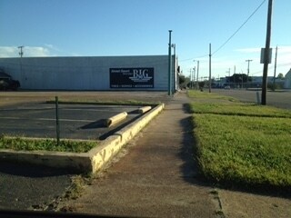
Property Record
664 S State St, Jackson, MS 39201


NEARBY LISTINGS FOR SALE OR LEASE
Property Detail
664 S State St
Jackson, MS
Shelton Sub
0195-0013-001
BEG NW COR LOT 2 DAVID SHELTON SUBN OF 2 AC LOT 3 S J S 136 FT E 181 FT N/LY 138 FT W 201 FT TO POB BEING ALL LOTS 2 & 3 & PT LOTS 1 & 4 DAVID SHELTON SUBN OF 2 AC LOT 3 S J
Charitableorganization
Hinds
X
Mississippi
28049C0316J
2,3
2024
0.54 AC
2025
Downtown Jackson
002700
Jackson
22,956 SF
DEMOGRAPHICS near 664 S State St
1 Mile
3 Mile
5 Mile
2024 Total Population
1,576
32,485
104,932
2029 Population
1,565
31,868
102,799
Pop Growth 2024-2029
(0.70%)
(1.90%)
(2.03%)
Average Age
41
37
38
2024 Total Households
805
13,527
43,509
HH Growth 2024-2029
+ 0.12%
(2.02%)
(2.19%)
Median Household Inc
$44,649
$28,484
$32,987
Avg Household Size
1.60
2.10
2.30
2024 Avg HH Vehicles
1.00
1.00
2.00
Median Home Value
$63,445
$73,231
$83,874
Median Year Built
1996
1962
1966
Nearby Places
Map Layers
Map Styles
 Street
 Aerial
- Restaurants
- Banks
- Shops
- Fitness
- Groceries
PUBLIC TRANSPORTATION
COMMUTER RAIL
Jackson (City of New Orleans - Amtrak)
DRIVE
WALK
Distance
Jackson (City of New Orleans - Amtrak)
2 min
20 min
1.1 mi
AIRPORT
Jackson-Medgar Wiley Evers International
DRIVE
WALK
Distance
Jackson-Medgar Wiley Evers International
19 min
11.4 mi
Freight Ports
Port of Greater Baton Rouge
DRIVE
WALK
Distance
Port of Greater Baton Rouge
196 min
175.8 mi
SALE & LEASE HISTORY
LISTING DATE
SALE/LEASE

Sep 24, 2016
For Sale
Nearby Properties
Address
Land Use
TOTAL SIZE
Lot Size
Zoning
Address
Land Use
TOTAL SIZE
Lot Size
Zoning
435,199 SF
1.83 AC
Address
Land Use
TOTAL SIZE
Lot Size
Zoning
560,993 SF
47 AC
Address
Land Use
TOTAL SIZE
Lot Size
Zoning
74,923 SF
0.01 AC
Address
Land Use
TOTAL SIZE
Lot Size
Zoning
9,650 SF
0.55 AC
Address
Land Use
TOTAL SIZE
Lot Size
Zoning
7.60 AC
Address
Land Use
TOTAL SIZE
Lot Size
Zoning
Address
Land Use
TOTAL SIZE
Lot Size
Zoning
145,789 SF
6 AC
Address
Land Use
TOTAL SIZE
Lot Size
Zoning
206,400 SF
7.96 AC
Address
Land Use
TOTAL SIZE
Lot Size
Zoning
40,445 SF
3 AC
Address
Land Use
TOTAL SIZE
Lot Size
Zoning
51,260 SF
1.58 AC
Address
Land Use
TOTAL SIZE
Lot Size
Zoning
413,174 SF
2 AC
Address
Land Use
TOTAL SIZE
Lot Size
Zoning
40,148 SF
37.47 AC
Address
Land Use
TOTAL SIZE
Lot Size
Zoning
96,444 SF
0.88 AC
Address
Land Use
TOTAL SIZE
Lot Size
Zoning
247,574 SF
0.94 AC
Address
Land Use
TOTAL SIZE
Lot Size
Zoning
115,200 SF
0.35 AC
Address
Land Use
TOTAL SIZE
Lot Size
Zoning
45,186 SF
0.15 AC
Address
Land Use
TOTAL SIZE
Lot Size
Zoning
17,261 SF
18.20 AC
Address
Land Use
TOTAL SIZE
Lot Size
Zoning
123,308 SF
20.88 AC
Address
Land Use
TOTAL SIZE
Lot Size
Zoning
46,958 SF
0.77 AC
Address
Land Use
TOTAL SIZE
Lot Size
Zoning
30,925 SF
38.73 AC
Address
Land Use
TOTAL SIZE
Lot Size
Zoning
32,886 SF
1.07 AC
Address
Land Use
TOTAL SIZE
Lot Size
Zoning
31,541 SF
4 AC
Address
Land Use
TOTAL SIZE
Lot Size
Zoning
2,190,610 SF
2 AC
Address
Land Use
TOTAL SIZE
Lot Size
Zoning
47,885 SF
0.01 AC
Address
Land Use
TOTAL SIZE
Lot Size
Zoning
69,034 SF
0.64 AC
Address
Land Use
TOTAL SIZE
Lot Size
Zoning
9,081 SF
0.73 AC
Address
Land Use
TOTAL SIZE
Lot Size
Zoning
55,591 SF
1.01 AC
Address
Land Use
TOTAL SIZE
Lot Size
Zoning
15,374 SF
0.64 AC
Address
Land Use
TOTAL SIZE
Lot Size
Zoning
0.01 AC
Address
Land Use
TOTAL SIZE
Lot Size
Zoning
42,520 SF
0.22 AC
The World's #1 Commercial Real Estate Marketplace
Connect with us
© 2025 CoStar Group
The information above has been obtained from sources believed reliable. While we do not doubt its accuracy we have not verified it and make no guarantee, warranty or representation about it. It is your responsibility to independently confirm its accuracy and completeness. Any projections, opinions, assumptions, or estimates used are for example only and do not represent the current or future performance of the property. The value of this transaction to you depends on tax and other factors which should be evaluated by your tax, financial, and legal advisors. You and your advisors should conduct a careful, independent investigation of the property to determine to your satisfaction the suitability of the property for your needs.