Property Record
665 12Th Ave Nw, West Fargo, ND 58078

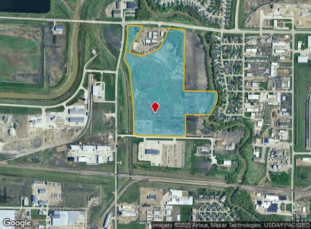
This Property Is For Sale
NEARBY LISTINGS FOR SALE OR LEASE
Property Detail
665 12Th Ave Nw
Fargo, ND-MN
LOT: 1 BLOCK: 1 ADDITION: STOCKYARDS 1ST ADDITION ADDITIONAL: STOCKYARDS 1ST ADDN LT 1 BLK 1 **9-9-22 PLATTED FRM 02-3000-02220-000 & 02-3000-02211-000 PER PLAT DOC#1673921 FOR 2022
02-3850-00010-000
Cass
Miscellaneous
North Dakota
2024
1
2024
Fargo
010205
Other Market Areas
DEMOGRAPHICS near 665 12Th Ave Nw
1 Mile
3 Mile
5 Mile
2024 Total Population
1,335
22,430
77,228
2029 Population
1,423
23,954
82,648
Pop Growth 2024-2029
+ 6.59%
+ 6.79%
+ 7.02%
Average Age
37
39
35
2024 Total Households
499
9,431
33,292
HH Growth 2024-2029
+ 7.01%
+ 7.23%
+ 7.70%
Median Household Inc
$105,388
$75,937
$64,108
Avg Household Size
2.70
2.30
2.20
2024 Avg HH Vehicles
2.00
2.00
2.00
Median Home Value
$317,045
$235,799
$254,545
Median Year Built
1998
1991
2000
Nearby Places
Map Layers
Map Styles
 Street
 Aerial
- Restaurants
- Banks
- Shops
- Fitness
- Groceries
PUBLIC TRANSPORTATION
COMMUTER RAIL
Fargo Amtrak Station (Empire Builder - Amtrak)
DRIVE
WALK
Distance
Fargo Amtrak Station (Empire Builder - Amtrak)
15 min
7.4 mi
AIRPORT
Hector International
DRIVE
WALK
Distance
Hector International
18 min
8.9 mi
Freight Ports
Port Milwaukee
DRIVE
WALK
Distance
Port Milwaukee
639 min
579.3 mi
Nearby Properties
Address
Land Use
TOTAL SIZE
Lot Size
Zoning
Address
Land Use
TOTAL SIZE
Lot Size
Zoning
122,006 SF
24.45 AC
GI
Address
Land Use
TOTAL SIZE
Lot Size
Zoning
230,272 SF
21.77 AC
GC
Address
Land Use
TOTAL SIZE
Lot Size
Zoning
175,969 SF
35.10 AC
GI
Address
Land Use
TOTAL SIZE
Lot Size
Zoning
163,195 SF
11.95 AC
GC
Address
Land Use
TOTAL SIZE
Lot Size
Zoning
Address
Land Use
TOTAL SIZE
Lot Size
Zoning
37.39 AC
Address
Land Use
TOTAL SIZE
Lot Size
Zoning
206,540 SF
16.68 AC
GI
Address
Land Use
TOTAL SIZE
Lot Size
Zoning
190,588 SF
6.32 AC
Address
Land Use
TOTAL SIZE
Lot Size
Zoning
218,579 SF
21.28 AC
GC
Address
Land Use
TOTAL SIZE
Lot Size
Zoning
49.50 AC
Address
Land Use
TOTAL SIZE
Lot Size
Zoning
152,508 SF
13.85 AC
GI
Address
Land Use
TOTAL SIZE
Lot Size
Zoning
15,895 SF
41.76 AC
Address
Land Use
TOTAL SIZE
Lot Size
Zoning
184,560 SF
17.11 AC
Address
Land Use
TOTAL SIZE
Lot Size
Zoning
135,235 SF
6.01 AC
GC
Address
Land Use
TOTAL SIZE
Lot Size
Zoning
99,300 SF
12.72 AC
Address
Land Use
TOTAL SIZE
Lot Size
Zoning
Address
Land Use
TOTAL SIZE
Lot Size
Zoning
207,189 SF
23.72 AC
Address
Land Use
TOTAL SIZE
Lot Size
Zoning
Address
Land Use
TOTAL SIZE
Lot Size
Zoning
79,310 SF
17.79 AC
Address
Land Use
TOTAL SIZE
Lot Size
Zoning
354,677 SF
13.13 AC
Address
Land Use
TOTAL SIZE
Lot Size
Zoning
122,750 SF
14.27 AC
GI
Address
Land Use
TOTAL SIZE
Lot Size
Zoning
101,324 SF
7.12 AC
LI
Address
Land Use
TOTAL SIZE
Lot Size
Zoning
156,450 SF
14.92 AC
Address
Land Use
TOTAL SIZE
Lot Size
Zoning
240,766 SF
15.14 AC
Address
Land Use
TOTAL SIZE
Lot Size
Zoning
90,920 SF
13.88 AC
GI
Address
Land Use
TOTAL SIZE
Lot Size
Zoning
131,360 SF
4.52 AC
Address
Land Use
TOTAL SIZE
Lot Size
Zoning
141,474 SF
16.03 AC
GC
Address
Land Use
TOTAL SIZE
Lot Size
Zoning
Address
Land Use
TOTAL SIZE
Lot Size
Zoning
18,432 SF
1.01 AC
MR3
Address
Land Use
TOTAL SIZE
Lot Size
Zoning
180,000 SF
10.73 AC
The World's #1 Commercial Real Estate Marketplace
Connect with us
© 2026 CoStar Group
The information above has been obtained from sources believed reliable. While we do not doubt its accuracy we have not verified it and make no guarantee, warranty or representation about it. It is your responsibility to independently confirm its accuracy and completeness. Any projections, opinions, assumptions, or estimates used are for example only and do not represent the current or future performance of the property. The value of this transaction to you depends on tax and other factors which should be evaluated by your tax, financial, and legal advisors. You and your advisors should conduct a careful, independent investigation of the property to determine to your satisfaction the suitability of the property for your needs.