Property Record
665 Mainstream Dr, Nashville, TN 37228


NEARBY LISTINGS FOR SALE OR LEASE
Property Detail
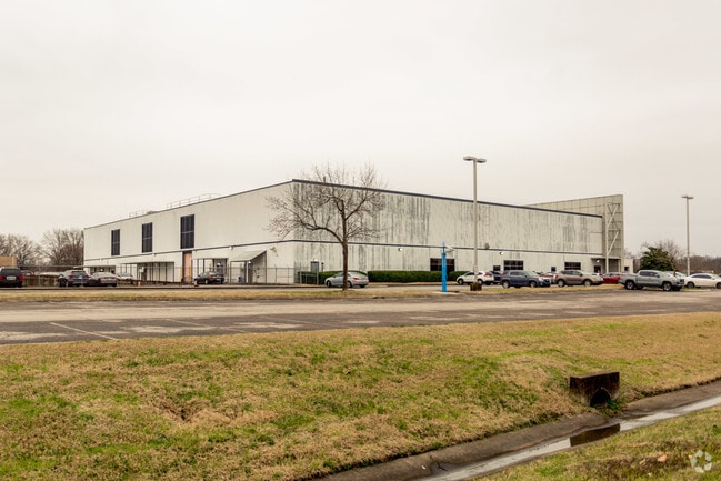
665 Mainstream Dr
Nashville-Davidson--Murfreesboro--Franklin, TN
Metrocenter Section 12
070-14-0-004
LOT 37D METROCENTER TRACT 37D SEC 12
Officebuilding
Davidson
AE
Tennessee
47037C0229H
37d
0
11.42 AC
2025
North
013702
Nashville
55,073 SF
DEMOGRAPHICS near 665 Mainstream Dr
1 Mile
3 Mile
5 Mile
2024 Total Population
7,392
74,608
214,466
2029 Population
7,510
76,696
218,669
Pop Growth 2024-2029
+ 1.60%
+ 2.80%
+ 1.96%
Average Age
38
36
36
2024 Total Households
3,025
32,378
96,264
HH Growth 2024-2029
+ 1.72%
+ 3.33%
+ 2.26%
Median Household Inc
$42,086
$54,741
$61,137
Avg Household Size
2.20
2.10
2.00
2024 Avg HH Vehicles
2.00
1.00
1.00
Median Home Value
$297,585
$353,368
$412,739
Median Year Built
1981
2004
2000
Nearby Places
Map Layers
Map Styles
 Street
 Aerial
- Restaurants
- Banks
- Shops
- Fitness
- Groceries
PUBLIC TRANSPORTATION
COMMUTER RAIL
Riverfront (East Corridor Line - Tennessee Regional Transportation Authority Music City Star (Music City Star))
DRIVE
WALK
Distance
Riverfront (East Corridor Line - Tennessee Regional Transportation Authority Music City Star (Music City Star))
10 min
4.6 mi
AIRPORT
Nashville International
DRIVE
WALK
Distance
Nashville International
22 min
13.5 mi
Freight Ports
Port of Mobile
DRIVE
WALK
Distance
Port of Mobile
491 min
449.4 mi
Nearby Properties
Address
Land Use
TOTAL SIZE
Lot Size
Zoning
Address
Land Use
TOTAL SIZE
Lot Size
Zoning
220,779 SF
2.93 AC
DTC
Address
Land Use
TOTAL SIZE
Lot Size
Zoning
18,446 SF
5.97 AC
DTC
Address
Land Use
TOTAL SIZE
Lot Size
Zoning
148,222 SF
25.86 AC
MULTI-ZONE
Address
Land Use
TOTAL SIZE
Lot Size
Zoning
6.35 AC
MULTI-ZONE
Address
Land Use
TOTAL SIZE
Lot Size
Zoning
30.16 AC
MULTI-ZONE
Address
Land Use
TOTAL SIZE
Lot Size
Zoning
208,992 SF
6.09 AC
MUG
Address
Land Use
TOTAL SIZE
Lot Size
Zoning
35,620 SF
8.86 AC
IG
Address
Land Use
TOTAL SIZE
Lot Size
Zoning
4.23 AC
DTC
Address
Land Use
TOTAL SIZE
Lot Size
Zoning
4.89 AC
DTC
Address
Land Use
TOTAL SIZE
Lot Size
Zoning
255,425 SF
1.88 AC
MULTIZONE
Address
Land Use
TOTAL SIZE
Lot Size
Zoning
242,672 SF
16.30 AC
MULTI-ZONE
Address
Land Use
TOTAL SIZE
Lot Size
Zoning
237,557 SF
1.67 AC
MULTIZONE
Address
Land Use
TOTAL SIZE
Lot Size
Zoning
576,252 SF
29,096 AC
DTC
Address
Land Use
TOTAL SIZE
Lot Size
Zoning
515,541 SF
4.83 AC
DTC
Address
Land Use
TOTAL SIZE
Lot Size
Zoning
267,538 SF
1.78 AC
MULTI-ZONE
Address
Land Use
TOTAL SIZE
Lot Size
Zoning
226,184 SF
10.01 AC
IWD
Address
Land Use
TOTAL SIZE
Lot Size
Zoning
538,947 SF
32,148 AC
DTC
Address
Land Use
TOTAL SIZE
Lot Size
Zoning
36,716 SF
2.42 AC
DTC
Address
Land Use
TOTAL SIZE
Lot Size
Zoning
4.14 AC
DTC
Address
Land Use
TOTAL SIZE
Lot Size
Zoning
440,676 SF
7.33 AC
SP
Address
Land Use
TOTAL SIZE
Lot Size
Zoning
2.20 AC
DTC
Address
Land Use
TOTAL SIZE
Lot Size
Zoning
398,306 SF
1.13 AC
MULTIZONE
Address
Land Use
TOTAL SIZE
Lot Size
Zoning
3.83 AC
DTC
Address
Land Use
TOTAL SIZE
Lot Size
Zoning
3.67 AC
DTC
Address
Land Use
TOTAL SIZE
Lot Size
Zoning
2.19 AC
DTC
Address
Land Use
TOTAL SIZE
Lot Size
Zoning
226,728 SF
10.15 AC
MUG-A
Address
Land Use
TOTAL SIZE
Lot Size
Zoning
178,790 SF
4.74 AC
SP
Address
Land Use
TOTAL SIZE
Lot Size
Zoning
25,872 SF
13.31 AC
MUL
Address
Land Use
TOTAL SIZE
Lot Size
Zoning
542,333 SF
4.53 AC
MULTIZONE
The World's #1 Commercial Real Estate Marketplace
Connect with us
© 2025 CoStar Group
The information above has been obtained from sources believed reliable. While we do not doubt its accuracy we have not verified it and make no guarantee, warranty or representation about it. It is your responsibility to independently confirm its accuracy and completeness. Any projections, opinions, assumptions, or estimates used are for example only and do not represent the current or future performance of the property. The value of this transaction to you depends on tax and other factors which should be evaluated by your tax, financial, and legal advisors. You and your advisors should conduct a careful, independent investigation of the property to determine to your satisfaction the suitability of the property for your needs.