Property Record
665 San Rodolfo Dr, Solana Beach, CA 92075


NEARBY LISTINGS FOR SALE OR LEASE
Property Detail
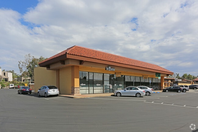
665 San Rodolfo Dr
263-421-14
County Of San Diego Tract 3580
Regionalshoppingcenterormallwithanchorstore
PAR 4 TR PM18513
X
San Diego
06073C1307H
California
2025
8.23 AC
2025
Del Mar/S Bch/Rho SF
017308
San Diego
99,999 SF
San Diego-Carlsbad, CA
DEMOGRAPHICS near 665 San Rodolfo Dr
1 Mile
3 Mile
5 Mile
2024 Total Population
12,457
40,872
123,431
2029 Population
12,613
40,856
122,821
Pop Growth 2024-2029
+ 1.25%
(0.04%)
(0.49%)
Average Age
45
45
43
2024 Total Households
5,440
17,193
48,213
HH Growth 2024-2029
+ 1.32%
+ 0.04%
(0.54%)
Median Household Inc
$118,937
$142,089
$153,912
Avg Household Size
2.30
2.30
2.50
2024 Avg HH Vehicles
2.00
2.00
2.00
Median Home Value
$1,127,892
$1,122,527
$1,105,065
Median Year Built
1976
1977
1983
Nearby Places
Map Layers
Map Styles
 Street
 Aerial
- Restaurants
- Banks
- Shops
- Fitness
- Groceries
PUBLIC TRANSPORTATION
COMMUTER RAIL
Solana Beach (Coaster - San Diego North County Transit District (Coaster/Sprinter/Breeze))
DRIVE
WALK
Distance
Solana Beach (Coaster - San Diego North County Transit District (Coaster/Sprinter/Breeze))
3 min
1.1 mi
Encinitas (Coaster - San Diego North County Transit District (Coaster/Sprinter/Breeze))
DRIVE
WALK
Distance
Encinitas (Coaster - San Diego North County Transit District (Coaster/Sprinter/Breeze))
8 min
5.3 mi
AIRPORT
San Diego International
DRIVE
WALK
Distance
San Diego International
26 min
20.0 mi
Freight Ports
Port of San Diego
DRIVE
WALK
Distance
Port of San Diego
32 min
24.5 mi
Nearby Properties
Address
Land Use
TOTAL SIZE
Lot Size
Zoning
Address
Land Use
TOTAL SIZE
Lot Size
Zoning
70,334 SF
9.92 AC
CC-1-3
Address
Land Use
TOTAL SIZE
Lot Size
Zoning
84,312 SF
2.92 AC
C
Address
Land Use
TOTAL SIZE
Lot Size
Zoning
71,369 SF
4.99 AC
CC-1-3
Address
Land Use
TOTAL SIZE
Lot Size
Zoning
4.46 AC
RR1
Address
Land Use
TOTAL SIZE
Lot Size
Zoning
91,869 SF
1.72 AC
C
Address
Land Use
TOTAL SIZE
Lot Size
Zoning
71,644 SF
2.18 AC
C
Address
Land Use
TOTAL SIZE
Lot Size
Zoning
5.63 AC
CV-1-1
Address
Land Use
TOTAL SIZE
Lot Size
Zoning
98,636 SF
10.35 AC
CC-1-3
Address
Land Use
TOTAL SIZE
Lot Size
Zoning
16.89 AC
MHRd
Address
Land Use
TOTAL SIZE
Lot Size
Zoning
4.31 AC
OP
Address
Land Use
TOTAL SIZE
Lot Size
Zoning
2.26 AC
LI
Address
Land Use
TOTAL SIZE
Lot Size
Zoning
59,065 SF
3.06 AC
C
Address
Land Use
TOTAL SIZE
Lot Size
Zoning
5.49 AC
R15
Address
Land Use
TOTAL SIZE
Lot Size
Zoning
6.96 AC
R15
Address
Land Use
TOTAL SIZE
Lot Size
Zoning
9.41 AC
R15
Address
Land Use
TOTAL SIZE
Lot Size
Zoning
5.80 AC
C
Address
Land Use
TOTAL SIZE
Lot Size
Zoning
71,403 SF
4.22 AC
C
Address
Land Use
TOTAL SIZE
Lot Size
Zoning
10,164 SF
3.52 AC
R1
Address
Land Use
TOTAL SIZE
Lot Size
Zoning
89,168 SF
6.90 AC
RM-3-7
Address
Land Use
TOTAL SIZE
Lot Size
Zoning
13.20 AC
ROW
Address
Land Use
TOTAL SIZE
Lot Size
Zoning
72,800 SF
3.62 AC
CVPD-MF2
Address
Land Use
TOTAL SIZE
Lot Size
Zoning
3.44 AC
HRd
Address
Land Use
TOTAL SIZE
Lot Size
Zoning
69,484 SF
173.79 AC
A70
Address
Land Use
TOTAL SIZE
Lot Size
Zoning
35,850 SF
2.32 AC
C
Address
Land Use
TOTAL SIZE
Lot Size
Zoning
14.57 AC
RR2
Address
Land Use
TOTAL SIZE
Lot Size
Zoning
90,028 SF
3.24 AC
R3
Address
Land Use
TOTAL SIZE
Lot Size
Zoning
79,600 SF
6.19 AC
HRd
Address
Land Use
TOTAL SIZE
Lot Size
Zoning
36,168 SF
3.23 AC
C
Address
Land Use
TOTAL SIZE
Lot Size
Zoning
82,555 SF
4.31 AC
C36
The World's #1 Commercial Real Estate Marketplace
Connect with us
© 2025 CoStar Group
The information above has been obtained from sources believed reliable. While we do not doubt its accuracy we have not verified it and make no guarantee, warranty or representation about it. It is your responsibility to independently confirm its accuracy and completeness. Any projections, opinions, assumptions, or estimates used are for example only and do not represent the current or future performance of the property. The value of this transaction to you depends on tax and other factors which should be evaluated by your tax, financial, and legal advisors. You and your advisors should conduct a careful, independent investigation of the property to determine to your satisfaction the suitability of the property for your needs.