Property Record
6650 Goodman Rd, Olive Branch, MS 38654
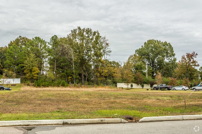

Property Detail
6650 Goodman Rd
1069302300000100
ALDI ADD TO OLIVE BRANCH 2ND REV LOT 1 B-1
Commercialnec
DESOTO
C-4
Mississippi
B and X Area of moderate flood hazard, usually the area between the limits of the 100-year and 500-year floods.
1-b-1
2025
0.91 AC
2025
DeSoto County
070723
Memphis
2,934 SF
Memphis, TN-MS-AR
NEARBY LISTINGS FOR SALE OR LEASE
DEMOGRAPHICS near 6650 Goodman Rd
1 mile
3 mile
5 mile
2025 Total Population
4,432
23,566
88,825
2030 Population
4,595
24,576
90,478
Pop Growth 2025-2030
+ 3.68%
+ 4.29%
+ 1.86%
Average Age
41
41
39
2025 Total Households
1,604
8,691
31,638
HH Growth 2025-2030
+ 3.74%
+ 4.31%
+ 1.91%
Median Household Inc
$105,132
$101,258
$90,422
Avg Household Size
2.70
2.70
2.80
2025 Avg HH Vehicles
2.00
2.00
2.00
Median Home Value
$335,651
$326,687
$274,957
Median Year Built
1998
2000
1996
Nearby Places
Map Layers
Map Styles
 Street
 Aerial
Layers
 Traffic
 Biking
Places
Listings with unknown addresses are not visible on the map
- Restaurants
- Banks
- Shops
- Fitness
- Groceries
PUBLIC TRANSPORTATION
AIRPORT
Memphis International
Drive
Walk
Distance
Memphis International
22 min
11.7 mi
SALE & LEASE HISTORY
LISTING DATE
SALE/LEASE

Nov 15, 2018
For Sale
Nearby Properties
Address
Land Use
TOTAL SIZE
Lot Size
Zoning
Address
Land Use
TOTAL SIZE
Lot Size
Zoning
921,576 SF
25.20 AC
CA
Address
Land Use
TOTAL SIZE
Lot Size
Zoning
434,122 SF
23.97 AC
R-6
Address
Land Use
TOTAL SIZE
Lot Size
Zoning
158,366 SF
24.31 AC
R-6
Address
Land Use
TOTAL SIZE
Lot Size
Zoning
326,743 SF
22.91 AC
R-8
Address
Land Use
TOTAL SIZE
Lot Size
Zoning
345,770 SF
18.13 AC
EMP
Address
Land Use
TOTAL SIZE
Lot Size
Zoning
903,083 SF
45.12 AC
EMP
Address
Land Use
TOTAL SIZE
Lot Size
Zoning
864,054 SF
72.19 AC
M-1
Address
Land Use
TOTAL SIZE
Lot Size
Zoning
379,348 SF
23.82 AC
IH
Address
Land Use
TOTAL SIZE
Lot Size
Zoning
364,578 SF
19.76 AC
IH
Address
Land Use
TOTAL SIZE
Lot Size
Zoning
366,046 SF
22.37 AC
CA
Address
Land Use
TOTAL SIZE
Lot Size
Zoning
307,100 SF
18.95 AC
CA
Address
Land Use
TOTAL SIZE
Lot Size
Zoning
309,885 SF
17.49 AC
R-8
Address
Land Use
TOTAL SIZE
Lot Size
Zoning
860,464 SF
54.55 AC
M-1
Address
Land Use
TOTAL SIZE
Lot Size
Zoning
693,680 SF
47.15 AC
M-1
Address
Land Use
TOTAL SIZE
Lot Size
Zoning
814,054 SF
51.14 AC
M-1
Address
Land Use
TOTAL SIZE
Lot Size
Zoning
217,172 SF
12.32 AC
R-6
Address
Land Use
TOTAL SIZE
Lot Size
Zoning
210,161 SF
14.86 AC
R-6
Address
Land Use
TOTAL SIZE
Lot Size
Zoning
174,148 SF
7.09 AC
CA
Address
Land Use
TOTAL SIZE
Lot Size
Zoning
210,354 SF
17.31 AC
R-8
Address
Land Use
TOTAL SIZE
Lot Size
Zoning
60,296 SF
18.86 AC
CA
Address
Land Use
TOTAL SIZE
Lot Size
Zoning
390,874 SF
122.03 AC
M-1
Address
Land Use
TOTAL SIZE
Lot Size
Zoning
445,114 SF
32.34 AC
M-1
Address
Land Use
TOTAL SIZE
Lot Size
Zoning
180,307 SF
9.97 AC
CA
Address
Land Use
TOTAL SIZE
Lot Size
Zoning
27,669 SF
34.27 AC
R-4
Address
Land Use
TOTAL SIZE
Lot Size
Zoning
130,360 SF
8.63 AC
CA
Address
Land Use
TOTAL SIZE
Lot Size
Zoning
10,155 SF
26.43 AC
R-4
Address
Land Use
TOTAL SIZE
Lot Size
Zoning
368,608 SF
21.85 AC
M-1
Address
Land Use
TOTAL SIZE
Lot Size
Zoning
5,189 SF
9.62 AC
C-4
Address
Land Use
TOTAL SIZE
Lot Size
Zoning
130,091 SF
9.39 AC
R-6
Address
Land Use
TOTAL SIZE
Lot Size
Zoning
329,096 SF
21.64 AC
M-1
The World's #1 Commercial Real Estate Marketplace
Connect with us
© 2026 CoStar Group
The information above has been obtained from sources believed reliable. While we do not doubt its accuracy we have not verified it and make no guarantee, warranty or representation about it. It is your responsibility to independently confirm its accuracy and completeness. Any projections, opinions, assumptions, or estimates used are for example only and do not represent the current or future performance of the property. The value of this transaction to you depends on tax and other factors which should be evaluated by your tax, financial, and legal advisors. You and your advisors should conduct a careful, independent investigation of the property to determine to your satisfaction the suitability of the property for your needs.