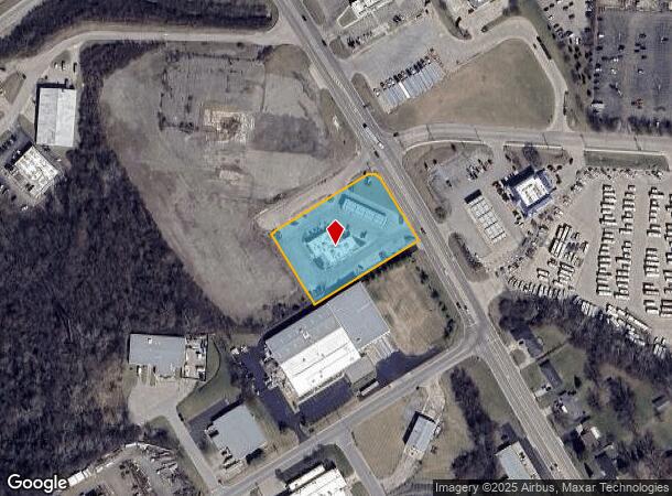
Property Record
6651 N State Route 123, Franklin, OH 45005


NEARBY LISTINGS FOR SALE OR LEASE
Property Detail
6651 N State Route 123
Cincinnati, OH-KY-IN
Cattani Commerce Ctr
08-30-151-017
CATTANI COMMERCE CTR LOT 1 PT.
Storebuilding
Warren
AE
Ohio
39165C0016G
1
2024
1.73 AC
2024
Outlying Warren County
030600
Cincinnati/Dayton
7,198 SF
DEMOGRAPHICS near 6651 N State Route 123
1 Mile
3 Mile
5 Mile
2024 Total Population
2,140
25,802
84,913
2029 Population
2,330
28,013
90,346
Pop Growth 2024-2029
+ 8.88%
+ 8.57%
+ 6.40%
Average Age
42
42
41
2024 Total Households
828
10,485
33,962
HH Growth 2024-2029
+ 8.94%
+ 8.59%
+ 6.30%
Median Household Inc
$83,972
$72,396
$73,803
Avg Household Size
2.50
2.40
2.40
2024 Avg HH Vehicles
2.00
2.00
2.00
Median Home Value
$215,000
$178,483
$187,954
Median Year Built
1994
1973
1976
Nearby Places
Map Layers
Map Styles
 Street
 Aerial
- Restaurants
- Banks
- Shops
- Fitness
- Groceries
PUBLIC TRANSPORTATION
AIRPORT
James M Cox Dayton International
DRIVE
WALK
Distance
James M Cox Dayton International
40 min
29.8 mi
Cincinnati/Northern Kentucky International
DRIVE
WALK
Distance
Cincinnati/Northern Kentucky International
71 min
50.0 mi
Nearby Properties
Address
Land Use
TOTAL SIZE
Lot Size
Zoning
Address
Land Use
TOTAL SIZE
Lot Size
Zoning
Address
Land Use
TOTAL SIZE
Lot Size
Zoning
5,000 SF
60.29 AC
Address
Land Use
TOTAL SIZE
Lot Size
Zoning
11,684 SF
16.01 AC
Address
Land Use
TOTAL SIZE
Lot Size
Zoning
6,048 SF
51.16 AC
Address
Land Use
TOTAL SIZE
Lot Size
Zoning
266,231 SF
17.07 AC
Address
Land Use
TOTAL SIZE
Lot Size
Zoning
36,570 SF
20.29 AC
Address
Land Use
TOTAL SIZE
Lot Size
Zoning
13.24 AC
Address
Land Use
TOTAL SIZE
Lot Size
Zoning
7.18 AC
Address
Land Use
TOTAL SIZE
Lot Size
Zoning
27,780 SF
1.20 AC
Address
Land Use
TOTAL SIZE
Lot Size
Zoning
15,228 SF
37.19 AC
R1
Address
Land Use
TOTAL SIZE
Lot Size
Zoning
15,559 SF
40.01 AC
Address
Land Use
TOTAL SIZE
Lot Size
Zoning
11,260 SF
6.32 AC
Address
Land Use
TOTAL SIZE
Lot Size
Zoning
17.47 AC
Address
Land Use
TOTAL SIZE
Lot Size
Zoning
81,259 SF
63.28 AC
Address
Land Use
TOTAL SIZE
Lot Size
Zoning
120,000 SF
11.52 AC
Address
Land Use
TOTAL SIZE
Lot Size
Zoning
11,847 SF
5.96 AC
Address
Land Use
TOTAL SIZE
Lot Size
Zoning
32,550 SF
26.11 AC
Address
Land Use
TOTAL SIZE
Lot Size
Zoning
20,250 SF
3.28 AC
Address
Land Use
TOTAL SIZE
Lot Size
Zoning
487,924 SF
22.33 AC
Address
Land Use
TOTAL SIZE
Lot Size
Zoning
217,679 SF
25.16 AC
Address
Land Use
TOTAL SIZE
Lot Size
Zoning
74,368 SF
10 AC
Address
Land Use
TOTAL SIZE
Lot Size
Zoning
26,459 SF
6.95 AC
Address
Land Use
TOTAL SIZE
Lot Size
Zoning
868 SF
36.06 AC
Address
Land Use
TOTAL SIZE
Lot Size
Zoning
13.19 AC
Address
Land Use
TOTAL SIZE
Lot Size
Zoning
96,535 SF
12.07 AC
Address
Land Use
TOTAL SIZE
Lot Size
Zoning
156,360 SF
36.84 AC
Address
Land Use
TOTAL SIZE
Lot Size
Zoning
14.36 AC
Address
Land Use
TOTAL SIZE
Lot Size
Zoning
12,480 SF
14.98 AC
Address
Land Use
TOTAL SIZE
Lot Size
Zoning
57,605 SF
17.30 AC
Address
Land Use
TOTAL SIZE
Lot Size
Zoning
59,038 SF
10 AC
The World's #1 Commercial Real Estate Marketplace
Connect with us
© 2025 CoStar Group
The information above has been obtained from sources believed reliable. While we do not doubt its accuracy we have not verified it and make no guarantee, warranty or representation about it. It is your responsibility to independently confirm its accuracy and completeness. Any projections, opinions, assumptions, or estimates used are for example only and do not represent the current or future performance of the property. The value of this transaction to you depends on tax and other factors which should be evaluated by your tax, financial, and legal advisors. You and your advisors should conduct a careful, independent investigation of the property to determine to your satisfaction the suitability of the property for your needs.