Property Record
6655 Jet Park Rd, Charleston, SC 29406


NEARBY LISTINGS FOR SALE OR LEASE
Property Detail
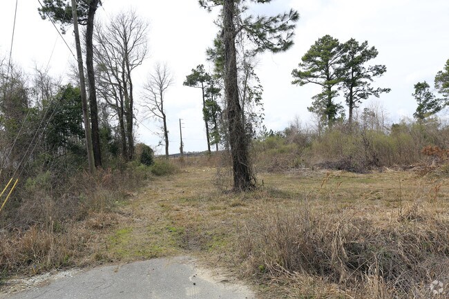
6655 Jet Park Rd
Charleston-North Charleston, SC
Jet Industrial Park
403-04-00-024
SUBDIVISION NAME -JET INDUSTRIAL PARK DESCRIPTION -LOT 7
Commercialnec
Charleston
X
South Carolina
45019C0295K
7
2025
1.26 AC
2024
North Charleston
003105
Charleston/N Charleston
DEMOGRAPHICS near 6655 Jet Park Rd
1 Mile
3 Mile
5 Mile
2024 Total Population
3,935
56,760
140,944
2029 Population
4,163
62,197
153,832
Pop Growth 2024-2029
+ 5.79%
+ 9.58%
+ 9.14%
Average Age
33
36
37
2024 Total Households
1,500
22,503
55,791
HH Growth 2024-2029
+ 5.67%
+ 9.41%
+ 8.98%
Median Household Inc
$29,114
$51,505
$57,382
Avg Household Size
2.50
2.40
2.40
2024 Avg HH Vehicles
1.00
2.00
2.00
Median Home Value
$83,980
$193,893
$231,943
Median Year Built
1981
1986
1988
Nearby Places
Map Layers
Map Styles
 Street
 Aerial
- Restaurants
- Banks
- Shops
- Fitness
- Groceries
PUBLIC TRANSPORTATION
COMMUTER RAIL
DRIVE
WALK
Distance
11 min
5.2 mi
AIRPORT
Charleston AFB/International
DRIVE
WALK
Distance
Charleston AFB/International
13 min
4.1 mi
Freight Ports
North Charleston Terminal
DRIVE
WALK
Distance
North Charleston Terminal
10 min
4.9 mi
SALE & LEASE HISTORY
LISTING DATE
SALE/LEASE

Sep 24, 2016
For Sale
Nearby Properties
Address
Land Use
TOTAL SIZE
Lot Size
Zoning
Address
Land Use
TOTAL SIZE
Lot Size
Zoning
2,917 SF
11.76 AC
HANAHAN -
Address
Land Use
TOTAL SIZE
Lot Size
Zoning
Address
Land Use
TOTAL SIZE
Lot Size
Zoning
10,172 SF
12.76 AC
Address
Land Use
TOTAL SIZE
Lot Size
Zoning
7,200 SF
8.73 AC
Address
Land Use
TOTAL SIZE
Lot Size
Zoning
64,584 SF
10.92 AC
HANAHAN -
Address
Land Use
TOTAL SIZE
Lot Size
Zoning
137,576 SF
5 AC
HANAHAN -
Address
Land Use
TOTAL SIZE
Lot Size
Zoning
68,655 SF
9.48 AC
Address
Land Use
TOTAL SIZE
Lot Size
Zoning
4,320 SF
8.14 AC
HANAHAN -
Address
Land Use
TOTAL SIZE
Lot Size
Zoning
36,882 SF
5.80 AC
HANAHAN -
Address
Land Use
TOTAL SIZE
Lot Size
Zoning
36,912 SF
6.19 AC
HANAHAN -
Address
Land Use
TOTAL SIZE
Lot Size
Zoning
21,364 SF
7.71 AC
Address
Land Use
TOTAL SIZE
Lot Size
Zoning
3,672 SF
3.62 AC
HANAHAN -
Address
Land Use
TOTAL SIZE
Lot Size
Zoning
10,560 SF
7.50 AC
Address
Land Use
TOTAL SIZE
Lot Size
Zoning
68,208 SF
21.38 AC
HANAHAN -
Address
Land Use
TOTAL SIZE
Lot Size
Zoning
7,176 SF
3.55 AC
HANAHAN -
Address
Land Use
TOTAL SIZE
Lot Size
Zoning
101,011 SF
6.58 AC
Address
Land Use
TOTAL SIZE
Lot Size
Zoning
199,300 SF
13.28 AC
Address
Land Use
TOTAL SIZE
Lot Size
Zoning
48,885 SF
5.02 AC
Address
Land Use
TOTAL SIZE
Lot Size
Zoning
126,385 SF
13.45 AC
Address
Land Use
TOTAL SIZE
Lot Size
Zoning
133.75 AC
MUC_DC
Address
Land Use
TOTAL SIZE
Lot Size
Zoning
15,027 SF
3.62 AC
HANAHAN -
Address
Land Use
TOTAL SIZE
Lot Size
Zoning
48,400 SF
5.76 AC
Address
Land Use
TOTAL SIZE
Lot Size
Zoning
167,100 SF
8 AC
Address
Land Use
TOTAL SIZE
Lot Size
Zoning
70,400 SF
2.90 AC
HANAHAN -
Address
Land Use
TOTAL SIZE
Lot Size
Zoning
58,444 SF
5.61 AC
Address
Land Use
TOTAL SIZE
Lot Size
Zoning
44,300 SF
2.34 AC
Address
Land Use
TOTAL SIZE
Lot Size
Zoning
1,925 SF
8.37 AC
HANAHAN -
Address
Land Use
TOTAL SIZE
Lot Size
Zoning
33.88 AC
Address
Land Use
TOTAL SIZE
Lot Size
Zoning
25.97 AC
Address
Land Use
TOTAL SIZE
Lot Size
Zoning
The World's #1 Commercial Real Estate Marketplace
Connect with us
© 2026 CoStar Group
The information above has been obtained from sources believed reliable. While we do not doubt its accuracy we have not verified it and make no guarantee, warranty or representation about it. It is your responsibility to independently confirm its accuracy and completeness. Any projections, opinions, assumptions, or estimates used are for example only and do not represent the current or future performance of the property. The value of this transaction to you depends on tax and other factors which should be evaluated by your tax, financial, and legal advisors. You and your advisors should conduct a careful, independent investigation of the property to determine to your satisfaction the suitability of the property for your needs.