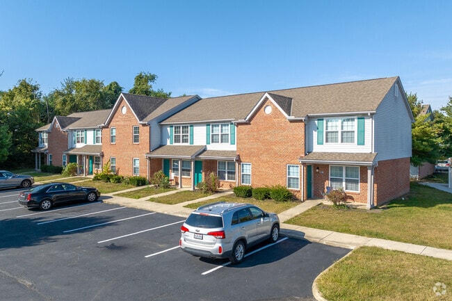
Property Record
6655 Kodiak Dr, Canal Winchester, OH 43110


NEARBY LISTINGS FOR SALE OR LEASE
Property Detail
6655 Kodiak Dr
490-230544
Homewood Corporation
Governmentalpublicusegeneral
GENDER ROAD R21 T11 S25 12.068 ACRES
X
Franklin
39045C0125G
Ohio
0
12.07 AC
2024
Canal Winchester
009403
Columbus
45,663 SF
Columbus, OH
DEMOGRAPHICS near 6655 Kodiak Dr
1 Mile
3 Mile
5 Mile
2024 Total Population
8,301
35,993
120,350
2029 Population
8,215
36,547
123,894
Pop Growth 2024-2029
(1.04%)
+ 1.54%
+ 2.94%
Average Age
35
37
37
2024 Total Households
3,050
13,379
44,824
HH Growth 2024-2029
(1.05%)
+ 1.26%
+ 2.75%
Median Household Inc
$66,852
$74,684
$72,846
Avg Household Size
2.60
2.60
2.60
2024 Avg HH Vehicles
2.00
2.00
2.00
Median Home Value
$211,145
$238,607
$219,698
Median Year Built
1999
2001
1994
Nearby Places
Map Layers
Map Styles
 Street
 Aerial
- Restaurants
- Banks
- Shops
- Fitness
- Groceries
PUBLIC TRANSPORTATION
AIRPORT
Rickenbacker International
DRIVE
WALK
Distance
Rickenbacker International
19 min
11.1 mi
John Glenn Columbus International
DRIVE
WALK
Distance
John Glenn Columbus International
22 min
14.2 mi
Freight Ports
Port of Toledo
DRIVE
WALK
Distance
Port of Toledo
201 min
162.3 mi
SALE & LEASE HISTORY
LISTING DATE
SALE/LEASE

May 03, 2018
For Sale
Apr 30, 2018
For Sale
Nearby Properties
Address
Land Use
TOTAL SIZE
Lot Size
Zoning
Address
Land Use
TOTAL SIZE
Lot Size
Zoning
65,760 SF
25.37 AC
Address
Land Use
TOTAL SIZE
Lot Size
Zoning
553,548 SF
46.23 AC
Address
Land Use
TOTAL SIZE
Lot Size
Zoning
307,190 SF
55.18 AC
Address
Land Use
TOTAL SIZE
Lot Size
Zoning
195,626 SF
41.45 AC
Address
Land Use
TOTAL SIZE
Lot Size
Zoning
528,750 SF
42.14 AC
Address
Land Use
TOTAL SIZE
Lot Size
Zoning
224,090 SF
66.22 AC
Address
Land Use
TOTAL SIZE
Lot Size
Zoning
60,005 SF
36 AC
Address
Land Use
TOTAL SIZE
Lot Size
Zoning
446,160 SF
91.12 AC
Address
Land Use
TOTAL SIZE
Lot Size
Zoning
46,340 SF
10.58 AC
Address
Land Use
TOTAL SIZE
Lot Size
Zoning
446,160 SF
22.71 AC
Address
Land Use
TOTAL SIZE
Lot Size
Zoning
129,499 SF
107.80 AC
Address
Land Use
TOTAL SIZE
Lot Size
Zoning
122,938 SF
29.37 AC
Address
Land Use
TOTAL SIZE
Lot Size
Zoning
452,764 SF
34.81 AC
Address
Land Use
TOTAL SIZE
Lot Size
Zoning
263,120 SF
23.12 AC
Address
Land Use
TOTAL SIZE
Lot Size
Zoning
29,311 SF
24.95 AC
Address
Land Use
TOTAL SIZE
Lot Size
Zoning
33,230 SF
28.79 AC
Address
Land Use
TOTAL SIZE
Lot Size
Zoning
374,220 SF
Address
Land Use
TOTAL SIZE
Lot Size
Zoning
22,368 SF
23.08 AC
Address
Land Use
TOTAL SIZE
Lot Size
Zoning
29,569 SF
25.30 AC
Address
Land Use
TOTAL SIZE
Lot Size
Zoning
141,966 SF
40.45 AC
Address
Land Use
TOTAL SIZE
Lot Size
Zoning
87,037 SF
20.32 AC
Address
Land Use
TOTAL SIZE
Lot Size
Zoning
87,458 SF
7.44 AC
Address
Land Use
TOTAL SIZE
Lot Size
Zoning
54,754 SF
23.10 AC
Address
Land Use
TOTAL SIZE
Lot Size
Zoning
66,617 SF
78.33 AC
Address
Land Use
TOTAL SIZE
Lot Size
Zoning
215,776 SF
35.86 AC
Address
Land Use
TOTAL SIZE
Lot Size
Zoning
211,019 SF
52.14 AC
Address
Land Use
TOTAL SIZE
Lot Size
Zoning
49,448 SF
9.35 AC
Address
Land Use
TOTAL SIZE
Lot Size
Zoning
81,133 SF
17.49 AC
Address
Land Use
TOTAL SIZE
Lot Size
Zoning
211,600 SF
24.63 AC
Address
Land Use
TOTAL SIZE
Lot Size
Zoning
209,250 SF
12.03 AC
The World's #1 Commercial Real Estate Marketplace
Connect with us
© 2026 CoStar Group
The information above has been obtained from sources believed reliable. While we do not doubt its accuracy we have not verified it and make no guarantee, warranty or representation about it. It is your responsibility to independently confirm its accuracy and completeness. Any projections, opinions, assumptions, or estimates used are for example only and do not represent the current or future performance of the property. The value of this transaction to you depends on tax and other factors which should be evaluated by your tax, financial, and legal advisors. You and your advisors should conduct a careful, independent investigation of the property to determine to your satisfaction the suitability of the property for your needs.