Property Record
6655 W Richmar Ave, Enterprise, NV 89124

NEARBY LISTINGS FOR SALE OR LEASE
Property Detail
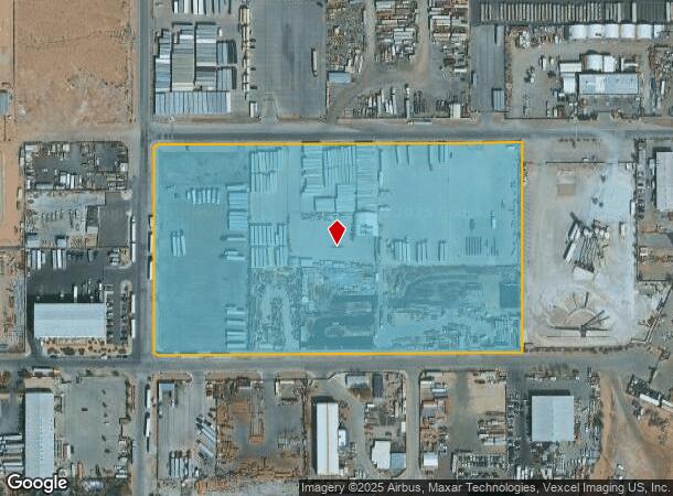
6655 W Richmar Ave
Las Vegas-Henderson-Paradise, NV
Arden Indst Park
176-23-410-008
ARDEN INDST PARK PLAT BOOK 90 PAGE 8 PT LOT 1
Vacantlandnec
Clark
X
Nevada
32003C2565D
1
2024
14.65 AC
2025
Southwest Las Vegas
007500
Las Vegas
DEMOGRAPHICS near 6655 W Richmar Ave
1 Mile
3 Mile
5 Mile
2024 Total Population
7,096
138,215
267,228
2029 Population
7,767
150,358
290,997
Pop Growth 2024-2029
+ 9.46%
+ 8.79%
+ 8.89%
Average Age
36
37
37
2024 Total Households
2,295
46,936
96,770
HH Growth 2024-2029
+ 9.41%
+ 8.74%
+ 8.78%
Median Household Inc
$104,127
$92,918
$86,433
Avg Household Size
3.00
2.90
2.70
2024 Avg HH Vehicles
2.00
2.00
2.00
Median Home Value
$450,916
$430,070
$423,076
Median Year Built
2010
2008
2006
Nearby Places
Map Layers
Map Styles
 Street
 Aerial
- Restaurants
- Banks
- Shops
- Fitness
- Groceries
PUBLIC TRANSPORTATION
AIRPORT
Harry Reid International
DRIVE
WALK
Distance
Harry Reid International
16 min
9.2 mi
Boulder City Municipal
DRIVE
WALK
Distance
Boulder City Municipal
40 min
26.7 mi
Freight Ports
Port of Long Beach
DRIVE
WALK
Distance
Port of Long Beach
311 min
276.2 mi
Nearby Properties
Address
Land Use
TOTAL SIZE
Lot Size
Zoning
Address
Land Use
TOTAL SIZE
Lot Size
Zoning
60 AC
PF
Address
Land Use
TOTAL SIZE
Lot Size
Zoning
17,206 SF
225 AC
Address
Land Use
TOTAL SIZE
Lot Size
Zoning
317,500 SF
19.26 AC
Address
Land Use
TOTAL SIZE
Lot Size
Zoning
Address
Land Use
TOTAL SIZE
Lot Size
Zoning
35.55 AC
PF
Address
Land Use
TOTAL SIZE
Lot Size
Zoning
239,500 SF
13.18 AC
Address
Land Use
TOTAL SIZE
Lot Size
Zoning
3,398 SF
13.56 AC
Address
Land Use
TOTAL SIZE
Lot Size
Zoning
117.50 AC
Address
Land Use
TOTAL SIZE
Lot Size
Zoning
9.34 AC
Address
Land Use
TOTAL SIZE
Lot Size
Zoning
4,830 SF
15.84 AC
Address
Land Use
TOTAL SIZE
Lot Size
Zoning
4,199 SF
12.11 AC
RE
Address
Land Use
TOTAL SIZE
Lot Size
Zoning
6,782 SF
17.45 AC
R3
Address
Land Use
TOTAL SIZE
Lot Size
Zoning
370,870 SF
28.56 AC
MD
Address
Land Use
TOTAL SIZE
Lot Size
Zoning
5,921 SF
17.62 AC
RE
Address
Land Use
TOTAL SIZE
Lot Size
Zoning
14.65 AC
RE
Address
Land Use
TOTAL SIZE
Lot Size
Zoning
18.03 AC
PF
Address
Land Use
TOTAL SIZE
Lot Size
Zoning
5,697 SF
10.66 AC
R3
Address
Land Use
TOTAL SIZE
Lot Size
Zoning
53,331 SF
77.50 AC
Address
Land Use
TOTAL SIZE
Lot Size
Zoning
192,814 SF
20.27 AC
Address
Land Use
TOTAL SIZE
Lot Size
Zoning
6,095 SF
13.82 AC
Address
Land Use
TOTAL SIZE
Lot Size
Zoning
494,886 SF
26.61 AC
M1
Address
Land Use
TOTAL SIZE
Lot Size
Zoning
7,121 SF
14.27 AC
R3
Address
Land Use
TOTAL SIZE
Lot Size
Zoning
5,931 SF
3.80 AC
R3
Address
Land Use
TOTAL SIZE
Lot Size
Zoning
186,421 SF
19.06 AC
Address
Land Use
TOTAL SIZE
Lot Size
Zoning
9,787 SF
65.73 AC
RE
Address
Land Use
TOTAL SIZE
Lot Size
Zoning
17.85 AC
PF
Address
Land Use
TOTAL SIZE
Lot Size
Zoning
86,780 SF
14.58 AC
PF
Address
Land Use
TOTAL SIZE
Lot Size
Zoning
15 AC
RE
Address
Land Use
TOTAL SIZE
Lot Size
Zoning
136,654 SF
15 AC
PF
Address
Land Use
TOTAL SIZE
Lot Size
Zoning
124,257 SF
16.11 AC
The World's #1 Commercial Real Estate Marketplace
Connect with us
© 2025 CoStar Group
The information above has been obtained from sources believed reliable. While we do not doubt its accuracy we have not verified it and make no guarantee, warranty or representation about it. It is your responsibility to independently confirm its accuracy and completeness. Any projections, opinions, assumptions, or estimates used are for example only and do not represent the current or future performance of the property. The value of this transaction to you depends on tax and other factors which should be evaluated by your tax, financial, and legal advisors. You and your advisors should conduct a careful, independent investigation of the property to determine to your satisfaction the suitability of the property for your needs.