Property Record
6656 Spindle Top Rd, San Angelo, TX 76901
Property Detail
6656 Spindle Top Rd
35-02740-0000-002-00
ACRES: 5.010 SUBD: NORTHWOOD ESTATES ROADS IN NORTHWOOD ESTATES
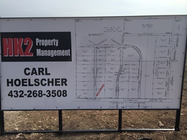
Officebuilding
TOM GREEN
B and X Area of moderate flood hazard, usually the area between the limits of the 100-year and 500-year floods.
Texas
0
3.33 AC
2025
Texas West Area
001709
Other Market Areas
1,875 SF
San Angelo, TX
NEARBY LISTINGS FOR SALE OR LEASE
-
-
View all San Angelo listings for sale on LoopNet.com
DEMOGRAPHICS near 6656 Spindle Top Rd
1 mile
3 mile
5 mile
2025 Total Population
898
9,869
37,116
2030 Population
898
9,895
37,146
Pop Growth 2025-2030
0.00%
+ 0.26%
+ 0.08%
Average Age
43
40
39
2025 Total Households
341
3,651
13,741
HH Growth 2025-2030
0.00%
+ 0.03%
(0.12%)
Median Household Inc
$72,374
$52,029
$43,746
Avg Household Size
2.60
2.60
2.50
2025 Avg HH Vehicles
2.00
2.00
2.00
Median Home Value
$203,333
$142,686
$125,244
Median Year Built
1980
1971
1966
Nearby Places
Map Layers
Map Styles
 Street
 Aerial
Layers
 Traffic
 Biking
Places
Listings with unknown addresses are not visible on the map
- Restaurants
- Banks
- Shops
- Fitness
- Groceries
PUBLIC TRANSPORTATION
AIRPORT
San Angelo Regional/Mathis Field
Drive
Walk
Distance
San Angelo Regional/Mathis Field
28 min
17.3 mi
Freight Ports
Calhoun Port
Drive
Walk
Distance
Calhoun Port
406 min
365.8 mi
Nearby Properties
Address
Land Use
TOTAL SIZE
Lot Size
Zoning
Address
Land Use
TOTAL SIZE
Lot Size
Zoning
204,347 SF
25.94 AC
Address
Land Use
TOTAL SIZE
Lot Size
Zoning
69,776 SF
3.59 AC
Address
Land Use
TOTAL SIZE
Lot Size
Zoning
70,000 SF
7.93 AC
Address
Land Use
TOTAL SIZE
Lot Size
Zoning
11,760 SF
3.34 AC
Address
Land Use
TOTAL SIZE
Lot Size
Zoning
1,250 SF
117.01 AC
Address
Land Use
TOTAL SIZE
Lot Size
Zoning
73,100 SF
6.13 AC
Address
Land Use
TOTAL SIZE
Lot Size
Zoning
16,125 SF
4.71 AC
Address
Land Use
TOTAL SIZE
Lot Size
Zoning
2,000 SF
9 AC
Address
Land Use
TOTAL SIZE
Lot Size
Zoning
3,216 SF
7.18 AC
Address
Land Use
TOTAL SIZE
Lot Size
Zoning
5,490 SF
3.06 AC
Address
Land Use
TOTAL SIZE
Lot Size
Zoning
88,257 SF
5.12 AC
Address
Land Use
TOTAL SIZE
Lot Size
Zoning
13,680 SF
2.48 AC
Address
Land Use
TOTAL SIZE
Lot Size
Zoning
24,510 SF
3 AC
Address
Land Use
TOTAL SIZE
Lot Size
Zoning
9,000 SF
2.87 AC
Address
Land Use
TOTAL SIZE
Lot Size
Zoning
14,460 SF
1.36 AC
Address
Land Use
TOTAL SIZE
Lot Size
Zoning
10,000 SF
1.72 AC
Address
Land Use
TOTAL SIZE
Lot Size
Zoning
9,120 SF
2.06 AC
Address
Land Use
TOTAL SIZE
Lot Size
Zoning
1,400 SF
18.81 AC
Address
Land Use
TOTAL SIZE
Lot Size
Zoning
23,040 SF
0.78 AC
Address
Land Use
TOTAL SIZE
Lot Size
Zoning
26,158 SF
1.67 AC
Address
Land Use
TOTAL SIZE
Lot Size
Zoning
3,116 SF
3.50 AC
Address
Land Use
TOTAL SIZE
Lot Size
Zoning
27,500 SF
5 AC
Address
Land Use
TOTAL SIZE
Lot Size
Zoning
11,800 SF
5.47 AC
Address
Land Use
TOTAL SIZE
Lot Size
Zoning
12,800 SF
3.09 AC
Address
Land Use
TOTAL SIZE
Lot Size
Zoning
1,920 SF
1.13 AC
Address
Land Use
TOTAL SIZE
Lot Size
Zoning
Address
Land Use
TOTAL SIZE
Lot Size
Zoning
5,000 SF
5.44 AC
Address
Land Use
TOTAL SIZE
Lot Size
Zoning
19,368 SF
1.12 AC
Address
Land Use
TOTAL SIZE
Lot Size
Zoning
3,216 SF
1.38 AC
Address
Land Use
TOTAL SIZE
Lot Size
Zoning
6,935 SF
0.67 AC
The World's #1 Commercial Real Estate Marketplace
Connect with us
© 2026 CoStar Group
The information above has been obtained from sources believed reliable. While we do not doubt its accuracy we have not verified it and make no guarantee, warranty or representation about it. It is your responsibility to independently confirm its accuracy and completeness. Any projections, opinions, assumptions, or estimates used are for example only and do not represent the current or future performance of the property. The value of this transaction to you depends on tax and other factors which should be evaluated by your tax, financial, and legal advisors. You and your advisors should conduct a careful, independent investigation of the property to determine to your satisfaction the suitability of the property for your needs.