Property Record
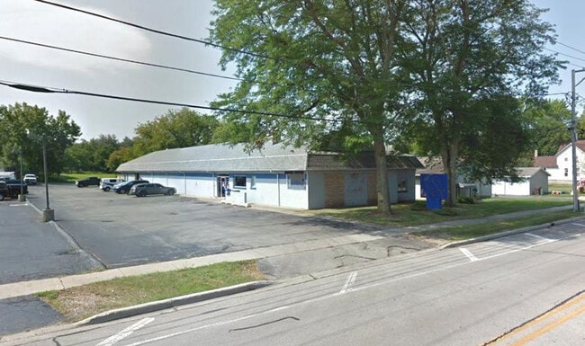
666 E Calhoun St, Woodstock, IL 60098


Property Detail
666 E Calhoun St
Chicago-Naperville-Elgin, IL-IN
DOC 2021R0064986 (RE-RECORD) PT LT 83 ASSRS PLAT
13-05-456-033
McHenry
Commercialnec
Illinois
B and X Area of moderate flood hazard, usually the area between the limits of the 100-year and 500-year floods.
83
2024
0.70 AC
2024
McHenry County
870905
Chicago
7,037 SF
NEARBY LISTINGS FOR SALE OR LEASE
DEMOGRAPHICS near 666 E Calhoun St
1 mile
3 mile
5 mile
2025 Total Population
8,962
28,094
33,124
2030 Population
9,087
28,545
33,636
Pop Growth 2025-2030
+ 1.39%
+ 1.61%
+ 1.55%
Average Age
41
41
41
2025 Total Households
3,742
10,705
12,520
HH Growth 2025-2030
+ 1.36%
+ 1.63%
+ 1.57%
Median Household Inc
$67,667
$83,338
$87,288
Avg Household Size
2.30
2.50
2.50
2025 Avg HH Vehicles
2.00
2.00
2.00
Median Home Value
$239,071
$268,274
$280,410
Median Year Built
1964
1983
1984
Nearby Places
Map Layers
Map Styles
 Street
 Aerial
Layers
 Traffic
 Biking
Places
Listings with unknown addresses are not visible on the map
- Restaurants
- Banks
- Shops
- Fitness
- Groceries
PUBLIC TRANSPORTATION
TRANSIT/SUBWAY
Woodstock Station (Union Pacific Northwest Line - Northeast Illinois Regional Commuter Railroad (Metra))
Drive
Walk
Distance
Woodstock Station (Union Pacific Northwest Line - Northeast Illinois Regional Commuter Railroad (Metra))
3 min
14 min
0.7 mi
COMMUTER RAIL
Woodstock Station (Union Pacific Northwest Line - Northeast Illinois Regional Commuter Railroad (Metra))
Drive
Walk
Distance
Woodstock Station (Union Pacific Northwest Line - Northeast Illinois Regional Commuter Railroad (Metra))
3 min
14 min
0.7 mi
Crystal Lake Station (Union Pacific Northwest Line - Northeast Illinois Regional Commuter Railroad (Metra))
Drive
Walk
Distance
Crystal Lake Station (Union Pacific Northwest Line - Northeast Illinois Regional Commuter Railroad (Metra))
16 min
8.8 mi
AIRPORT
Chicago/Rockford International
Drive
Walk
Distance
Chicago/Rockford International
68 min
44.0 mi
Chicago O'Hare International
Drive
Walk
Distance
Chicago O'Hare International
65 min
48.0 mi
Freight Ports
Port Milwaukee
Drive
Walk
Distance
Port Milwaukee
94 min
68.0 mi
SALE & LEASE HISTORY
LISTING DATE
SALE/LEASE

Sep 13, 2024
For Lease
Sep 12, 2024
For Sale
Jun 12, 2018
For Lease
Jun 12, 2018
For Sale
Jul 21, 2025
For Sale
Nearby Properties
Address
Land Use
TOTAL SIZE
Lot Size
Zoning
Address
Land Use
TOTAL SIZE
Lot Size
Zoning
41,872 SF
19.37 AC
Address
Land Use
TOTAL SIZE
Lot Size
Zoning
58,535 SF
6.26 AC
Address
Land Use
TOTAL SIZE
Lot Size
Zoning
219,350 SF
19.83 AC
Address
Land Use
TOTAL SIZE
Lot Size
Zoning
352,260 SF
20.65 AC
Address
Land Use
TOTAL SIZE
Lot Size
Zoning
107,299 SF
19.62 AC
Address
Land Use
TOTAL SIZE
Lot Size
Zoning
129,755 SF
13.01 AC
Address
Land Use
TOTAL SIZE
Lot Size
Zoning
214,500 SF
21.21 AC
Address
Land Use
TOTAL SIZE
Lot Size
Zoning
64,528 SF
9.51 AC
Address
Land Use
TOTAL SIZE
Lot Size
Zoning
383,325 SF
30.77 AC
Address
Land Use
TOTAL SIZE
Lot Size
Zoning
50,749 SF
5.92 AC
Address
Land Use
TOTAL SIZE
Lot Size
Zoning
96,633 SF
3.97 AC
Address
Land Use
TOTAL SIZE
Lot Size
Zoning
137,539 SF
22.05 AC
Address
Land Use
TOTAL SIZE
Lot Size
Zoning
164,167 SF
16.11 AC
Address
Land Use
TOTAL SIZE
Lot Size
Zoning
581,330 SF
15.02 AC
Address
Land Use
TOTAL SIZE
Lot Size
Zoning
148,917 SF
9.22 AC
Address
Land Use
TOTAL SIZE
Lot Size
Zoning
72,582 SF
3.74 AC
Address
Land Use
TOTAL SIZE
Lot Size
Zoning
45,876 SF
5.02 AC
Address
Land Use
TOTAL SIZE
Lot Size
Zoning
42,772 SF
4.81 AC
Address
Land Use
TOTAL SIZE
Lot Size
Zoning
93,884 SF
7.46 AC
Address
Land Use
TOTAL SIZE
Lot Size
Zoning
178,561 SF
19.09 AC
Address
Land Use
TOTAL SIZE
Lot Size
Zoning
12,699 SF
8 AC
Address
Land Use
TOTAL SIZE
Lot Size
Zoning
72,543 SF
9.48 AC
Address
Land Use
TOTAL SIZE
Lot Size
Zoning
127,765 SF
7.91 AC
Address
Land Use
TOTAL SIZE
Lot Size
Zoning
71,740 SF
4.66 AC
Address
Land Use
TOTAL SIZE
Lot Size
Zoning
64,973 SF
6.54 AC
Address
Land Use
TOTAL SIZE
Lot Size
Zoning
2.78 AC
Address
Land Use
TOTAL SIZE
Lot Size
Zoning
24,968 SF
0.50 AC
Address
Land Use
TOTAL SIZE
Lot Size
Zoning
93,280 SF
11.89 AC
Address
Land Use
TOTAL SIZE
Lot Size
Zoning
189,136 SF
26.97 AC
Address
Land Use
TOTAL SIZE
Lot Size
Zoning
32,308 SF
4.58 AC
The World's #1 Commercial Real Estate Marketplace
Connect with us
© 2026 CoStar Group
The information above has been obtained from sources believed reliable. While we do not doubt its accuracy we have not verified it and make no guarantee, warranty or representation about it. It is your responsibility to independently confirm its accuracy and completeness. Any projections, opinions, assumptions, or estimates used are for example only and do not represent the current or future performance of the property. The value of this transaction to you depends on tax and other factors which should be evaluated by your tax, financial, and legal advisors. You and your advisors should conduct a careful, independent investigation of the property to determine to your satisfaction the suitability of the property for your needs.