Property Record
6660 S Sheridan Rd, Tulsa, OK 74133
Current Lease Availabilities
NEARBY LISTINGS FOR SALE OR LEASE
Property Detail
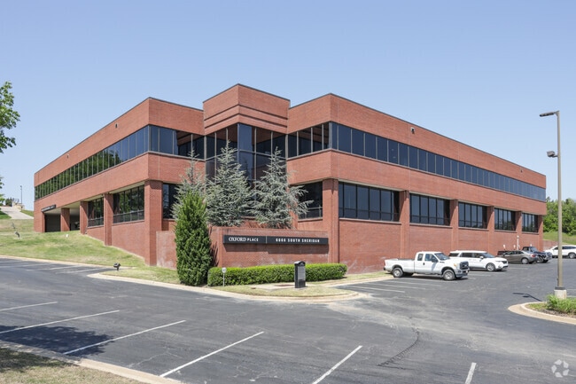
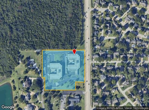
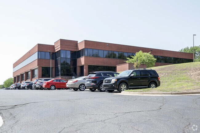
6660 S Sheridan Rd
Tulsa, OK
Oxford Place
30930-83-03-33840
LT 1 BLK 1
Officebuilding
Tulsa
X
Oklahoma
40143C0359M
1
2025
6.09 AC
2025
South Central
007615
Tulsa
84,979 SF
DEMOGRAPHICS near 6660 S Sheridan Rd
1 Mile
3 Mile
5 Mile
2024 Total Population
10,767
92,328
238,532
2029 Population
11,097
95,381
246,029
Pop Growth 2024-2029
+ 3.06%
+ 3.31%
+ 3.14%
Average Age
44
40
39
2024 Total Households
5,010
40,458
102,436
HH Growth 2024-2029
+ 3.17%
+ 3.34%
+ 3.21%
Median Household Inc
$59,580
$63,740
$59,772
Avg Household Size
2.00
2.20
2.20
2024 Avg HH Vehicles
2.00
2.00
2.00
Median Home Value
$224,825
$231,623
$219,074
Median Year Built
1977
1979
1978
Nearby Places
- Restaurants
- Banks
- Shops
- Fitness
- Groceries
PUBLIC TRANSPORTATION
AIRPORT
Tulsa International
DRIVE
WALK
Distance
Tulsa International
22 min
11.1 mi
Freight Ports
Tulsa Port Of Catoosa
DRIVE
WALK
Distance
Tulsa Port Of Catoosa
27 min
18.7 mi
Nearby Properties
Address
Land Use
TOTAL SIZE
Lot Size
Zoning
Address
Land Use
TOTAL SIZE
Lot Size
Zoning
2,622,731 SF
26.90 AC
OH
Address
Land Use
TOTAL SIZE
Lot Size
Zoning
717,386 SF
49.74 AC
OL
Address
Land Use
TOTAL SIZE
Lot Size
Zoning
323,882 SF
20 AC
CO
Address
Land Use
TOTAL SIZE
Lot Size
Zoning
184,679 SF
33.97 AC
AG
Address
Land Use
TOTAL SIZE
Lot Size
Zoning
236,738 SF
11.56 AC
PUD
Address
Land Use
TOTAL SIZE
Lot Size
Zoning
139,648 SF
20.75 AC
RS3
Address
Land Use
TOTAL SIZE
Lot Size
Zoning
61,153 SF
7.16 AC
CH
Address
Land Use
TOTAL SIZE
Lot Size
Zoning
206,760 SF
78.45 AC
AG
Address
Land Use
TOTAL SIZE
Lot Size
Zoning
216,280 SF
41.17 AC
RS2
Address
Land Use
TOTAL SIZE
Lot Size
Zoning
163,472 SF
29.92 AC
AG
Address
Land Use
TOTAL SIZE
Lot Size
Zoning
25,173 SF
155.93 AC
RS3
Address
Land Use
TOTAL SIZE
Lot Size
Zoning
72,042 SF
5.10 AC
RS3
Address
Land Use
TOTAL SIZE
Lot Size
Zoning
592,682 SF
30.42 AC
CO
Address
Land Use
TOTAL SIZE
Lot Size
Zoning
146,538 SF
2.56 AC
CS
Address
Land Use
TOTAL SIZE
Lot Size
Zoning
108,416 SF
4.26 AC
OM
Address
Land Use
TOTAL SIZE
Lot Size
Zoning
45,191 SF
6.30 AC
CS
Address
Land Use
TOTAL SIZE
Lot Size
Zoning
107,538 SF
19.74 AC
OM
Address
Land Use
TOTAL SIZE
Lot Size
Zoning
180,642 SF
5.14 AC
CS
Address
Land Use
TOTAL SIZE
Lot Size
Zoning
62,086 SF
79.79 AC
AG
Address
Land Use
TOTAL SIZE
Lot Size
Zoning
8,388 SF
63.49 AC
AG
Address
Land Use
TOTAL SIZE
Lot Size
Zoning
56,611 SF
26.92 AC
RS2
Address
Land Use
TOTAL SIZE
Lot Size
Zoning
66,276 SF
3.97 AC
IL
Address
Land Use
TOTAL SIZE
Lot Size
Zoning
58,864 SF
5.18 AC
RS3
Address
Land Use
TOTAL SIZE
Lot Size
Zoning
625 SF
78.96 AC
RS3
Address
Land Use
TOTAL SIZE
Lot Size
Zoning
65,812 SF
14.12 AC
RS1
Address
Land Use
TOTAL SIZE
Lot Size
Zoning
74,600 SF
3.65 AC
RM2
Address
Land Use
TOTAL SIZE
Lot Size
Zoning
86,747 SF
19.01 AC
RS3
Address
Land Use
TOTAL SIZE
Lot Size
Zoning
1,011,877 SF
5.55 AC
CH
Address
Land Use
TOTAL SIZE
Lot Size
Zoning
24,134 SF
7.47 AC
OM
Address
Land Use
TOTAL SIZE
Lot Size
Zoning
22,938 SF
2.95 AC
OM
The World's #1 Commercial Real Estate Marketplace
Connect with us
© 2025 CoStar Group
The information above has been obtained from sources believed reliable. While we do not doubt its accuracy we have not verified it and make no guarantee, warranty or representation about it. It is your responsibility to independently confirm its accuracy and completeness. Any projections, opinions, assumptions, or estimates used are for example only and do not represent the current or future performance of the property. The value of this transaction to you depends on tax and other factors which should be evaluated by your tax, financial, and legal advisors. You and your advisors should conduct a careful, independent investigation of the property to determine to your satisfaction the suitability of the property for your needs.