Property Record
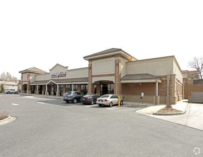
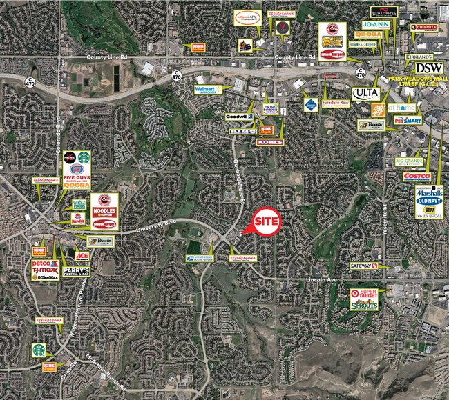
6670 Timberline Rd, Highlands Ranch, CO 80130

Property Detail
6670 Timberline Rd
2231-084-06-089
LOT 1D HIGHLANDS RANCH FLG 61B 1ST AMENDMENT 1.722 AM/L
Commercialnec
Douglas
PDU
Colorado
B and X Area of moderate flood hazard, usually the area between the limits of the 100-year and 500-year floods.
1d
2024
1.72 AC
2025
South
014113
Denver
11,180 SF
Denver-Aurora-Centennial, CO
NEARBY LISTINGS FOR SALE OR LEASE
DEMOGRAPHICS near 6670 Timberline Rd
1 mile
3 mile
5 mile
2025 Total Population
14,816
99,482
206,385
2030 Population
15,697
104,862
215,878
Pop Growth 2025-2030
+ 5.95%
+ 5.41%
+ 4.60%
Average Age
41
40
41
2025 Total Households
5,321
38,361
80,282
HH Growth 2025-2030
+ 6.24%
+ 5.79%
+ 4.89%
Median Household Inc
$152,042
$144,052
$139,550
Avg Household Size
2.80
2.60
2.50
2025 Avg HH Vehicles
2.00
2.00
2.00
Median Home Value
$745,547
$761,851
$755,897
Median Year Built
1992
1996
1994
Nearby Places
Map Layers
Map Styles
 Street
 Aerial
Layers
 Traffic
 Biking
Places
Listings with unknown addresses are not visible on the map
- Restaurants
- Banks
- Shops
- Fitness
- Groceries
PUBLIC TRANSPORTATION
AIRPORT
Denver International
Drive
Walk
Distance
Denver International
39 min
37.3 mi
Freight Ports
Port of Shreveport
Drive
Walk
Distance
Port of Shreveport
1 min
802.1 mi
SALE & LEASE HISTORY
LISTING DATE
SALE/LEASE

Oct 18, 2018
For Sale
Nov 02, 2022
For Sale
Mar 07, 2024
For Sale
Feb 09, 2024
For Sale
Feb 07, 2024
For Lease
Dec 31, 2019
For Sale
Nearby Properties
Address
Land Use
TOTAL SIZE
Lot Size
Zoning
Address
Land Use
TOTAL SIZE
Lot Size
Zoning
709,725 SF
15.21 AC
Address
Land Use
TOTAL SIZE
Lot Size
Zoning
709,725 SF
29.14 AC
Address
Land Use
TOTAL SIZE
Lot Size
Zoning
805,440 SF
28.65 AC
Address
Land Use
TOTAL SIZE
Lot Size
Zoning
260,667 SF
19.72 AC
Address
Land Use
TOTAL SIZE
Lot Size
Zoning
530,720 SF
38.86 AC
PDU
Address
Land Use
TOTAL SIZE
Lot Size
Zoning
637,459 SF
4.94 AC
AMU
Address
Land Use
TOTAL SIZE
Lot Size
Zoning
207,637 SF
28.17 AC
PDU
Address
Land Use
TOTAL SIZE
Lot Size
Zoning
1,630,979 SF
32.01 AC
Address
Land Use
TOTAL SIZE
Lot Size
Zoning
1,210,850 SF
13.65 AC
AMU
Address
Land Use
TOTAL SIZE
Lot Size
Zoning
248,965 SF
70.73 AC
Address
Land Use
TOTAL SIZE
Lot Size
Zoning
364,806 SF
75.76 AC
PDU
Address
Land Use
TOTAL SIZE
Lot Size
Zoning
305,198 SF
34.41 AC
PUD
Address
Land Use
TOTAL SIZE
Lot Size
Zoning
162,758 SF
11.21 AC
Address
Land Use
TOTAL SIZE
Lot Size
Zoning
650,416 SF
33.37 AC
LI
Address
Land Use
TOTAL SIZE
Lot Size
Zoning
139,291 SF
8.63 AC
AMU
Address
Land Use
TOTAL SIZE
Lot Size
Zoning
253,902 SF
34.30 AC
PDU
Address
Land Use
TOTAL SIZE
Lot Size
Zoning
163,443 SF
14.39 AC
Address
Land Use
TOTAL SIZE
Lot Size
Zoning
231,715 SF
5.58 AC
Address
Land Use
TOTAL SIZE
Lot Size
Zoning
661,139 SF
Address
Land Use
TOTAL SIZE
Lot Size
Zoning
488,998 SF
32.43 AC
PDU
Address
Land Use
TOTAL SIZE
Lot Size
Zoning
418,258 SF
14.46 AC
PDU
Address
Land Use
TOTAL SIZE
Lot Size
Zoning
475,502 SF
36 AC
PDU
Address
Land Use
TOTAL SIZE
Lot Size
Zoning
128,812 SF
2.55 AC
Address
Land Use
TOTAL SIZE
Lot Size
Zoning
651,701 SF
10.77 AC
PDU
Address
Land Use
TOTAL SIZE
Lot Size
Zoning
481,223 SF
5.23 AC
Address
Land Use
TOTAL SIZE
Lot Size
Zoning
329,937 SF
35.07 AC
PUD
Address
Land Use
TOTAL SIZE
Lot Size
Zoning
126,202 SF
2.27 AC
Address
Land Use
TOTAL SIZE
Lot Size
Zoning
326,230 SF
9.69 AC
Address
Land Use
TOTAL SIZE
Lot Size
Zoning
169,233 SF
12.17 AC
PDU
Address
Land Use
TOTAL SIZE
Lot Size
Zoning
112,021 SF
3.17 AC
The World's #1 Commercial Real Estate Marketplace
Connect with us
© 2026 CoStar Group
The information above has been obtained from sources believed reliable. While we do not doubt its accuracy we have not verified it and make no guarantee, warranty or representation about it. It is your responsibility to independently confirm its accuracy and completeness. Any projections, opinions, assumptions, or estimates used are for example only and do not represent the current or future performance of the property. The value of this transaction to you depends on tax and other factors which should be evaluated by your tax, financial, and legal advisors. You and your advisors should conduct a careful, independent investigation of the property to determine to your satisfaction the suitability of the property for your needs.