Property Record
6675 Petersen Rd, Petaluma, CA 94952
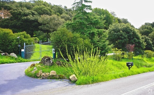

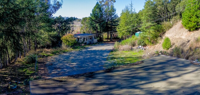

This Property Is For Sale
Property Detail
6675 Petersen Rd
024-031-062
78 FORM 24-030-21 AP # CHANGE MD
Foodprocessing
Sonoma
DA10
California
B and X Area of moderate flood hazard, usually the area between the limits of the 100-year and 500-year floods.
2 AC
2025
Sebastopol/Bodega
2025
North Bay/Santa Rosa
153501
Santa Rosa-Petaluma, CA
3,800 SF
NEARBY LISTINGS FOR SALE OR LEASE
DEMOGRAPHICS near 6675 Petersen Rd
1 mile
3 mile
5 mile
2025 Total Population
306
15,447
66,627
2030 Population
281
15,320
66,292
Pop Growth 2025-2030
(8.17%)
(0.82%)
(0.50%)
Average Age
48
41
41
2025 Total Households
119
5,884
24,423
HH Growth 2025-2030
(8.40%)
(0.85%)
(0.58%)
Median Household Inc
$99,305
$93,197
$99,849
Avg Household Size
2.50
2.50
2.60
2025 Avg HH Vehicles
2.00
2.00
2.00
Median Home Value
$1,070,408
$721,048
$727,091
Median Year Built
1975
1979
1980
Nearby Places
Map Layers
Map Styles
 Street
 Aerial
Transit
 Traffic
 Biking
Places
Listings with unknown addresses are not visible on the map
- Restaurants
- Banks
- Shops
- Fitness
- Groceries
PUBLIC TRANSPORTATION
COMMUTER RAIL
Smart Cotati (Main Line - Sonoma Marin Area Rail Transit)
Drive
Walk
Distance
Smart Cotati (Main Line - Sonoma Marin Area Rail Transit)
11 min
5.7 mi
Smart Rohnert Park (Main Line - Sonoma Marin Area Rail Transit)
Drive
Walk
Distance
Smart Rohnert Park (Main Line - Sonoma Marin Area Rail Transit)
13 min
6.8 mi
AIRPORT
Charles M Schulz - Sonoma County
Drive
Walk
Distance
Charles M Schulz - Sonoma County
30 min
20.4 mi
Freight Ports
Port of Richmond
Drive
Walk
Distance
Port of Richmond
59 min
42.4 mi
Nearby Properties
Address
Land Use
TOTAL SIZE
Lot Size
Zoning
Address
Land Use
TOTAL SIZE
Lot Size
Zoning
23,112 SF
12.30 AC
Address
Land Use
TOTAL SIZE
Lot Size
Zoning
4,652 SF
11.09 AC
MLPD
Address
Land Use
TOTAL SIZE
Lot Size
Zoning
26,699 SF
6 AC
MLPD
Address
Land Use
TOTAL SIZE
Lot Size
Zoning
389.05 AC
Address
Land Use
TOTAL SIZE
Lot Size
Zoning
12,491 SF
5.40 AC
MLPD
Address
Land Use
TOTAL SIZE
Lot Size
Zoning
149,007 SF
0.25 AC
M1RP
Address
Land Use
TOTAL SIZE
Lot Size
Zoning
7,745 SF
2.28 AC
Address
Land Use
TOTAL SIZE
Lot Size
Zoning
61,880 SF
2.53 AC
Address
Land Use
TOTAL SIZE
Lot Size
Zoning
144,198 SF
12.08 AC
CRPD
Address
Land Use
TOTAL SIZE
Lot Size
Zoning
26,390 SF
3.33 AC
MLPD
Address
Land Use
TOTAL SIZE
Lot Size
Zoning
138,134 SF
12.54 AC
C1
Address
Land Use
TOTAL SIZE
Lot Size
Zoning
85,844 SF
2.34 AC
MLPD
Address
Land Use
TOTAL SIZE
Lot Size
Zoning
55,387 SF
3.07 AC
CITYRP
Address
Land Use
TOTAL SIZE
Lot Size
Zoning
77,857 SF
6.69 AC
CITYRP
Address
Land Use
TOTAL SIZE
Lot Size
Zoning
2,750 SF
6.25 AC
MR
Address
Land Use
TOTAL SIZE
Lot Size
Zoning
58,407 SF
4.40 AC
MLPD
Address
Land Use
TOTAL SIZE
Lot Size
Zoning
90,690 SF
8.62 AC
CITYRP
Address
Land Use
TOTAL SIZE
Lot Size
Zoning
58,411 SF
1.83 AC
MLPD
Address
Land Use
TOTAL SIZE
Lot Size
Zoning
50,072 SF
8.48 AC
CITYCO
Address
Land Use
TOTAL SIZE
Lot Size
Zoning
3,000 SF
3.20 AC
CITYRP
Address
Land Use
TOTAL SIZE
Lot Size
Zoning
117,290 SF
8.50 AC
CRPD
Address
Land Use
TOTAL SIZE
Lot Size
Zoning
82,477 SF
2.78 AC
CRPD
Address
Land Use
TOTAL SIZE
Lot Size
Zoning
91,048 SF
5.67 AC
CITYRP
Address
Land Use
TOTAL SIZE
Lot Size
Zoning
65,328 SF
5.47 AC
M1
Address
Land Use
TOTAL SIZE
Lot Size
Zoning
7,296 SF
1.63 AC
CITYRP
Address
Land Use
TOTAL SIZE
Lot Size
Zoning
31,896 SF
6.55 AC
CRPD
Address
Land Use
TOTAL SIZE
Lot Size
Zoning
84,865 SF
5.23 AC
PDRP
Address
Land Use
TOTAL SIZE
Lot Size
Zoning
6,000 SF
2.64 AC
CITYRP
Address
Land Use
TOTAL SIZE
Lot Size
Zoning
104.12 AC
Address
Land Use
TOTAL SIZE
Lot Size
Zoning
4,992 SF
2.63 AC
CITYRP
The World's #1 Commercial Real Estate Marketplace
Connect with us
© 2026 CoStar Group
The information above has been obtained from sources believed reliable. While we do not doubt its accuracy we have not verified it and make no guarantee, warranty or representation about it. It is your responsibility to independently confirm its accuracy and completeness. Any projections, opinions, assumptions, or estimates used are for example only and do not represent the current or future performance of the property. The value of this transaction to you depends on tax and other factors which should be evaluated by your tax, financial, and legal advisors. You and your advisors should conduct a careful, independent investigation of the property to determine to your satisfaction the suitability of the property for your needs.