Property Record
6677 Crossings Dr Se, Grand Rapids, MI 49508

NEARBY LISTINGS FOR SALE OR LEASE
Property Detail
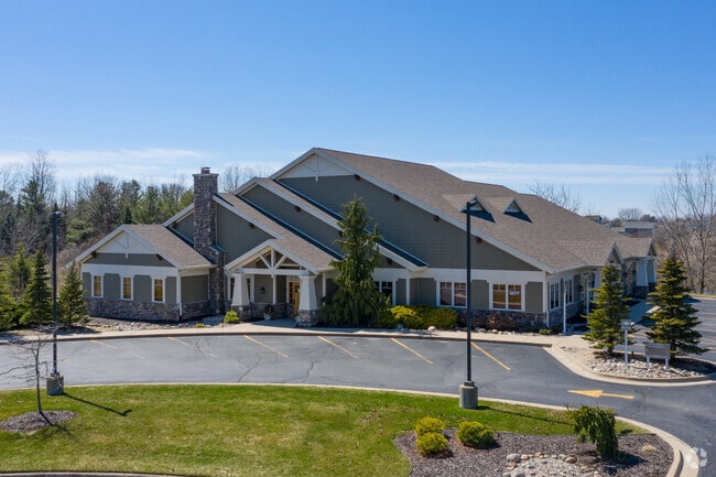
6677 Crossings Dr Se
41-22-05-480-003
First Crossings Office Condominiums Kent
Officebuilding
412205480001 UNIT 1 * FIRST CROSSINGS OFFICE CONDOMINIUMS KENT COUNTY CONDOMINIUM SUBDIVISION PLAN NO. 803 INSTRUMENT NO.
X
Kent
26005C0125G
Michigan
2023
1.89 AC
2025
Byron/Gaines
014809
West Michigan
2,667 SF
Grand Rapids-Wyoming, MI
DEMOGRAPHICS near 6677 Crossings Dr Se
1 Mile
3 Mile
5 Mile
2024 Total Population
8,630
68,297
132,137
2029 Population
8,662
68,985
133,436
Pop Growth 2024-2029
+ 0.37%
+ 1.01%
+ 0.98%
Average Age
38
38
38
2024 Total Households
3,279
24,965
49,903
HH Growth 2024-2029
+ 0.43%
+ 1.03%
+ 0.99%
Median Household Inc
$73,371
$67,734
$67,161
Avg Household Size
2.60
2.70
2.60
2024 Avg HH Vehicles
2.00
2.00
2.00
Median Home Value
$277,379
$226,230
$228,903
Median Year Built
1992
1985
1984
Nearby Places
Map Layers
Map Styles
 Street
 Aerial
- Restaurants
- Banks
- Shops
- Fitness
- Groceries
PUBLIC TRANSPORTATION
AIRPORT
Gerald R Ford International
DRIVE
WALK
Distance
Gerald R Ford International
15 min
7.7 mi
SALE & LEASE HISTORY
LISTING DATE
SALE/LEASE

May 24, 2018
For Sale
Apr 26, 2017
For Lease
Nearby Properties
Address
Land Use
TOTAL SIZE
Lot Size
Zoning
Address
Land Use
TOTAL SIZE
Lot Size
Zoning
48.43 AC
PUD-PL UNI
Address
Land Use
TOTAL SIZE
Lot Size
Zoning
216,171 SF
32.06 AC
R4
Address
Land Use
TOTAL SIZE
Lot Size
Zoning
38.98 AC
PUD-PL UNI
Address
Land Use
TOTAL SIZE
Lot Size
Zoning
25.05 AC
R3-MED RES
Address
Land Use
TOTAL SIZE
Lot Size
Zoning
165,085 SF
22.58 AC
R4
Address
Land Use
TOTAL SIZE
Lot Size
Zoning
151,788 SF
18.31 AC
PUD-PL UNI
Address
Land Use
TOTAL SIZE
Lot Size
Zoning
2,593 SF
18 AC
PUD-PL UNI
Address
Land Use
TOTAL SIZE
Lot Size
Zoning
158,240 SF
13.56 AC
R4
Address
Land Use
TOTAL SIZE
Lot Size
Zoning
229,572 SF
16.20 AC
PUD-PL UNI
Address
Land Use
TOTAL SIZE
Lot Size
Zoning
720 SF
74.47 AC
R4-MOBILE
Address
Land Use
TOTAL SIZE
Lot Size
Zoning
57,030 SF
17.74 AC
R3-MED RES
Address
Land Use
TOTAL SIZE
Lot Size
Zoning
11.35 AC
Address
Land Use
TOTAL SIZE
Lot Size
Zoning
107,186 SF
31.06 AC
PUD-PL UNI
Address
Land Use
TOTAL SIZE
Lot Size
Zoning
175,360 SF
15.61 AC
R4
Address
Land Use
TOTAL SIZE
Lot Size
Zoning
896 SF
82.41 AC
R4-MOBILE
Address
Land Use
TOTAL SIZE
Lot Size
Zoning
50.15 AC
Address
Land Use
TOTAL SIZE
Lot Size
Zoning
108,911 SF
10.80 AC
D1
Address
Land Use
TOTAL SIZE
Lot Size
Zoning
132,600 SF
14 AC
R-PUD-1
Address
Land Use
TOTAL SIZE
Lot Size
Zoning
137,114 SF
12.50 AC
R4
Address
Land Use
TOTAL SIZE
Lot Size
Zoning
1,296 SF
12 AC
PUD-PL UNI
Address
Land Use
TOTAL SIZE
Lot Size
Zoning
140,742 SF
18.57 AC
D1
Address
Land Use
TOTAL SIZE
Lot Size
Zoning
49.29 AC
R4-MOBILE
Address
Land Use
TOTAL SIZE
Lot Size
Zoning
48.57 AC
RD
Address
Land Use
TOTAL SIZE
Lot Size
Zoning
89,453 SF
9.12 AC
PUD-PL UNI
Address
Land Use
TOTAL SIZE
Lot Size
Zoning
2,514 SF
35.90 AC
R5
Address
Land Use
TOTAL SIZE
Lot Size
Zoning
77,454 SF
12.41 AC
R3
Address
Land Use
TOTAL SIZE
Lot Size
Zoning
45.66 AC
RD
Address
Land Use
TOTAL SIZE
Lot Size
Zoning
1,356 SF
31.16 AC
R5
Address
Land Use
TOTAL SIZE
Lot Size
Zoning
1.11 AC
PUD-PL UNI
Address
Land Use
TOTAL SIZE
Lot Size
Zoning
201,500 SF
11.98 AC
D1
The World's #1 Commercial Real Estate Marketplace
Connect with us
© 2025 CoStar Group
The information above has been obtained from sources believed reliable. While we do not doubt its accuracy we have not verified it and make no guarantee, warranty or representation about it. It is your responsibility to independently confirm its accuracy and completeness. Any projections, opinions, assumptions, or estimates used are for example only and do not represent the current or future performance of the property. The value of this transaction to you depends on tax and other factors which should be evaluated by your tax, financial, and legal advisors. You and your advisors should conduct a careful, independent investigation of the property to determine to your satisfaction the suitability of the property for your needs.