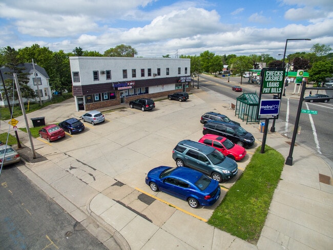
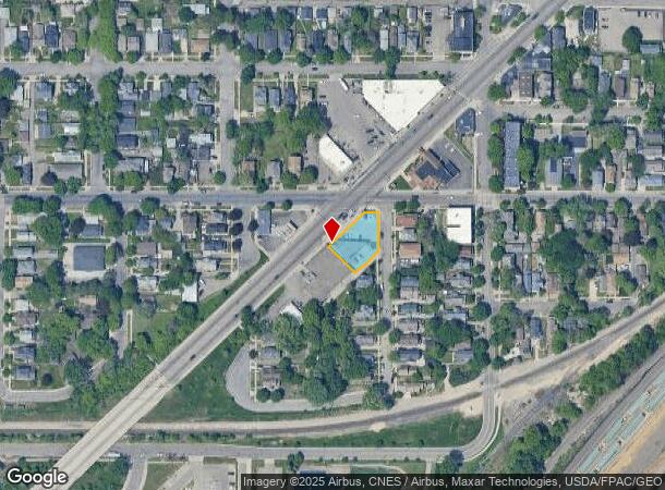
Property Record
670 7Th St W, Saint Paul, MN 55102
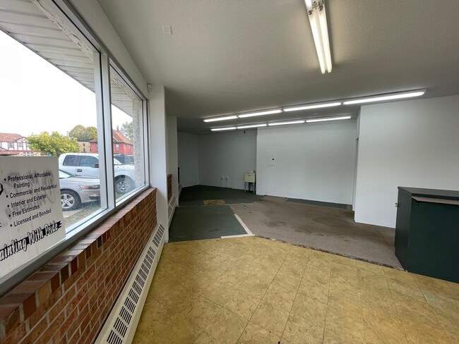
Current Lease Availabilities
NEARBY LISTINGS FOR SALE OR LEASE
Property Detail
670 7Th St W
Minneapolis-St. Paul-Bloomington, MN-WI
Watson & Rices Subdivision C
12-28-23-21-0102
WATSON & RICES SUBDIVISION C SUBJ TO ST; LOTS 1,2 & LOT 3 BLK 2
Commercialnec
Ramsey
X
Minnesota
27037C0036E
1,2,3
2024
0.26 AC
2025
St Paul
036900
Minneapolis/St Paul
8,190 SF
DEMOGRAPHICS near 670 7Th St W
1 Mile
3 Mile
5 Mile
2024 Total Population
16,856
151,312
341,201
2029 Population
16,428
148,547
334,944
Pop Growth 2024-2029
(2.54%)
(1.83%)
(1.83%)
Average Age
41
38
38
2024 Total Households
8,565
63,673
138,823
HH Growth 2024-2029
(2.71%)
(1.85%)
(1.81%)
Median Household Inc
$71,344
$68,104
$67,929
Avg Household Size
1.90
2.20
2.30
2024 Avg HH Vehicles
1.00
2.00
2.00
Median Home Value
$342,791
$291,550
$289,055
Median Year Built
1947
1949
1955
Nearby Places
Map Layers
Map Styles
 Street
 Aerial
- Restaurants
- Banks
- Shops
- Fitness
- Groceries
PUBLIC TRANSPORTATION
COMMUTER RAIL
DRIVE
WALK
Distance
6 min
2.2 mi
AIRPORT
Minneapolis-St Paul International/Wold-Chamberlain
DRIVE
WALK
Distance
Minneapolis-St Paul International/Wold-Chamberlain
15 min
7.1 mi
Nearby Properties
Address
Land Use
TOTAL SIZE
Lot Size
Zoning
Address
Land Use
TOTAL SIZE
Lot Size
Zoning
384,515 SF
18.04 AC
Address
Land Use
TOTAL SIZE
Lot Size
Zoning
84,316 SF
40.83 AC
Address
Land Use
TOTAL SIZE
Lot Size
Zoning
384,515 SF
1.33 AC
Address
Land Use
TOTAL SIZE
Lot Size
Zoning
582,896 SF
14 AC
Address
Land Use
TOTAL SIZE
Lot Size
Zoning
825,463 SF
7.04 AC
Address
Land Use
TOTAL SIZE
Lot Size
Zoning
124,932 SF
9.68 AC
Address
Land Use
TOTAL SIZE
Lot Size
Zoning
63.12 AC
Address
Land Use
TOTAL SIZE
Lot Size
Zoning
646,900 SF
7.66 AC
Address
Land Use
TOTAL SIZE
Lot Size
Zoning
32,854 SF
5.55 AC
Address
Land Use
TOTAL SIZE
Lot Size
Zoning
408.23 AC
Address
Land Use
TOTAL SIZE
Lot Size
Zoning
267,530 SF
28.60 AC
Address
Land Use
TOTAL SIZE
Lot Size
Zoning
420,177 SF
2.13 AC
Address
Land Use
TOTAL SIZE
Lot Size
Zoning
395,419 SF
2.73 AC
Address
Land Use
TOTAL SIZE
Lot Size
Zoning
516,325 SF
16.81 AC
Address
Land Use
TOTAL SIZE
Lot Size
Zoning
759,622 SF
2.66 AC
Address
Land Use
TOTAL SIZE
Lot Size
Zoning
786,042 SF
2.10 AC
Address
Land Use
TOTAL SIZE
Lot Size
Zoning
643,305 SF
1.93 AC
Address
Land Use
TOTAL SIZE
Lot Size
Zoning
7.41 AC
Address
Land Use
TOTAL SIZE
Lot Size
Zoning
793,465 SF
1.93 AC
Address
Land Use
TOTAL SIZE
Lot Size
Zoning
329,070 SF
5.75 AC
Address
Land Use
TOTAL SIZE
Lot Size
Zoning
160,800 SF
5.05 AC
Address
Land Use
TOTAL SIZE
Lot Size
Zoning
393,443 SF
3.75 AC
Address
Land Use
TOTAL SIZE
Lot Size
Zoning
173.22 AC
Address
Land Use
TOTAL SIZE
Lot Size
Zoning
260,739 SF
3.04 AC
Address
Land Use
TOTAL SIZE
Lot Size
Zoning
445,437 SF
7.80 AC
Address
Land Use
TOTAL SIZE
Lot Size
Zoning
265,736 SF
6.67 AC
Address
Land Use
TOTAL SIZE
Lot Size
Zoning
3.13 AC
Address
Land Use
TOTAL SIZE
Lot Size
Zoning
455,628 SF
2.81 AC
Address
Land Use
TOTAL SIZE
Lot Size
Zoning
207.61 AC
Address
Land Use
TOTAL SIZE
Lot Size
Zoning
364,480 SF
8.33 AC
The World's #1 Commercial Real Estate Marketplace
Connect with us
© 2025 CoStar Group
The information above has been obtained from sources believed reliable. While we do not doubt its accuracy we have not verified it and make no guarantee, warranty or representation about it. It is your responsibility to independently confirm its accuracy and completeness. Any projections, opinions, assumptions, or estimates used are for example only and do not represent the current or future performance of the property. The value of this transaction to you depends on tax and other factors which should be evaluated by your tax, financial, and legal advisors. You and your advisors should conduct a careful, independent investigation of the property to determine to your satisfaction the suitability of the property for your needs.