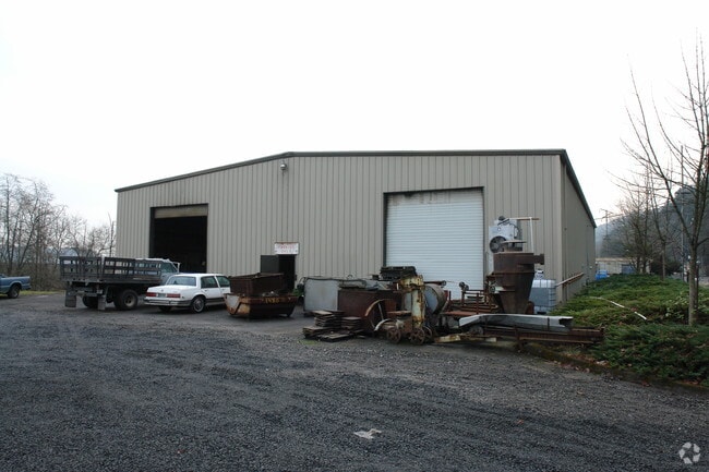
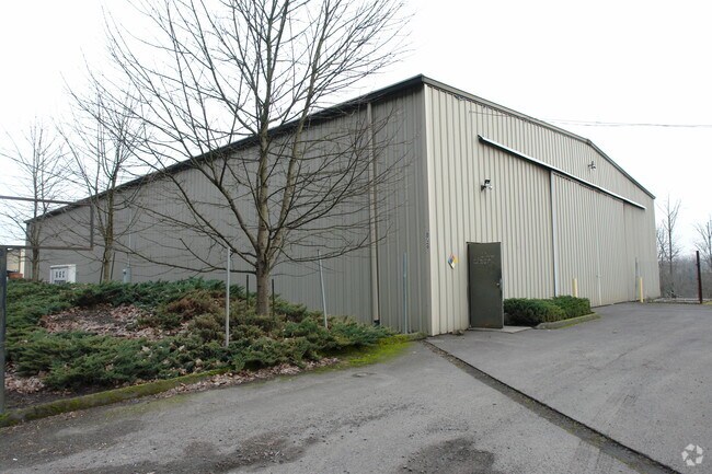
Property Record
6688 Nw Saint Helens Rd, Portland, OR 97210


NEARBY LISTINGS FOR SALE OR LEASE
Property Detail
6688 Nw Saint Helens Rd
R324194
SECTION 13 1N 1W, TL 500 0.68 ACRES
Industrialgeneral
Multnomah
ARE
Oregon
41067C0375E
0.68 AC
2025
Guilds Lake
2025
Portland
004300
Portland-Vancouver-Hillsboro, OR-WA
11,344 SF
DEMOGRAPHICS near 6688 Nw Saint Helens Rd
1 Mile
3 Mile
5 Mile
2024 Total Population
458
55,510
231,536
2029 Population
449
54,406
230,851
Pop Growth 2024-2029
(1.97%)
(1.99%)
(0.30%)
Average Age
42
38
39
2024 Total Households
197
20,368
101,897
HH Growth 2024-2029
(2.03%)
(2.40%)
(0.48%)
Median Household Inc
$74,127
$106,120
$98,240
Avg Household Size
2.30
2.50
2.20
2024 Avg HH Vehicles
2.00
2.00
2.00
Median Home Value
$492,104
$581,262
$649,149
Median Year Built
1948
1972
1984
Nearby Places
Map Layers
Map Styles
 Street
 Aerial
- Restaurants
- Banks
- Shops
- Fitness
- Groceries
PUBLIC TRANSPORTATION
COMMUTER RAIL
DRIVE
WALK
Distance
12 min
5.3 mi
AIRPORT
Portland International
DRIVE
WALK
Distance
Portland International
28 min
14.7 mi
Nearby Properties
Address
Land Use
TOTAL SIZE
Lot Size
Zoning
Address
Land Use
TOTAL SIZE
Lot Size
Zoning
200,109 SF
70.44 AC
IH
Address
Land Use
TOTAL SIZE
Lot Size
Zoning
882,480 SF
80.73 AC
CI1
Address
Land Use
TOTAL SIZE
Lot Size
Zoning
Address
Land Use
TOTAL SIZE
Lot Size
Zoning
262,045 SF
17.10 AC
R5
Address
Land Use
TOTAL SIZE
Lot Size
Zoning
Address
Land Use
TOTAL SIZE
Lot Size
Zoning
335.31 AC
OS
Address
Land Use
TOTAL SIZE
Lot Size
Zoning
191,506 SF
10.43 AC
IH
Address
Land Use
TOTAL SIZE
Lot Size
Zoning
537,280 SF
NULL
Address
Land Use
TOTAL SIZE
Lot Size
Zoning
75.20 AC
IH
Address
Land Use
TOTAL SIZE
Lot Size
Zoning
318,562 SF
33.59 AC
CI1
Address
Land Use
TOTAL SIZE
Lot Size
Zoning
Address
Land Use
TOTAL SIZE
Lot Size
Zoning
100 SF
82.93 AC
IH
Address
Land Use
TOTAL SIZE
Lot Size
Zoning
73,657 SF
1.90 AC
CI1
Address
Land Use
TOTAL SIZE
Lot Size
Zoning
963,658 SF
64.43 AC
IH
Address
Land Use
TOTAL SIZE
Lot Size
Zoning
37,770 SF
6.90 AC
EG2
Address
Land Use
TOTAL SIZE
Lot Size
Zoning
Address
Land Use
TOTAL SIZE
Lot Size
Zoning
610,230 SF
26.65 AC
IH
Address
Land Use
TOTAL SIZE
Lot Size
Zoning
Address
Land Use
TOTAL SIZE
Lot Size
Zoning
Address
Land Use
TOTAL SIZE
Lot Size
Zoning
909,769 SF
29.86 AC
IHI
Address
Land Use
TOTAL SIZE
Lot Size
Zoning
229,981 SF
5.29 AC
EG2_EG2C
Address
Land Use
TOTAL SIZE
Lot Size
Zoning
Address
Land Use
TOTAL SIZE
Lot Size
Zoning
215,104 SF
NULL
Address
Land Use
TOTAL SIZE
Lot Size
Zoning
385,275 SF
25.29 AC
IH
Address
Land Use
TOTAL SIZE
Lot Size
Zoning
24.90 AC
IG2
Address
Land Use
TOTAL SIZE
Lot Size
Zoning
212,785 SF
22.27 AC
IG2
Address
Land Use
TOTAL SIZE
Lot Size
Zoning
96,513 SF
1.74 AC
CI1
Address
Land Use
TOTAL SIZE
Lot Size
Zoning
100,000 SF
8.34 AC
INST
Address
Land Use
TOTAL SIZE
Lot Size
Zoning
93,519 SF
1.12 AC
CI1
Address
Land Use
TOTAL SIZE
Lot Size
Zoning
301,812 SF
17.46 AC
IG2
The World's #1 Commercial Real Estate Marketplace
Connect with us
© 2025 CoStar Group
The information above has been obtained from sources believed reliable. While we do not doubt its accuracy we have not verified it and make no guarantee, warranty or representation about it. It is your responsibility to independently confirm its accuracy and completeness. Any projections, opinions, assumptions, or estimates used are for example only and do not represent the current or future performance of the property. The value of this transaction to you depends on tax and other factors which should be evaluated by your tax, financial, and legal advisors. You and your advisors should conduct a careful, independent investigation of the property to determine to your satisfaction the suitability of the property for your needs.