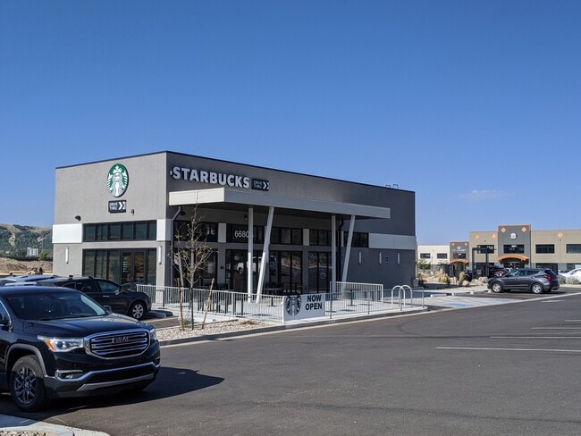
Property Record
6696 S 2500 E, Ogden, UT 84405

NEARBY LISTINGS FOR SALE OR LEASE
Property Detail
6696 S 2500 E
Ogden-Clearfield, UT
Uintah Springs Business Park Phase 2
07-777-0003
ALL OF LOT 6, UINTAH SPRINGS BUSINESS PARK PHASE 2, UINTAH CITY, WEBER COUNTY, UTAH.
Officebuilding
Weber
X
Utah
49011C0093F
6
2025
0.97 AC
2025
Davis/Weber Counties
211202
Salt Lake City
16,222 SF
DEMOGRAPHICS near 6696 S 2500 E
1 Mile
3 Mile
5 Mile
2024 Total Population
3,121
31,677
97,440
2029 Population
3,314
33,656
103,902
Pop Growth 2024-2029
+ 6.18%
+ 6.25%
+ 6.63%
Average Age
38
39
36
2024 Total Households
973
10,779
33,306
HH Growth 2024-2029
+ 6.37%
+ 6.55%
+ 6.74%
Median Household Inc
$116,406
$106,271
$82,585
Avg Household Size
3.20
2.90
2.80
2024 Avg HH Vehicles
3.00
2.00
2.00
Median Home Value
$496,408
$475,883
$394,666
Median Year Built
1990
1993
1987
Nearby Places
Map Layers
Map Styles
 Street
 Aerial
- Restaurants
- Banks
- Shops
- Fitness
- Groceries
PUBLIC TRANSPORTATION
COMMUTER RAIL
Layton (FrontRunner North - Utah Transit Authority (UTA))
DRIVE
WALK
Distance
Layton (FrontRunner North - Utah Transit Authority (UTA))
14 min
8.5 mi
Clearfield (FrontRunner North - Utah Transit Authority (UTA))
DRIVE
WALK
Distance
Clearfield (FrontRunner North - Utah Transit Authority (UTA))
16 min
8.6 mi
AIRPORT
Salt Lake City International
DRIVE
WALK
Distance
Salt Lake City International
39 min
30.3 mi
Freight Ports
Port of Stockton
DRIVE
WALK
Distance
Port of Stockton
740 min
720.7 mi
SALE & LEASE HISTORY
LISTING DATE
SALE/LEASE

Sep 23, 2020
For Sale
Jun 26, 2019
For Sale
Nearby Properties
Address
Land Use
TOTAL SIZE
Lot Size
Zoning
Address
Land Use
TOTAL SIZE
Lot Size
Zoning
13,376 SF
11.50 AC
Address
Land Use
TOTAL SIZE
Lot Size
Zoning
4,442 SF
7.19 AC
Address
Land Use
TOTAL SIZE
Lot Size
Zoning
7,672 SF
11.64 AC
RM1
Address
Land Use
TOTAL SIZE
Lot Size
Zoning
63,343 SF
16.43 AC
Address
Land Use
TOTAL SIZE
Lot Size
Zoning
20,636 SF
6.30 AC
Address
Land Use
TOTAL SIZE
Lot Size
Zoning
134,666 SF
13.50 AC
Address
Land Use
TOTAL SIZE
Lot Size
Zoning
1,618 SF
5.65 AC
RM1PRUD
Address
Land Use
TOTAL SIZE
Lot Size
Zoning
101,279 SF
9.70 AC
M1
Address
Land Use
TOTAL SIZE
Lot Size
Zoning
24,933 SF
19.51 AC
R110
Address
Land Use
TOTAL SIZE
Lot Size
Zoning
4,504 SF
4.16 AC
Address
Land Use
TOTAL SIZE
Lot Size
Zoning
49,441 SF
1.80 AC
RM
Address
Land Use
TOTAL SIZE
Lot Size
Zoning
78,289 SF
4 AC
Address
Land Use
TOTAL SIZE
Lot Size
Zoning
58,727 SF
4.98 AC
Address
Land Use
TOTAL SIZE
Lot Size
Zoning
48,444 SF
20.76 AC
Address
Land Use
TOTAL SIZE
Lot Size
Zoning
44,211 SF
3.15 AC
Address
Land Use
TOTAL SIZE
Lot Size
Zoning
68,554 SF
11.47 AC
A
Address
Land Use
TOTAL SIZE
Lot Size
Zoning
56,932 SF
7.77 AC
C-H
Address
Land Use
TOTAL SIZE
Lot Size
Zoning
7,704 SF
3.07 AC
Address
Land Use
TOTAL SIZE
Lot Size
Zoning
68,808 SF
4.88 AC
RM
Address
Land Use
TOTAL SIZE
Lot Size
Zoning
80,182 SF
43.16 AC
Address
Land Use
TOTAL SIZE
Lot Size
Zoning
29,693 SF
3 AC
RM
Address
Land Use
TOTAL SIZE
Lot Size
Zoning
40,972 SF
6.39 AC
CP1
Address
Land Use
TOTAL SIZE
Lot Size
Zoning
140 SF
20.24 AC
NR
Address
Land Use
TOTAL SIZE
Lot Size
Zoning
16,813 SF
4 AC
Address
Land Use
TOTAL SIZE
Lot Size
Zoning
1,200 SF
0.89 AC
Address
Land Use
TOTAL SIZE
Lot Size
Zoning
12,932 SF
6.40 AC
The World's #1 Commercial Real Estate Marketplace
Connect with us
© 2026 CoStar Group
The information above has been obtained from sources believed reliable. While we do not doubt its accuracy we have not verified it and make no guarantee, warranty or representation about it. It is your responsibility to independently confirm its accuracy and completeness. Any projections, opinions, assumptions, or estimates used are for example only and do not represent the current or future performance of the property. The value of this transaction to you depends on tax and other factors which should be evaluated by your tax, financial, and legal advisors. You and your advisors should conduct a careful, independent investigation of the property to determine to your satisfaction the suitability of the property for your needs.