Property Record
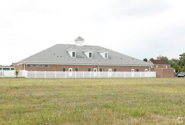
6697 N Canton Center Rd, Canton, MI 48187


NEARBY LISTINGS FOR SALE OR LEASE
Property Detail
6697 N Canton Center Rd
Detroit-Warren-Dearborn, MI
Sunflower Village
71-033-99-0009-717
PART OF THE NE 1/4 SEC 9, T2S R8E, CANTON TOWNSHIP, WAYNE COUNTY, MICHIGAN DESC AS: COMMENCING AT THE E 1/4 COR SEC 9 TH ALONG E LINE SEC 9 N 00DEG 10M 57S E 855.94 FT TH S 89DEG 47M 06S W 60.00 FT TO W'LY ROW CANTON CENTER ROAD AND POB TH S 89DEG 47
Daycare
Wayne
X
Michigan
26163C0203E
0009
2025
1.40 AC
2025
Southern I-275 Corridor
563500
Detroit
10,516 SF
DEMOGRAPHICS near 6697 N Canton Center Rd
1 Mile
3 Mile
5 Mile
2024 Total Population
10,855
77,968
156,078
2029 Population
10,408
74,693
150,013
Pop Growth 2024-2029
(4.12%)
(4.20%)
(3.89%)
Average Age
41
41
41
2024 Total Households
3,844
29,301
62,272
HH Growth 2024-2029
(4.14%)
(4.18%)
(3.87%)
Median Household Inc
$119,007
$113,989
$98,723
Avg Household Size
2.80
2.60
2.50
2024 Avg HH Vehicles
2.00
2.00
2.00
Median Home Value
$304,349
$328,472
$300,476
Median Year Built
1978
1981
1983
Nearby Places
Map Layers
Map Styles
 Street
 Aerial
- Restaurants
- Banks
- Shops
- Fitness
- Groceries
PUBLIC TRANSPORTATION
AIRPORT
Detroit Metro Wayne County
DRIVE
WALK
Distance
Detroit Metro Wayne County
23 min
16.4 mi
Windsor International
DRIVE
WALK
Distance
Windsor International
59 min
37.9 mi
Freight Ports
Port of Toledo
DRIVE
WALK
Distance
Port of Toledo
72 min
58.1 mi
Nearby Properties
Address
Land Use
TOTAL SIZE
Lot Size
Zoning
Address
Land Use
TOTAL SIZE
Lot Size
Zoning
17.50 AC
R-2
Address
Land Use
TOTAL SIZE
Lot Size
Zoning
400,857 SF
27.44 AC
RP
Address
Land Use
TOTAL SIZE
Lot Size
Zoning
37.30 AC
MR
Address
Land Use
TOTAL SIZE
Lot Size
Zoning
176,796 SF
17.08 AC
C-2
Address
Land Use
TOTAL SIZE
Lot Size
Zoning
167,491 SF
18.59 AC
Address
Land Use
TOTAL SIZE
Lot Size
Zoning
408,122 SF
23.31 AC
MR
Address
Land Use
TOTAL SIZE
Lot Size
Zoning
21.71 AC
MR
Address
Land Use
TOTAL SIZE
Lot Size
Zoning
311,556 SF
23.17 AC
C-3
Address
Land Use
TOTAL SIZE
Lot Size
Zoning
24.63 AC
MR
Address
Land Use
TOTAL SIZE
Lot Size
Zoning
20.91 AC
Address
Land Use
TOTAL SIZE
Lot Size
Zoning
206,896 SF
19.49 AC
R-6
Address
Land Use
TOTAL SIZE
Lot Size
Zoning
123,225 SF
9 AC
CJ/ARC
Address
Land Use
TOTAL SIZE
Lot Size
Zoning
Address
Land Use
TOTAL SIZE
Lot Size
Zoning
954,882 SF
47.92 AC
LI-2
Address
Land Use
TOTAL SIZE
Lot Size
Zoning
186,967 SF
9.75 AC
Address
Land Use
TOTAL SIZE
Lot Size
Zoning
11.40 AC
MR
Address
Land Use
TOTAL SIZE
Lot Size
Zoning
16.03 AC
MR
Address
Land Use
TOTAL SIZE
Lot Size
Zoning
147,968 SF
16.68 AC
Address
Land Use
TOTAL SIZE
Lot Size
Zoning
66,670 SF
11.20 AC
C-3
Address
Land Use
TOTAL SIZE
Lot Size
Zoning
269,649 SF
18.27 AC
LI-1
Address
Land Use
TOTAL SIZE
Lot Size
Zoning
78,205 SF
14.66 AC
RR
Address
Land Use
TOTAL SIZE
Lot Size
Zoning
484,535 SF
30.20 AC
IND
Address
Land Use
TOTAL SIZE
Lot Size
Zoning
100,098 SF
10.52 AC
C-2
Address
Land Use
TOTAL SIZE
Lot Size
Zoning
73,056 SF
7.44 AC
C-3
Address
Land Use
TOTAL SIZE
Lot Size
Zoning
187,281 SF
26.35 AC
C-2
Address
Land Use
TOTAL SIZE
Lot Size
Zoning
51,550 SF
6.49 AC
O-1
Address
Land Use
TOTAL SIZE
Lot Size
Zoning
122,116 SF
4.99 AC
PUD
Address
Land Use
TOTAL SIZE
Lot Size
Zoning
17.38 AC
MR
Address
Land Use
TOTAL SIZE
Lot Size
Zoning
204,978 SF
10.28 AC
LI-1
Address
Land Use
TOTAL SIZE
Lot Size
Zoning
5.43 AC
R-2
The World's #1 Commercial Real Estate Marketplace
Connect with us
© 2025 CoStar Group
The information above has been obtained from sources believed reliable. While we do not doubt its accuracy we have not verified it and make no guarantee, warranty or representation about it. It is your responsibility to independently confirm its accuracy and completeness. Any projections, opinions, assumptions, or estimates used are for example only and do not represent the current or future performance of the property. The value of this transaction to you depends on tax and other factors which should be evaluated by your tax, financial, and legal advisors. You and your advisors should conduct a careful, independent investigation of the property to determine to your satisfaction the suitability of the property for your needs.