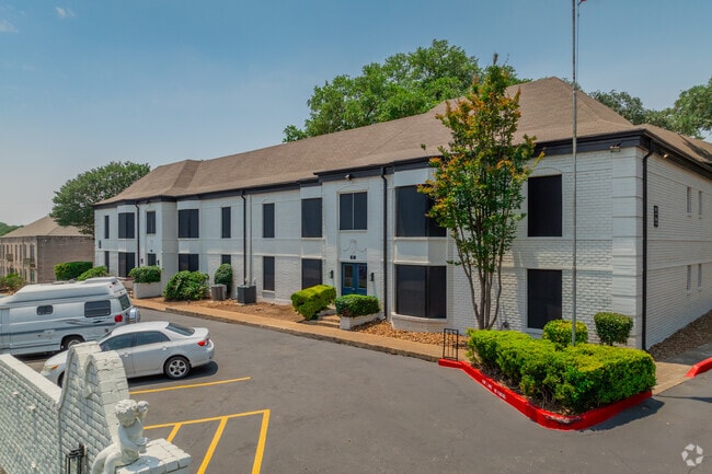
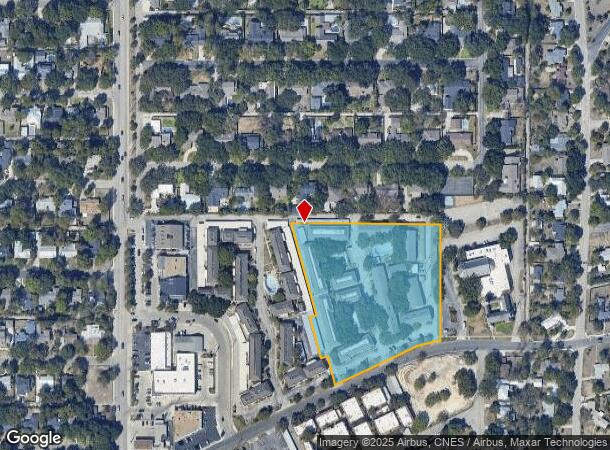
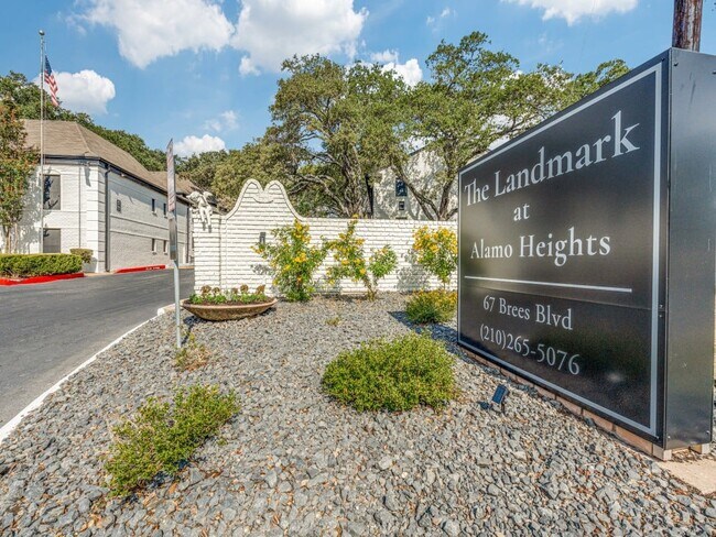
Property Record
67 Brees Blvd, San Antonio, TX 78209
NEARBY LISTINGS FOR SALE OR LEASE
Property Detail
67 Brees Blvd
San Antonio-New Braunfels, TX
Meadowwood Estates Coml Area B
12710-000-0201
NCB 12710 BLK LOT 20 & 26
Multifamilydwelling
Bexar
X
Texas
48029C0402H
201
2024
4.85 AC
2025
Terrell Heights
120602
San Antonio
126,704 SF
DEMOGRAPHICS near 67 Brees Blvd
1 Mile
3 Mile
5 Mile
2024 Total Population
13,772
93,134
266,429
2029 Population
14,616
99,546
284,233
Pop Growth 2024-2029
+ 6.13%
+ 6.88%
+ 6.68%
Average Age
40
40
39
2024 Total Households
6,142
39,259
107,728
HH Growth 2024-2029
+ 6.43%
+ 7.11%
+ 6.97%
Median Household Inc
$100,779
$64,468
$52,038
Avg Household Size
2.20
2.20
2.30
2024 Avg HH Vehicles
2.00
2.00
2.00
Median Home Value
$464,382
$345,919
$223,107
Median Year Built
1957
1968
1968
Nearby Places
Map Layers
Map Styles
 Street
 Aerial
- Restaurants
- Banks
- Shops
- Fitness
- Groceries
PUBLIC TRANSPORTATION
COMMUTER RAIL
San Antonio Amtrak Station (Sunset Limited - Amtrak, Texas Eagle - Amtrak)
DRIVE
WALK
Distance
San Antonio Amtrak Station (Sunset Limited - Amtrak, Texas Eagle - Amtrak)
12 min
6.6 mi
AIRPORT
San Antonio International
DRIVE
WALK
Distance
San Antonio International
9 min
3.5 mi
Freight Ports
Calhoun Port
DRIVE
WALK
Distance
Calhoun Port
186 min
149.7 mi
SALE & LEASE HISTORY
LISTING DATE
SALE/LEASE

Apr 20, 2021
For Sale
Apr 15, 2019
For Sale
Nearby Properties
Address
Land Use
TOTAL SIZE
Lot Size
Zoning
Address
Land Use
TOTAL SIZE
Lot Size
Zoning
557,078 SF
10.73 AC
Address
Land Use
TOTAL SIZE
Lot Size
Zoning
632,091 SF
27.82 AC
Address
Land Use
TOTAL SIZE
Lot Size
Zoning
173,422 SF
5.85 AC
Address
Land Use
TOTAL SIZE
Lot Size
Zoning
324,360 SF
15.05 AC
Address
Land Use
TOTAL SIZE
Lot Size
Zoning
246,000 SF
22.54 AC
Address
Land Use
TOTAL SIZE
Lot Size
Zoning
25,513 SF
18.14 AC
Address
Land Use
TOTAL SIZE
Lot Size
Zoning
303,199 SF
9.88 AC
Address
Land Use
TOTAL SIZE
Lot Size
Zoning
38.73 AC
Address
Land Use
TOTAL SIZE
Lot Size
Zoning
46,451 SF
7.03 AC
Address
Land Use
TOTAL SIZE
Lot Size
Zoning
Address
Land Use
TOTAL SIZE
Lot Size
Zoning
56,042 SF
14.60 AC
Address
Land Use
TOTAL SIZE
Lot Size
Zoning
239,264 SF
9.02 AC
Address
Land Use
TOTAL SIZE
Lot Size
Zoning
262,515 SF
6.38 AC
Address
Land Use
TOTAL SIZE
Lot Size
Zoning
316,556 SF
6.56 AC
Address
Land Use
TOTAL SIZE
Lot Size
Zoning
10,342 SF
1.41 AC
Address
Land Use
TOTAL SIZE
Lot Size
Zoning
250,990 SF
4.89 AC
Address
Land Use
TOTAL SIZE
Lot Size
Zoning
23,738 SF
4.84 AC
Address
Land Use
TOTAL SIZE
Lot Size
Zoning
268,495 SF
13.04 AC
Address
Land Use
TOTAL SIZE
Lot Size
Zoning
314,264 SF
4.27 AC
Address
Land Use
TOTAL SIZE
Lot Size
Zoning
32,315 SF
21.03 AC
Address
Land Use
TOTAL SIZE
Lot Size
Zoning
307,193 SF
7.18 AC
Address
Land Use
TOTAL SIZE
Lot Size
Zoning
128,396 SF
6.77 AC
Address
Land Use
TOTAL SIZE
Lot Size
Zoning
8,671 SF
2.71 AC
Address
Land Use
TOTAL SIZE
Lot Size
Zoning
157,762 SF
9.26 AC
Address
Land Use
TOTAL SIZE
Lot Size
Zoning
23.26 AC
Address
Land Use
TOTAL SIZE
Lot Size
Zoning
245,160 SF
15.10 AC
Address
Land Use
TOTAL SIZE
Lot Size
Zoning
74,510 SF
6.58 AC
Address
Land Use
TOTAL SIZE
Lot Size
Zoning
Address
Land Use
TOTAL SIZE
Lot Size
Zoning
279,012 SF
12.17 AC
Address
Land Use
TOTAL SIZE
Lot Size
Zoning
192,175 SF
5.08 AC
The World's #1 Commercial Real Estate Marketplace
Connect with us
© 2026 CoStar Group
The information above has been obtained from sources believed reliable. While we do not doubt its accuracy we have not verified it and make no guarantee, warranty or representation about it. It is your responsibility to independently confirm its accuracy and completeness. Any projections, opinions, assumptions, or estimates used are for example only and do not represent the current or future performance of the property. The value of this transaction to you depends on tax and other factors which should be evaluated by your tax, financial, and legal advisors. You and your advisors should conduct a careful, independent investigation of the property to determine to your satisfaction the suitability of the property for your needs.