Property Record
67 E Garner Rd, Brownsburg, IN 46112

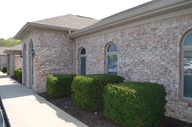

Property Detail
67 E Garner Rd
32-07-02-507-005.000-026
NORTHSIDE OFFICE PARK BLDG B UNIT 800 0.300AC (PT OF WHITINGTON PARK TRACT C) DBA SHAFER VISION CARE:
Officebuilding
HENDRICKS
B and X Area of moderate flood hazard, usually the area between the limits of the 100-year and 500-year floods.
Indiana
2025
0.30 AC
2025
Hendricks County
210106
Indianapolis
1,200 SF
Indianapolis-Carmel-Greenwood, IN
NEARBY LISTINGS FOR SALE OR LEASE
DEMOGRAPHICS near 67 E Garner Rd
1 mile
3 mile
5 mile
2025 Total Population
6,551
37,721
69,753
2030 Population
7,060
40,519
74,858
Pop Growth 2025-2030
+ 7.77%
+ 7.42%
+ 7.32%
Average Age
37
39
39
2025 Total Households
2,389
13,604
25,299
HH Growth 2025-2030
+ 7.91%
+ 7.62%
+ 7.48%
Median Household Inc
$114,522
$109,891
$113,771
Avg Household Size
2.70
2.70
2.70
2025 Avg HH Vehicles
2.00
2.00
2.00
Median Home Value
$346,934
$316,911
$336,539
Median Year Built
2000
1998
1999
Nearby Places
Map Layers
Map Styles
 Street
 Aerial
Layers
 Traffic
 Biking
Places
Listings with unknown addresses are not visible on the map
- Restaurants
- Banks
- Shops
- Fitness
- Groceries
PUBLIC TRANSPORTATION
AIRPORT
Indianapolis International
Drive
Walk
Distance
Indianapolis International
29 min
16.0 mi
Freight Ports
Port of Toledo
Drive
Walk
Distance
Port of Toledo
286 min
234.5 mi
SALE & LEASE HISTORY
LISTING DATE
SALE/LEASE

Oct 11, 2017
For Sale
Nearby Properties
Address
Land Use
TOTAL SIZE
Lot Size
Zoning
Address
Land Use
TOTAL SIZE
Lot Size
Zoning
805,018 SF
48.20 AC
Address
Land Use
TOTAL SIZE
Lot Size
Zoning
683,528 SF
43.54 AC
Address
Land Use
TOTAL SIZE
Lot Size
Zoning
773,129 SF
36.12 AC
Address
Land Use
TOTAL SIZE
Lot Size
Zoning
54,586 SF
5.84 AC
Address
Land Use
TOTAL SIZE
Lot Size
Zoning
Address
Land Use
TOTAL SIZE
Lot Size
Zoning
244,838 SF
3.01 AC
Address
Land Use
TOTAL SIZE
Lot Size
Zoning
225,712 SF
2.22 AC
Address
Land Use
TOTAL SIZE
Lot Size
Zoning
3,712 SF
17.58 AC
Address
Land Use
TOTAL SIZE
Lot Size
Zoning
526,200 SF
28.31 AC
Address
Land Use
TOTAL SIZE
Lot Size
Zoning
405,824 SF
32.37 AC
Address
Land Use
TOTAL SIZE
Lot Size
Zoning
396,768 SF
20.88 AC
Address
Land Use
TOTAL SIZE
Lot Size
Zoning
86,706 SF
19.47 AC
Address
Land Use
TOTAL SIZE
Lot Size
Zoning
Address
Land Use
TOTAL SIZE
Lot Size
Zoning
204,358 SF
12.50 AC
Address
Land Use
TOTAL SIZE
Lot Size
Zoning
100,108 SF
50.12 AC
Address
Land Use
TOTAL SIZE
Lot Size
Zoning
80,046 SF
13.65 AC
Address
Land Use
TOTAL SIZE
Lot Size
Zoning
20.46 AC
Address
Land Use
TOTAL SIZE
Lot Size
Zoning
99,038 SF
7.09 AC
Address
Land Use
TOTAL SIZE
Lot Size
Zoning
17,500 SF
33.72 AC
Address
Land Use
TOTAL SIZE
Lot Size
Zoning
75,809 SF
7.91 AC
Address
Land Use
TOTAL SIZE
Lot Size
Zoning
5,934 SF
9.78 AC
Address
Land Use
TOTAL SIZE
Lot Size
Zoning
190,668 SF
14.97 AC
Address
Land Use
TOTAL SIZE
Lot Size
Zoning
60,193 SF
3.54 AC
Address
Land Use
TOTAL SIZE
Lot Size
Zoning
57,080 SF
2.04 AC
Address
Land Use
TOTAL SIZE
Lot Size
Zoning
41,586 SF
10.30 AC
Address
Land Use
TOTAL SIZE
Lot Size
Zoning
15.70 AC
Address
Land Use
TOTAL SIZE
Lot Size
Zoning
122,044 SF
15.52 AC
Address
Land Use
TOTAL SIZE
Lot Size
Zoning
28,228 SF
16.07 AC
Address
Land Use
TOTAL SIZE
Lot Size
Zoning
38,436 SF
7.99 AC
Address
Land Use
TOTAL SIZE
Lot Size
Zoning
25,928 SF
8.83 AC
The World's #1 Commercial Real Estate Marketplace
Connect with us
© 2026 CoStar Group
The information above has been obtained from sources believed reliable. While we do not doubt its accuracy we have not verified it and make no guarantee, warranty or representation about it. It is your responsibility to independently confirm its accuracy and completeness. Any projections, opinions, assumptions, or estimates used are for example only and do not represent the current or future performance of the property. The value of this transaction to you depends on tax and other factors which should be evaluated by your tax, financial, and legal advisors. You and your advisors should conduct a careful, independent investigation of the property to determine to your satisfaction the suitability of the property for your needs.