Property Record
67 Lehigh Ave, Pueblo, CO 81005


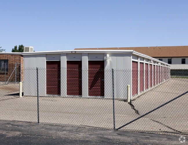
Property Detail
67 Lehigh Ave
1-5-09-1-02-012
LOT 3 LESS TRACT SOLD TO PUEBLO 1ST PARTNERSHIP,#686567. ALSO ALL LOTS 4-7 BLK 1 LEHIGH SQUARE 1ST ALSO,LOTS 1-4 BLK 1 BSA SUB 1ST. FORMERLY 15-091-26-001 THRU,004 + 15-091-02-011
Commercialnec
PUEBLO
B3:COMM/H&
Colorado
B and X Area of moderate flood hazard, usually the area between the limits of the 100-year and 500-year floods.
3,4-7
2024
4.29 AC
2024
Colorado East Area
002807
Other Market Areas
76,149 SF
Pueblo, CO
NEARBY LISTINGS FOR SALE OR LEASE
-
-
View all Pueblo listings for sale on LoopNet.com
DEMOGRAPHICS near 67 Lehigh Ave
1 mile
3 mile
5 mile
2025 Total Population
14,082
56,518
83,973
2030 Population
13,980
56,243
83,738
Pop Growth 2025-2030
(0.72%)
(0.49%)
(0.28%)
Average Age
44
42
41
2025 Total Households
5,888
23,517
34,642
HH Growth 2025-2030
(0.66%)
(0.46%)
(0.24%)
Median Household Inc
$67,346
$62,705
$57,931
Avg Household Size
2.30
2.30
2.30
2025 Avg HH Vehicles
2.00
2.00
2.00
Median Home Value
$308,640
$278,348
$261,453
Median Year Built
1974
1963
1960
Nearby Places
Map Layers
Map Styles
 Street
 Aerial
Transit
 Traffic
 Biking
Places
Listings with unknown addresses are not visible on the map
- Restaurants
- Banks
- Shops
- Fitness
- Groceries
Nearby Properties
Address
Land Use
TOTAL SIZE
Lot Size
Zoning
Address
Land Use
TOTAL SIZE
Lot Size
Zoning
4,492,279 SF
488.39 AC
Address
Land Use
TOTAL SIZE
Lot Size
Zoning
79,394 SF
5.57 AC
R5:RES/MUL
Address
Land Use
TOTAL SIZE
Lot Size
Zoning
40,986 SF
0.65 AC
R5:RES/MUL
Address
Land Use
TOTAL SIZE
Lot Size
Zoning
56,088 SF
4 AC
Address
Land Use
TOTAL SIZE
Lot Size
Zoning
94,278 SF
2.11 AC
R-5
Address
Land Use
TOTAL SIZE
Lot Size
Zoning
33,866 SF
3.34 AC
Address
Land Use
TOTAL SIZE
Lot Size
Zoning
199,914 SF
13.48 AC
B4:COMM/RE
Address
Land Use
TOTAL SIZE
Lot Size
Zoning
1,070,193 SF
43.08 AC
R5:RES/MUL
Address
Land Use
TOTAL SIZE
Lot Size
Zoning
45,219 SF
4.46 AC
Address
Land Use
TOTAL SIZE
Lot Size
Zoning
35,530 SF
0.55 AC
R-4
Address
Land Use
TOTAL SIZE
Lot Size
Zoning
19,763 SF
2.50 AC
R2:RES/1 F
Address
Land Use
TOTAL SIZE
Lot Size
Zoning
113,152 SF
5.84 AC
R4:RES/MUL
Address
Land Use
TOTAL SIZE
Lot Size
Zoning
136,337 SF
14.81 AC
PUD
Address
Land Use
TOTAL SIZE
Lot Size
Zoning
71,751 SF
2.73 AC
R3:RES/2 F
Address
Land Use
TOTAL SIZE
Lot Size
Zoning
28,490 SF
0.23 AC
R4:RES/MUL
Address
Land Use
TOTAL SIZE
Lot Size
Zoning
12,150 SF
1.10 AC
Address
Land Use
TOTAL SIZE
Lot Size
Zoning
12,018 SF
0.76 AC
B2:COMM/SU
Address
Land Use
TOTAL SIZE
Lot Size
Zoning
93,055 SF
9 AC
PUD
Address
Land Use
TOTAL SIZE
Lot Size
Zoning
42,408 SF
5.97 AC
B1:COMM/NG
Address
Land Use
TOTAL SIZE
Lot Size
Zoning
81,140 SF
3.22 AC
Address
Land Use
TOTAL SIZE
Lot Size
Zoning
154,378 SF
14.33 AC
B4:COMM/RE
Address
Land Use
TOTAL SIZE
Lot Size
Zoning
54,947 SF
2.03 AC
B3:COMM/H&
Address
Land Use
TOTAL SIZE
Lot Size
Zoning
29,338 SF
0.89 AC
B-4
Address
Land Use
TOTAL SIZE
Lot Size
Zoning
12,600 SF
0.23 AC
I3:IND/HEA
Address
Land Use
TOTAL SIZE
Lot Size
Zoning
61,485 SF
2.39 AC
I3:IND/HEA
Address
Land Use
TOTAL SIZE
Lot Size
Zoning
83,900 SF
0.83 AC
B-3
Address
Land Use
TOTAL SIZE
Lot Size
Zoning
95,309 SF
8.74 AC
B4:COMM/RE
Address
Land Use
TOTAL SIZE
Lot Size
Zoning
58,440 SF
4.42 AC
B-3
Address
Land Use
TOTAL SIZE
Lot Size
Zoning
10,200 SF
0.60 AC
R-3
The World's #1 Commercial Real Estate Marketplace
Connect with us
© 2026 CoStar Group
The information above has been obtained from sources believed reliable. While we do not doubt its accuracy we have not verified it and make no guarantee, warranty or representation about it. It is your responsibility to independently confirm its accuracy and completeness. Any projections, opinions, assumptions, or estimates used are for example only and do not represent the current or future performance of the property. The value of this transaction to you depends on tax and other factors which should be evaluated by your tax, financial, and legal advisors. You and your advisors should conduct a careful, independent investigation of the property to determine to your satisfaction the suitability of the property for your needs.