Property Record
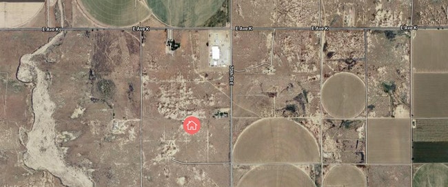
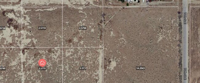
67 Ste Ave, Lancaster, CA 93535

This Property Is For Sale
Property Detail
67 Ste Ave
Los Angeles-Long Beach-Glendale, CA
SW 1/4 OF NW 1/4 OF NE 1/4 OF SE 1/4 OF SEC 26 T 7N R 11W
3386-010-013
LOS ANGELES
Residentialacreage
California
LCA21*
26
B and X Area of moderate flood hazard, usually the area between the limits of the 100-year and 500-year floods.
2.57 AC
2024
Antelope Valley
2025
Los Angeles
900508
NEARBY LISTINGS FOR SALE OR LEASE
DEMOGRAPHICS near 67 Ste Ave
1 mile
3 mile
5 mile
2025 Total Population
30
579
23,268
2030 Population
31
600
23,240
Pop Growth 2025-2030
+ 3.33%
+ 3.63%
(0.12%)
Average Age
39
40
35
2025 Total Households
9
183
6,346
HH Growth 2025-2030
0.00%
+ 3.83%
(0.24%)
Median Household Inc
$74,999
$66,710
$70,137
Avg Household Size
3.50
3.10
3.40
2025 Avg HH Vehicles
3.00
3.00
2.00
Median Home Value
$450,000
$482,142
$389,792
Median Year Built
1982
1984
1987
Nearby Places
Map Layers
Map Styles
 Street
 Aerial
Transit
 Traffic
 Biking
Places
Listings with unknown addresses are not visible on the map
- Restaurants
- Banks
- Shops
- Fitness
- Groceries
PUBLIC TRANSPORTATION
COMMUTER RAIL
Lancaster (Antelope Valley Line - Southern California Regional Rail Authority (Metrolink))
Drive
Walk
Distance
Lancaster (Antelope Valley Line - Southern California Regional Rail Authority (Metrolink))
16 min
9.5 mi
Freight Ports
Port of Long Beach
Drive
Walk
Distance
Port of Long Beach
120 min
95.0 mi
Nearby Properties
Address
Land Use
TOTAL SIZE
Lot Size
Zoning
Address
Land Use
TOTAL SIZE
Lot Size
Zoning
74,797 SF
15.44 AC
LCA21*
Address
Land Use
TOTAL SIZE
Lot Size
Zoning
3,874 SF
38.70 AC
PDM2 1/2-A
Address
Land Use
TOTAL SIZE
Lot Size
Zoning
1,917 SF
469.84 AC
LRR2.5
Address
Land Use
TOTAL SIZE
Lot Size
Zoning
279.67 AC
LCA21*
Address
Land Use
TOTAL SIZE
Lot Size
Zoning
325.63 AC
LCA11*
Address
Land Use
TOTAL SIZE
Lot Size
Zoning
5,482 SF
98.77 AC
POM11/2-A2
Address
Land Use
TOTAL SIZE
Lot Size
Zoning
1 SF
121.43 AC
LCA21*
Address
Land Use
TOTAL SIZE
Lot Size
Zoning
73.50 AC
LCA11*
Address
Land Use
TOTAL SIZE
Lot Size
Zoning
160.73 AC
LRR2.5
Address
Land Use
TOTAL SIZE
Lot Size
Zoning
158.16 AC
LCC4-R1750
Address
Land Use
TOTAL SIZE
Lot Size
Zoning
4,598 SF
2.24 AC
LCA21*
Address
Land Use
TOTAL SIZE
Lot Size
Zoning
1,374 SF
78.59 AC
LCA21*
Address
Land Use
TOTAL SIZE
Lot Size
Zoning
5,344 SF
78.51 AC
LCA21*
Address
Land Use
TOTAL SIZE
Lot Size
Zoning
5,236 SF
1.41 AC
LCC4*
Address
Land Use
TOTAL SIZE
Lot Size
Zoning
20.48 AC
LCA21*
Address
Land Use
TOTAL SIZE
Lot Size
Zoning
79.30 AC
PDM*
Address
Land Use
TOTAL SIZE
Lot Size
Zoning
184.51 AC
LCM11/2*
Address
Land Use
TOTAL SIZE
Lot Size
Zoning
159.23 AC
LCA21*
Address
Land Use
TOTAL SIZE
Lot Size
Zoning
30.91 AC
LRR7000*
Address
Land Use
TOTAL SIZE
Lot Size
Zoning
158.45 AC
LCA25*
Address
Land Use
TOTAL SIZE
Lot Size
Zoning
1,830 SF
9.53 AC
LCM2
Address
Land Use
TOTAL SIZE
Lot Size
Zoning
2 SF
124.01 AC
LCA12*
Address
Land Use
TOTAL SIZE
Lot Size
Zoning
153.12 AC
LCA25*
Address
Land Use
TOTAL SIZE
Lot Size
Zoning
700 SF
77.66 AC
LCA21*
Address
Land Use
TOTAL SIZE
Lot Size
Zoning
80.15 AC
LCA21*
Address
Land Use
TOTAL SIZE
Lot Size
Zoning
81.43 AC
LRR2.5
Address
Land Use
TOTAL SIZE
Lot Size
Zoning
27.52 AC
LR RR2.5
Address
Land Use
TOTAL SIZE
Lot Size
Zoning
2,331 SF
81.64 AC
LCA21*
Address
Land Use
TOTAL SIZE
Lot Size
Zoning
40.28 AC
PDLI
Address
Land Use
TOTAL SIZE
Lot Size
Zoning
40.27 AC
PDLI
The World's #1 Commercial Real Estate Marketplace
Connect with us
© 2026 CoStar Group
The information above has been obtained from sources believed reliable. While we do not doubt its accuracy we have not verified it and make no guarantee, warranty or representation about it. It is your responsibility to independently confirm its accuracy and completeness. Any projections, opinions, assumptions, or estimates used are for example only and do not represent the current or future performance of the property. The value of this transaction to you depends on tax and other factors which should be evaluated by your tax, financial, and legal advisors. You and your advisors should conduct a careful, independent investigation of the property to determine to your satisfaction the suitability of the property for your needs.