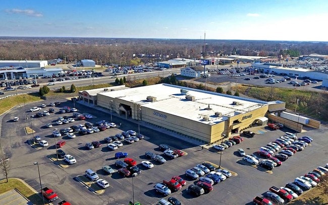
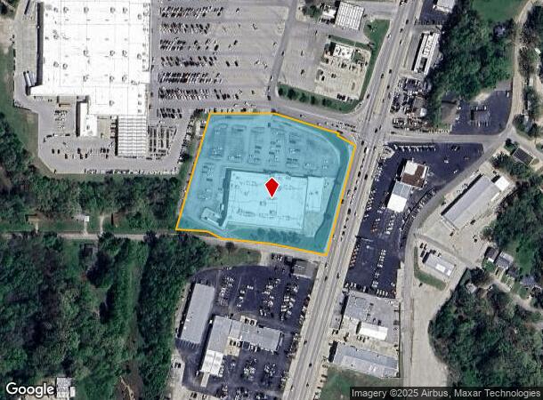
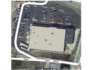
Property Record
67 W South Dr S, Poplar Bluff, MO 63901
NEARBY LISTINGS FOR SALE OR LEASE
Property Detail
67 W South Dr S
109-13-02-04-0-004-008-003-000
Smiths Resub
Storebuilding
PT SMITH'S RESUB,PT SMITH'S 2ND SUB, PT CHERRY ST, & PT NE1/2 SE1/4: FROM NE COR LOT 2 BLK 2 SMITH'S RESUB: NE 30.05: NW 65.9
X
Butler
29023C0193E
Missouri
2024
2
2024
4.57 AC
950101
Other Market Areas
50,792 SF
Poplar Bluff, MO
DEMOGRAPHICS near 67 W South Dr S
1 Mile
3 Mile
5 Mile
2024 Total Population
4,727
19,567
27,850
2029 Population
4,760
19,575
27,770
Pop Growth 2024-2029
+ 0.70%
+ 0.04%
(0.29%)
Average Age
39
39
40
2024 Total Households
2,048
7,983
11,342
HH Growth 2024-2029
+ 0.73%
+ 0.03%
(0.29%)
Median Household Inc
$22,170
$39,555
$42,479
Avg Household Size
2.30
2.30
2.40
2024 Avg HH Vehicles
1.00
2.00
2.00
Median Home Value
$72,548
$107,519
$128,525
Median Year Built
1973
1975
1978
Nearby Places
Map Layers
Map Styles
 Street
 Aerial
- Restaurants
- Banks
- Shops
- Fitness
- Groceries
PUBLIC TRANSPORTATION
COMMUTER RAIL
Poplar Bluff Amtrak Station (Texas Eagle - Amtrak)
DRIVE
WALK
Distance
Poplar Bluff Amtrak Station (Texas Eagle - Amtrak)
3 min
20 min
1.1 mi
Freight Ports
Tulsa Port of Inola
DRIVE
WALK
Distance
Tulsa Port of Inola
406 min
356.7 mi
SALE & LEASE HISTORY
LISTING DATE
SALE/LEASE

Dec 18, 2017
For Sale
Nearby Properties
Address
Land Use
TOTAL SIZE
Lot Size
Zoning
Address
Land Use
TOTAL SIZE
Lot Size
Zoning
Address
Land Use
TOTAL SIZE
Lot Size
Zoning
4.53 AC
Address
Land Use
TOTAL SIZE
Lot Size
Zoning
28,537 SF
29.88 AC
Address
Land Use
TOTAL SIZE
Lot Size
Zoning
72,348 SF
7.13 AC
Address
Land Use
TOTAL SIZE
Lot Size
Zoning
10,612 SF
30 AC
Address
Land Use
TOTAL SIZE
Lot Size
Zoning
138,085 SF
13.50 AC
Address
Land Use
TOTAL SIZE
Lot Size
Zoning
69,606 SF
10 AC
Address
Land Use
TOTAL SIZE
Lot Size
Zoning
6,068 SF
17.73 AC
Address
Land Use
TOTAL SIZE
Lot Size
Zoning
34,740 SF
6.87 AC
Address
Land Use
TOTAL SIZE
Lot Size
Zoning
31,780 SF
4.07 AC
Address
Land Use
TOTAL SIZE
Lot Size
Zoning
13,200 SF
30.45 AC
Address
Land Use
TOTAL SIZE
Lot Size
Zoning
11,688 SF
22.30 AC
Address
Land Use
TOTAL SIZE
Lot Size
Zoning
30.60 AC
Address
Land Use
TOTAL SIZE
Lot Size
Zoning
27,670 SF
4.03 AC
Address
Land Use
TOTAL SIZE
Lot Size
Zoning
71,641 SF
0.98 AC
Address
Land Use
TOTAL SIZE
Lot Size
Zoning
223,315 SF
28.61 AC
Address
Land Use
TOTAL SIZE
Lot Size
Zoning
41,250 SF
62.62 AC
Address
Land Use
TOTAL SIZE
Lot Size
Zoning
Address
Land Use
TOTAL SIZE
Lot Size
Zoning
Address
Land Use
TOTAL SIZE
Lot Size
Zoning
Address
Land Use
TOTAL SIZE
Lot Size
Zoning
101,306 SF
17.93 AC
Address
Land Use
TOTAL SIZE
Lot Size
Zoning
67,368 SF
5.29 AC
Address
Land Use
TOTAL SIZE
Lot Size
Zoning
28,144 SF
3.74 AC
Address
Land Use
TOTAL SIZE
Lot Size
Zoning
42,799 SF
11.12 AC
Address
Land Use
TOTAL SIZE
Lot Size
Zoning
27,325 SF
24.69 AC
Address
Land Use
TOTAL SIZE
Lot Size
Zoning
36,228 SF
1.01 AC
Address
Land Use
TOTAL SIZE
Lot Size
Zoning
49,592 SF
15.90 AC
Address
Land Use
TOTAL SIZE
Lot Size
Zoning
4,050 SF
9.98 AC
Address
Land Use
TOTAL SIZE
Lot Size
Zoning
12,181 SF
3.45 AC
Address
Land Use
TOTAL SIZE
Lot Size
Zoning
125,000 SF
5.21 AC
The World's #1 Commercial Real Estate Marketplace
Connect with us
© 2025 CoStar Group
The information above has been obtained from sources believed reliable. While we do not doubt its accuracy we have not verified it and make no guarantee, warranty or representation about it. It is your responsibility to independently confirm its accuracy and completeness. Any projections, opinions, assumptions, or estimates used are for example only and do not represent the current or future performance of the property. The value of this transaction to you depends on tax and other factors which should be evaluated by your tax, financial, and legal advisors. You and your advisors should conduct a careful, independent investigation of the property to determine to your satisfaction the suitability of the property for your needs.