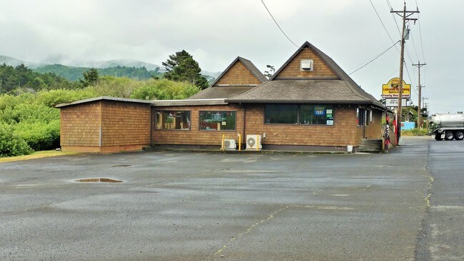
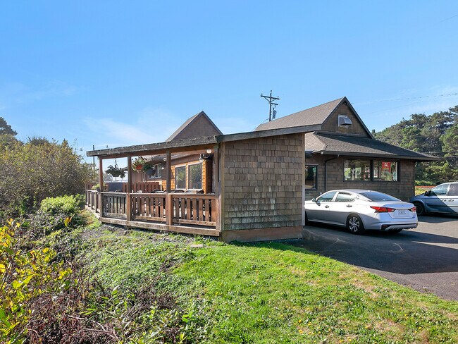
Property Record
670 Highway 101 N, Rockaway Beach, OR 97136

Property Detail
670 Highway 101 N
R0367196
LAKE LYTLE LOT 1 LOT 2 LOT 3 LOT 4 LOT 5 LOT 6 LOT 7 LOT 8 BLOCK 31
Commercialnec
Tillamook
RK-C-1
Oregon
AE The base floodplain where base flood elevations are provided. AE Zones are now used on new format FIRMs instead of A1-A30 Zones.
1-7
2025
0.47 AC
2025
Oregon West Area
960200
Other Market Areas
2,838 SF
NEARBY LISTINGS FOR SALE OR LEASE
DEMOGRAPHICS near 670 Highway 101 N
1 mile
3 mile
5 mile
2025 Total Population
2,188
3,855
4,821
2030 Population
2,406
4,174
5,093
Pop Growth 2025-2030
+ 9.96%
+ 8.27%
+ 5.64%
Average Age
52
51
51
2025 Total Households
1,022
1,845
2,294
HH Growth 2025-2030
+ 9.39%
+ 7.75%
+ 5.10%
Median Household Inc
$63,359
$58,600
$57,538
Avg Household Size
2.10
2.10
2.10
2025 Avg HH Vehicles
2.00
2.00
2.00
Median Home Value
$386,946
$387,269
$385,117
Median Year Built
1983
1985
1981
Nearby Places
Map Layers
Map Styles
 Street
 Aerial
Transit
 Traffic
 Biking
Places
Listings with unknown addresses are not visible on the map
- Restaurants
- Banks
- Shops
- Fitness
- Groceries
SALE & LEASE HISTORY
LISTING DATE
SALE/LEASE

Oct 23, 2019
For Sale
Nov 05, 2018
For Sale
Jun 12, 2020
For Sale
Jul 24, 2020
For Sale
Nearby Properties
Address
Land Use
TOTAL SIZE
Lot Size
Zoning
Address
Land Use
TOTAL SIZE
Lot Size
Zoning
152,218 SF
36.92 AC
R1
Address
Land Use
TOTAL SIZE
Lot Size
Zoning
36,169 SF
8.88 AC
R-2
Address
Land Use
TOTAL SIZE
Lot Size
Zoning
12,982 SF
117.01 AC
RM
Address
Land Use
TOTAL SIZE
Lot Size
Zoning
7,100 SF
3.83 AC
R-2
Address
Land Use
TOTAL SIZE
Lot Size
Zoning
21,912 SF
81.53 AC
RM
Address
Land Use
TOTAL SIZE
Lot Size
Zoning
71,824 SF
1.86 AC
SRR
Address
Land Use
TOTAL SIZE
Lot Size
Zoning
17,901 SF
1.02 AC
C-1
Address
Land Use
TOTAL SIZE
Lot Size
Zoning
Address
Land Use
TOTAL SIZE
Lot Size
Zoning
2,000,000 SF
218.47 AC
Address
Land Use
TOTAL SIZE
Lot Size
Zoning
10,719 SF
0.21 AC
C-1
Address
Land Use
TOTAL SIZE
Lot Size
Zoning
10 SF
3.93 AC
RM
Address
Land Use
TOTAL SIZE
Lot Size
Zoning
2,400 SF
5 AC
M-1
Address
Land Use
TOTAL SIZE
Lot Size
Zoning
24,408 SF
0.26 AC
RK-R-R
Address
Land Use
TOTAL SIZE
Lot Size
Zoning
5,992 SF
5.97 AC
RM
Address
Land Use
TOTAL SIZE
Lot Size
Zoning
7,089 SF
0.86 AC
RK-R-R
Address
Land Use
TOTAL SIZE
Lot Size
Zoning
8,181 SF
0.96 AC
C-1
Address
Land Use
TOTAL SIZE
Lot Size
Zoning
1.07 AC
RK-R-2
Address
Land Use
TOTAL SIZE
Lot Size
Zoning
6,995 SF
0.26 AC
RK-C-1
Address
Land Use
TOTAL SIZE
Lot Size
Zoning
9,293 SF
0.85 AC
C-1
Address
Land Use
TOTAL SIZE
Lot Size
Zoning
390 SF
2.87 AC
R-2
Address
Land Use
TOTAL SIZE
Lot Size
Zoning
12,318 SF
1.85 AC
RK-R-2
Address
Land Use
TOTAL SIZE
Lot Size
Zoning
24,408 SF
0.26 AC
RK-R-R
Address
Land Use
TOTAL SIZE
Lot Size
Zoning
4,500 SF
2.32 AC
RK-R-2
Address
Land Use
TOTAL SIZE
Lot Size
Zoning
8,802 SF
0.17 AC
RR
Address
Land Use
TOTAL SIZE
Lot Size
Zoning
9,659 SF
1.74 AC
RK-R-2
Address
Land Use
TOTAL SIZE
Lot Size
Zoning
420 SF
2.56 AC
CR-2
Address
Land Use
TOTAL SIZE
Lot Size
Zoning
7,658 SF
1.47 AC
RK-R-2
Address
Land Use
TOTAL SIZE
Lot Size
Zoning
10 SF
13.52 AC
O.S.
Address
Land Use
TOTAL SIZE
Lot Size
Zoning
3,860 SF
0.14 AC
RK-R-R
Address
Land Use
TOTAL SIZE
Lot Size
Zoning
5,258 SF
0.26 AC
C-1
The World's #1 Commercial Real Estate Marketplace
Connect with us
© 2026 CoStar Group
The information above has been obtained from sources believed reliable. While we do not doubt its accuracy we have not verified it and make no guarantee, warranty or representation about it. It is your responsibility to independently confirm its accuracy and completeness. Any projections, opinions, assumptions, or estimates used are for example only and do not represent the current or future performance of the property. The value of this transaction to you depends on tax and other factors which should be evaluated by your tax, financial, and legal advisors. You and your advisors should conduct a careful, independent investigation of the property to determine to your satisfaction the suitability of the property for your needs.