Property Record
670 Independence Blvd, Hardeeville, SC 29927
NEARBY LISTINGS FOR SALE OR LEASE
-
-
View all Hardeeville listings for sale on LoopNet.com
Property Detail
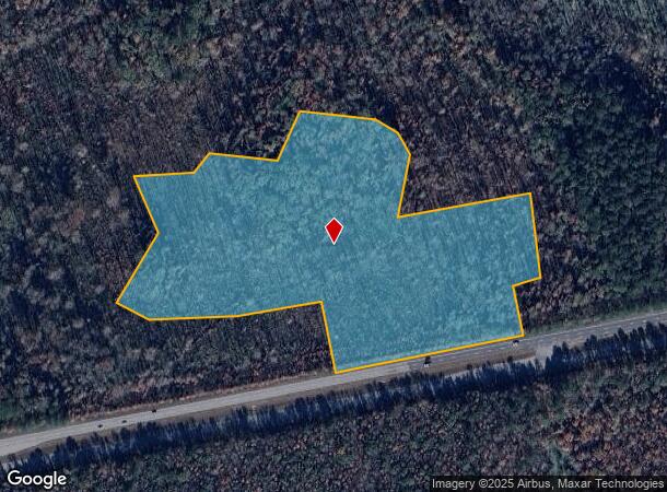
670 Independence Blvd
067-00-01-037
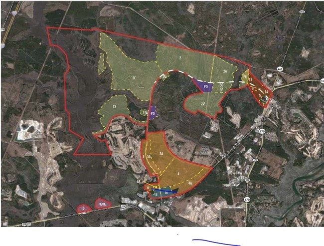
The East Argent Tract
Agriculturalland
COUNTY (DISTRICT 03)
AE
Jasper
45053C0415D
South Carolina
2025
13.99 AC
2025
I-95 Walterboro/Hardeeville
950301
Other Market Areas
1,152 SF
Hilton Head Island-Bluffton-Beaufort, SC
DEMOGRAPHICS near 670 Independence Blvd
1 Mile
3 Mile
5 Mile
2024 Total Population
986
7,137
20,675
2029 Population
1,212
8,798
24,375
Pop Growth 2024-2029
+ 22.92%
+ 23.27%
+ 17.90%
Average Age
49
51
52
2024 Total Households
436
3,344
9,473
HH Growth 2024-2029
+ 22.71%
+ 23.56%
+ 18.01%
Median Household Inc
$81,923
$80,292
$80,583
Avg Household Size
2.20
2.10
2.10
2024 Avg HH Vehicles
2.00
2.00
2.00
Median Home Value
$450,694
$459,396
$390,307
Median Year Built
2006
2010
2005
Nearby Places
Map Layers
Map Styles
 Street
 Aerial
- Restaurants
- Banks
- Shops
- Fitness
- Groceries
PUBLIC TRANSPORTATION
AIRPORT
Hilton Head
DRIVE
WALK
Distance
Hilton Head
30 min
21.0 mi
Savannah/Hilton Head International
DRIVE
WALK
Distance
Savannah/Hilton Head International
34 min
24.6 mi
Freight Ports
Georgia Ports - Savannah
DRIVE
WALK
Distance
Georgia Ports - Savannah
30 min
23.0 mi
SALE & LEASE HISTORY
LISTING DATE
SALE/LEASE

Sep 24, 2016
For Sale
Nearby Properties
Address
Land Use
TOTAL SIZE
Lot Size
Zoning
Address
Land Use
TOTAL SIZE
Lot Size
Zoning
1,248 SF
39.20 AC
PDD
Address
Land Use
TOTAL SIZE
Lot Size
Zoning
1,632 SF
18.20 AC
PDD
Address
Land Use
TOTAL SIZE
Lot Size
Zoning
1,632 SF
2.85 AC
PDD
Address
Land Use
TOTAL SIZE
Lot Size
Zoning
1,280 SF
7 AC
RA
Address
Land Use
TOTAL SIZE
Lot Size
Zoning
1,632 SF
5.42 AC
RA
Address
Land Use
TOTAL SIZE
Lot Size
Zoning
924 SF
17.76 AC
H2
Address
Land Use
TOTAL SIZE
Lot Size
Zoning
1,064 SF
29.45 AC
PDD
Address
Land Use
TOTAL SIZE
Lot Size
Zoning
1,280 SF
37.10 AC
RA
Address
Land Use
TOTAL SIZE
Lot Size
Zoning
26,844 SF
18.35 AC
6106
Address
Land Use
TOTAL SIZE
Lot Size
Zoning
56,327 SF
50.02 AC
6616
Address
Land Use
TOTAL SIZE
Lot Size
Zoning
7,700 SF
167.61 AC
FR
Address
Land Use
TOTAL SIZE
Lot Size
Zoning
65,592 SF
3.33 AC
6606
Address
Land Use
TOTAL SIZE
Lot Size
Zoning
Address
Land Use
TOTAL SIZE
Lot Size
Zoning
3,296 SF
4.56 AC
PDD
Address
Land Use
TOTAL SIZE
Lot Size
Zoning
1,680 SF
6.68 AC
PDD
Address
Land Use
TOTAL SIZE
Lot Size
Zoning
1,632 SF
18.77 AC
PDD
Address
Land Use
TOTAL SIZE
Lot Size
Zoning
17,304 SF
28.46 AC
6816
Address
Land Use
TOTAL SIZE
Lot Size
Zoning
55,148 SF
3.08 AC
Address
Land Use
TOTAL SIZE
Lot Size
Zoning
1,632 SF
19.99 AC
RC
Address
Land Use
TOTAL SIZE
Lot Size
Zoning
21,600 SF
2.37 AC
6616
Address
Land Use
TOTAL SIZE
Lot Size
Zoning
4.84 AC
Address
Land Use
TOTAL SIZE
Lot Size
Zoning
33,348 SF
32.24 AC
6616
Address
Land Use
TOTAL SIZE
Lot Size
Zoning
3,731 SF
530.60 AC
RA
Address
Land Use
TOTAL SIZE
Lot Size
Zoning
1,632 SF
2.14 AC
PDD
Address
Land Use
TOTAL SIZE
Lot Size
Zoning
22,293 SF
92.20 AC
6106
Address
Land Use
TOTAL SIZE
Lot Size
Zoning
Address
Land Use
TOTAL SIZE
Lot Size
Zoning
18,879 SF
1.92 AC
6616
Address
Land Use
TOTAL SIZE
Lot Size
Zoning
26,784 SF
2.67 AC
The World's #1 Commercial Real Estate Marketplace
Connect with us
© 2025 CoStar Group
The information above has been obtained from sources believed reliable. While we do not doubt its accuracy we have not verified it and make no guarantee, warranty or representation about it. It is your responsibility to independently confirm its accuracy and completeness. Any projections, opinions, assumptions, or estimates used are for example only and do not represent the current or future performance of the property. The value of this transaction to you depends on tax and other factors which should be evaluated by your tax, financial, and legal advisors. You and your advisors should conduct a careful, independent investigation of the property to determine to your satisfaction the suitability of the property for your needs.