Property Record
670 Industrial Dr, Lexington, SC 29072


NEARBY LISTINGS FOR SALE OR LEASE
Property Detail
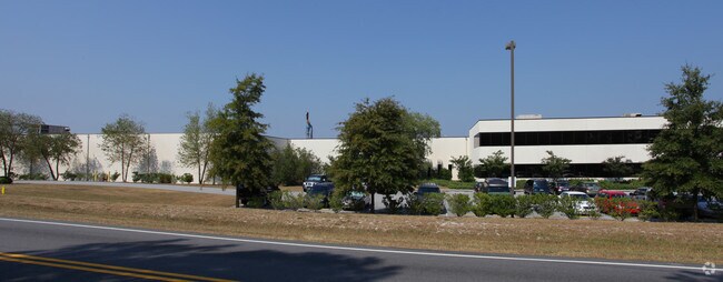
670 Industrial Dr
Columbia, SC
Proposed Lift Station #1
005498-06-002
TRACT 1 & 2 COOPER POWER TOOLS
Governmentalpublicusegeneral
Lexington
X
South Carolina
45063C0234J
34.20 AC
0
Lexington
2024
Columbia
021040
DEMOGRAPHICS near 670 Industrial Dr
1 Mile
3 Mile
5 Mile
2024 Total Population
1,908
27,554
82,093
2029 Population
2,088
30,162
89,724
Pop Growth 2024-2029
+ 9.43%
+ 9.47%
+ 9.30%
Average Age
37
38
38
2024 Total Households
652
10,491
30,768
HH Growth 2024-2029
+ 9.66%
+ 9.75%
+ 9.49%
Median Household Inc
$93,749
$73,457
$73,438
Avg Household Size
2.90
2.60
2.60
2024 Avg HH Vehicles
2.00
2.00
2.00
Median Home Value
$241,221
$212,974
$207,283
Median Year Built
2003
1999
2000
Nearby Places
Map Layers
Map Styles
 Street
 Aerial
- Restaurants
- Banks
- Shops
- Fitness
- Groceries
PUBLIC TRANSPORTATION
AIRPORT
Columbia Metro
DRIVE
WALK
Distance
Columbia Metro
32 min
11.1 mi
Freight Ports
North Charleston Terminal
DRIVE
WALK
Distance
North Charleston Terminal
134 min
113.0 mi
Nearby Properties
Address
Land Use
TOTAL SIZE
Lot Size
Zoning
Address
Land Use
TOTAL SIZE
Lot Size
Zoning
336,700 SF
80.12 AC
ID
Address
Land Use
TOTAL SIZE
Lot Size
Zoning
78,966 SF
10.34 AC
Address
Land Use
TOTAL SIZE
Lot Size
Zoning
4,198 SF
23.54 AC
Address
Land Use
TOTAL SIZE
Lot Size
Zoning
3,383 SF
20.65 AC
Address
Land Use
TOTAL SIZE
Lot Size
Zoning
567,464 SF
44.62 AC
ID
Address
Land Use
TOTAL SIZE
Lot Size
Zoning
219,967 SF
23.37 AC
ID
Address
Land Use
TOTAL SIZE
Lot Size
Zoning
97,606 SF
15.92 AC
ID
Address
Land Use
TOTAL SIZE
Lot Size
Zoning
3,079 SF
15.93 AC
HDR
Address
Land Use
TOTAL SIZE
Lot Size
Zoning
9,792 SF
7.47 AC
HDR
Address
Land Use
TOTAL SIZE
Lot Size
Zoning
41,883 SF
21.77 AC
ID
Address
Land Use
TOTAL SIZE
Lot Size
Zoning
44,100 SF
67.47 AC
RD
Address
Land Use
TOTAL SIZE
Lot Size
Zoning
78,665 SF
7.58 AC
GC
Address
Land Use
TOTAL SIZE
Lot Size
Zoning
15,343 SF
1.30 AC
GC
Address
Land Use
TOTAL SIZE
Lot Size
Zoning
55,686 SF
6.42 AC
ID
Address
Land Use
TOTAL SIZE
Lot Size
Zoning
1,572 SF
21.04 AC
GC
Address
Land Use
TOTAL SIZE
Lot Size
Zoning
7,752 SF
28.48 AC
RD
Address
Land Use
TOTAL SIZE
Lot Size
Zoning
60,000 SF
4.77 AC
ID
Address
Land Use
TOTAL SIZE
Lot Size
Zoning
25,650 SF
1.69 AC
Address
Land Use
TOTAL SIZE
Lot Size
Zoning
15,319 SF
12.72 AC
ID
Address
Land Use
TOTAL SIZE
Lot Size
Zoning
43,078 SF
4.50 AC
Address
Land Use
TOTAL SIZE
Lot Size
Zoning
79.51 AC
GC
Address
Land Use
TOTAL SIZE
Lot Size
Zoning
1,200 SF
7.16 AC
ID
Address
Land Use
TOTAL SIZE
Lot Size
Zoning
86,573 SF
4.92 AC
Address
Land Use
TOTAL SIZE
Lot Size
Zoning
44,851 SF
8.93 AC
ID
Address
Land Use
TOTAL SIZE
Lot Size
Zoning
30,555 SF
3.20 AC
GC
Address
Land Use
TOTAL SIZE
Lot Size
Zoning
86,781 SF
13.16 AC
ID
Address
Land Use
TOTAL SIZE
Lot Size
Zoning
52,296 SF
2.75 AC
GC
Address
Land Use
TOTAL SIZE
Lot Size
Zoning
50,982 SF
6.15 AC
GC
Address
Land Use
TOTAL SIZE
Lot Size
Zoning
117,188 SF
15.54 AC
ID
Address
Land Use
TOTAL SIZE
Lot Size
Zoning
24,198 SF
1.34 AC
GC
The World's #1 Commercial Real Estate Marketplace
Connect with us
© 2025 CoStar Group
The information above has been obtained from sources believed reliable. While we do not doubt its accuracy we have not verified it and make no guarantee, warranty or representation about it. It is your responsibility to independently confirm its accuracy and completeness. Any projections, opinions, assumptions, or estimates used are for example only and do not represent the current or future performance of the property. The value of this transaction to you depends on tax and other factors which should be evaluated by your tax, financial, and legal advisors. You and your advisors should conduct a careful, independent investigation of the property to determine to your satisfaction the suitability of the property for your needs.