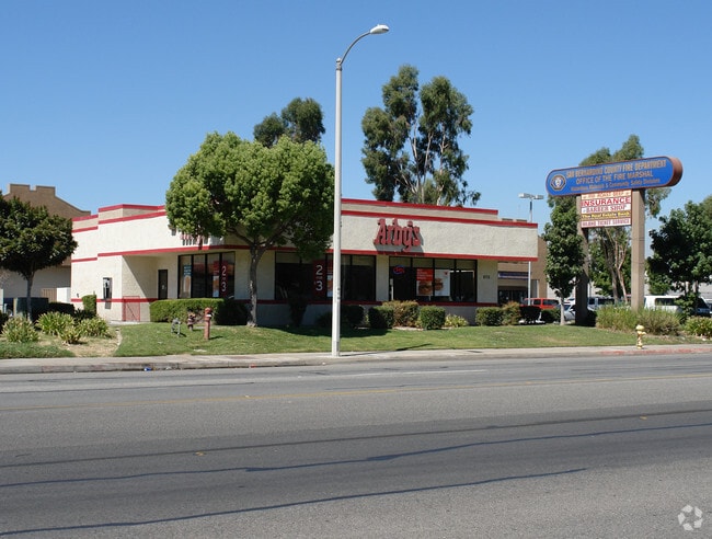
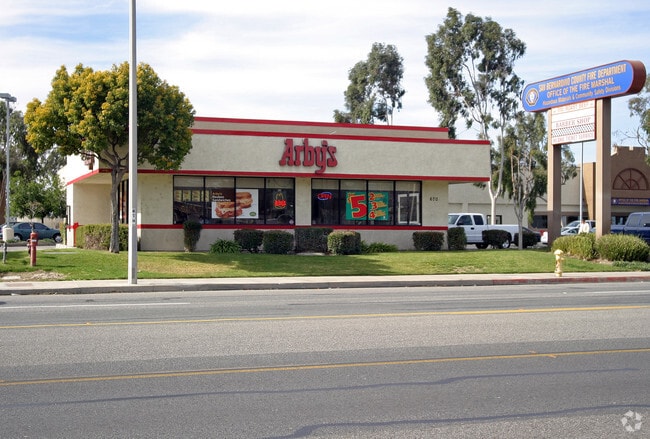
Property Record
670 S E St, San Bernardino, CA 92408


NEARBY LISTINGS FOR SALE OR LEASE
Property Detail
670 S E St
0136-501-25
Parcel Map No 15553
Restaurantdrivein
PARCEL MAP 15553 PARCEL 4 BOOK 192 PAGE 77
X
San Bernardino
06071C8683J
California
2024
0.46 AC
2025
San Bernardino
012400
Inland Empire (California)
2,416 SF
Riverside-San Bernardino-Ontario, CA
DEMOGRAPHICS near 670 S E St
1 Mile
3 Mile
5 Mile
2024 Total Population
4,962
129,217
342,580
2029 Population
4,978
131,103
348,617
Pop Growth 2024-2029
+ 0.32%
+ 1.46%
+ 1.76%
Average Age
36
34
35
2024 Total Households
1,456
37,532
99,369
HH Growth 2024-2029
+ 0.55%
+ 1.63%
+ 1.88%
Median Household Inc
$54,912
$50,915
$58,839
Avg Household Size
3.20
3.30
3.30
2024 Avg HH Vehicles
2.00
2.00
2.00
Median Home Value
$288,364
$315,686
$345,295
Median Year Built
1961
1969
1970
Nearby Places
Map Layers
Map Styles
 Street
 Aerial
- Restaurants
- Banks
- Shops
- Fitness
- Groceries
PUBLIC TRANSPORTATION
COMMUTER RAIL
San Bernardino - Downtown Metrolink Station (Metrolink Inland Empire-Orange County Line - Metrolink Trains, Metrolink San Bernardino Line - Metrolink Trains)
DRIVE
WALK
Distance
San Bernardino - Downtown Metrolink Station (Metrolink Inland Empire-Orange County Line - Metrolink Trains, Metrolink San Bernardino Line - Metrolink Trains)
3 min
15 min
0.8 mi
San Bernardino (Inland Empire-Orange County Line - Southern California Regional Rail Authority (Metrolink), San Bernardino Line - Southern California Regional Rail Authority (Metrolink))
DRIVE
WALK
Distance
San Bernardino (Inland Empire-Orange County Line - Southern California Regional Rail Authority (Metrolink), San Bernardino Line - Southern California Regional Rail Authority (Metrolink))
4 min
2.0 mi
AIRPORT
Ontario International
DRIVE
WALK
Distance
Ontario International
26 min
20.1 mi
Freight Ports
Port of Long Beach
DRIVE
WALK
Distance
Port of Long Beach
82 min
65.6 mi
Nearby Properties
Address
Land Use
TOTAL SIZE
Lot Size
Zoning
Address
Land Use
TOTAL SIZE
Lot Size
Zoning
2,134,798 SF
153.92 AC
Address
Land Use
TOTAL SIZE
Lot Size
Zoning
457,253 SF
20.14 AC
Address
Land Use
TOTAL SIZE
Lot Size
Zoning
308,030 SF
16.20 AC
Address
Land Use
TOTAL SIZE
Lot Size
Zoning
497,664 SF
56.39 AC
Address
Land Use
TOTAL SIZE
Lot Size
Zoning
1,032,072 SF
61.74 AC
Address
Land Use
TOTAL SIZE
Lot Size
Zoning
330,420 SF
15.31 AC
Address
Land Use
TOTAL SIZE
Lot Size
Zoning
1,081,199 SF
49.77 AC
Address
Land Use
TOTAL SIZE
Lot Size
Zoning
300,188 SF
11.98 AC
Address
Land Use
TOTAL SIZE
Lot Size
Zoning
1,139,976 SF
49.56 AC
Address
Land Use
TOTAL SIZE
Lot Size
Zoning
758,180 SF
31.86 AC
Address
Land Use
TOTAL SIZE
Lot Size
Zoning
391,468 SF
16.73 AC
Address
Land Use
TOTAL SIZE
Lot Size
Zoning
1,205,400 SF
58.05 AC
Address
Land Use
TOTAL SIZE
Lot Size
Zoning
210,418 SF
12.09 AC
Address
Land Use
TOTAL SIZE
Lot Size
Zoning
951,686 SF
47.90 AC
Address
Land Use
TOTAL SIZE
Lot Size
Zoning
913,716 SF
20 AC
Address
Land Use
TOTAL SIZE
Lot Size
Zoning
225,324 SF
11.03 AC
Address
Land Use
TOTAL SIZE
Lot Size
Zoning
474,680 SF
17.95 AC
Address
Land Use
TOTAL SIZE
Lot Size
Zoning
851,880 SF
42.20 AC
Address
Land Use
TOTAL SIZE
Lot Size
Zoning
404,725 SF
19.29 AC
Address
Land Use
TOTAL SIZE
Lot Size
Zoning
472,962 SF
23.28 AC
Address
Land Use
TOTAL SIZE
Lot Size
Zoning
178,926 SF
9.12 AC
IC
Address
Land Use
TOTAL SIZE
Lot Size
Zoning
549,796 SF
13.61 AC
Address
Land Use
TOTAL SIZE
Lot Size
Zoning
344,757 SF
14.89 AC
Address
Land Use
TOTAL SIZE
Lot Size
Zoning
147,744 SF
14.58 AC
Address
Land Use
TOTAL SIZE
Lot Size
Zoning
335,000 SF
8.44 AC
Address
Land Use
TOTAL SIZE
Lot Size
Zoning
151,859 SF
7.23 AC
Address
Land Use
TOTAL SIZE
Lot Size
Zoning
415,405 SF
18.43 AC
IC
Address
Land Use
TOTAL SIZE
Lot Size
Zoning
592,710 SF
28.89 AC
Address
Land Use
TOTAL SIZE
Lot Size
Zoning
318,940 SF
14.26 AC
Address
Land Use
TOTAL SIZE
Lot Size
Zoning
154,639 SF
6.87 AC
The World's #1 Commercial Real Estate Marketplace
Connect with us
© 2025 CoStar Group
The information above has been obtained from sources believed reliable. While we do not doubt its accuracy we have not verified it and make no guarantee, warranty or representation about it. It is your responsibility to independently confirm its accuracy and completeness. Any projections, opinions, assumptions, or estimates used are for example only and do not represent the current or future performance of the property. The value of this transaction to you depends on tax and other factors which should be evaluated by your tax, financial, and legal advisors. You and your advisors should conduct a careful, independent investigation of the property to determine to your satisfaction the suitability of the property for your needs.