Property Record
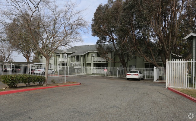
6700 Auburn St, Bakersfield, CA 93306


Property Detail
6700 Auburn St
437-020-01-00-3
TRACT 4869 , BLOCK A , LOT 2
Apartment
Kern
R-3 MH
California
B and X Area of moderate flood hazard, usually the area between the limits of the 100-year and 500-year floods.
2
2024
5.77 AC
2025
Outer East Bakersfield
000911
Bakersfield
68,496 SF
Bakersfield-Delano, CA
NEARBY LISTINGS FOR SALE OR LEASE
-
-
View all Bakersfield listings for sale on LoopNet.com
DEMOGRAPHICS near 6700 Auburn St
1 mile
3 mile
5 mile
2025 Total Population
7,882
75,265
146,491
2030 Population
8,080
76,322
148,518
Pop Growth 2025-2030
+ 2.51%
+ 1.40%
+ 1.38%
Average Age
35
35
34
2025 Total Households
2,725
22,718
43,493
HH Growth 2025-2030
+ 2.31%
+ 1.38%
+ 1.40%
Median Household Inc
$70,297
$66,788
$59,218
Avg Household Size
2.80
3.20
3.30
2025 Avg HH Vehicles
2.00
2.00
2.00
Median Home Value
$395,454
$320,863
$311,479
Median Year Built
1990
1976
1974
Nearby Places
Map Layers
Map Styles
 Street
 Aerial
Layers
 Traffic
 Biking
Places
Listings with unknown addresses are not visible on the map
- Restaurants
- Banks
- Shops
- Fitness
- Groceries
PUBLIC TRANSPORTATION
COMMUTER RAIL
Bakersfield (San Joaquins - Amtrak)
Drive
Walk
Distance
Bakersfield (San Joaquins - Amtrak)
10 min
6.2 mi
AIRPORT
Meadows Field
Drive
Walk
Distance
Meadows Field
20 min
11.3 mi
Freight Ports
The Port of Hueneme
Drive
Walk
Distance
The Port of Hueneme
161 min
129.9 mi
Nearby Properties
Address
Land Use
TOTAL SIZE
Lot Size
Zoning
Address
Land Use
TOTAL SIZE
Lot Size
Zoning
18,000 SF
35.01 AC
M-2
Address
Land Use
TOTAL SIZE
Lot Size
Zoning
1.38 AC
C-2
Address
Land Use
TOTAL SIZE
Lot Size
Zoning
11,267 SF
40 AC
Address
Land Use
TOTAL SIZE
Lot Size
Zoning
66,139 SF
4.48 AC
CO
Address
Land Use
TOTAL SIZE
Lot Size
Zoning
Address
Land Use
TOTAL SIZE
Lot Size
Zoning
112,052 SF
3.14 AC
R3
Address
Land Use
TOTAL SIZE
Lot Size
Zoning
66,139 SF
4.48 AC
CO
Address
Land Use
TOTAL SIZE
Lot Size
Zoning
161,946 SF
17.84 AC
C2 PD
Address
Land Use
TOTAL SIZE
Lot Size
Zoning
103,536 SF
6.31 AC
R-3
Address
Land Use
TOTAL SIZE
Lot Size
Zoning
102,262 SF
3.93 AC
Address
Land Use
TOTAL SIZE
Lot Size
Zoning
10.31 AC
Address
Land Use
TOTAL SIZE
Lot Size
Zoning
127,224 SF
7 AC
R-2/PUD
Address
Land Use
TOTAL SIZE
Lot Size
Zoning
137,900 SF
15.69 AC
C2
Address
Land Use
TOTAL SIZE
Lot Size
Zoning
115,058 SF
13.02 AC
C2
Address
Land Use
TOTAL SIZE
Lot Size
Zoning
1.06 AC
R-1
Address
Land Use
TOTAL SIZE
Lot Size
Zoning
0.41 AC
R1
Address
Land Use
TOTAL SIZE
Lot Size
Zoning
66,582 SF
3.36 AC
R-2
Address
Land Use
TOTAL SIZE
Lot Size
Zoning
179,460 SF
10.20 AC
R3
Address
Land Use
TOTAL SIZE
Lot Size
Zoning
68,264 SF
6.56 AC
C2
Address
Land Use
TOTAL SIZE
Lot Size
Zoning
4.94 AC
R-3
Address
Land Use
TOTAL SIZE
Lot Size
Zoning
46,522 SF
3.35 AC
R2
Address
Land Use
TOTAL SIZE
Lot Size
Zoning
34,733 SF
7.25 AC
C2
Address
Land Use
TOTAL SIZE
Lot Size
Zoning
29,440 SF
2.83 AC
C-2
Address
Land Use
TOTAL SIZE
Lot Size
Zoning
101,437 SF
9.05 AC
PCD
Address
Land Use
TOTAL SIZE
Lot Size
Zoning
96,952 SF
2.56 AC
R-2
Address
Land Use
TOTAL SIZE
Lot Size
Zoning
11.05 AC
C2/PCD
Address
Land Use
TOTAL SIZE
Lot Size
Zoning
127,050 SF
13.48 AC
M-1
Address
Land Use
TOTAL SIZE
Lot Size
Zoning
95,258 SF
5.34 AC
PUD
Address
Land Use
TOTAL SIZE
Lot Size
Zoning
132,044 SF
9.07 AC
R-3
Address
Land Use
TOTAL SIZE
Lot Size
Zoning
9,627 SF
12.37 AC
C2
The World's #1 Commercial Real Estate Marketplace
Connect with us
© 2026 CoStar Group
The information above has been obtained from sources believed reliable. While we do not doubt its accuracy we have not verified it and make no guarantee, warranty or representation about it. It is your responsibility to independently confirm its accuracy and completeness. Any projections, opinions, assumptions, or estimates used are for example only and do not represent the current or future performance of the property. The value of this transaction to you depends on tax and other factors which should be evaluated by your tax, financial, and legal advisors. You and your advisors should conduct a careful, independent investigation of the property to determine to your satisfaction the suitability of the property for your needs.