Property Record
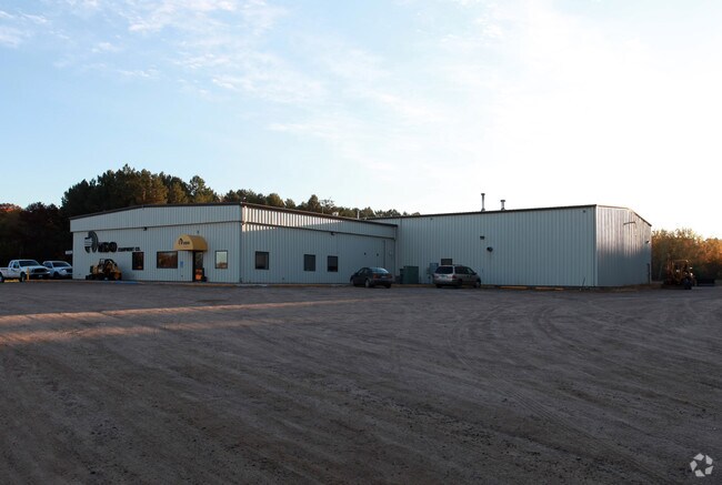
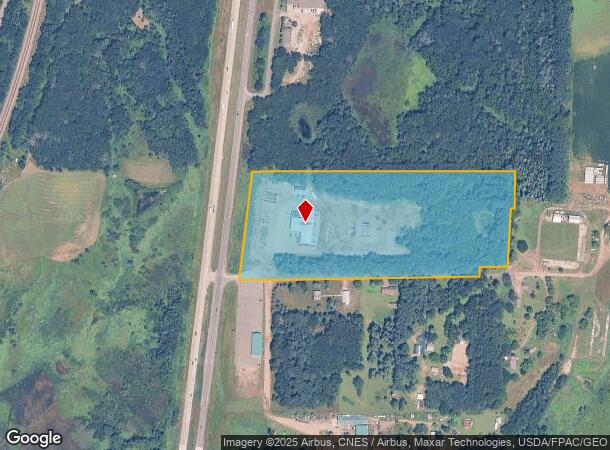
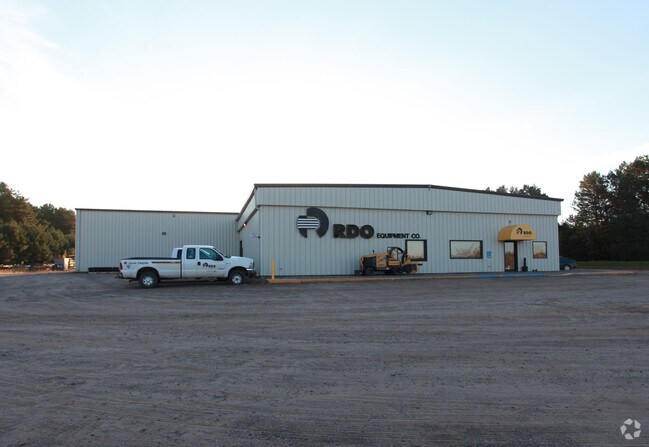
6700 Highway 10 Nw, Sauk Rapids, MN 56379
NEARBY LISTINGS FOR SALE OR LEASE
Property Detail
6700 Highway 10 Nw
12.00409.00
SECT-26 TWP-037 RANGE-031 19.55 AC COMM SW COR SW1/4 SEC 26 TH N 739.32 FT TO POB TH E 1143.29 FT TH N 52 FT TH E 125.55 FT
Utilities
Benton
X
Minnesota
27145C0420E
19.55 AC
2025
Benton County
2025
Minneapolis/St Paul
020205
St. Cloud, MN
13,200 SF
DEMOGRAPHICS near 6700 Highway 10 Nw
1 Mile
3 Mile
5 Mile
2024 Total Population
364
6,645
32,859
2029 Population
366
6,764
33,422
Pop Growth 2024-2029
+ 0.55%
+ 1.79%
+ 1.71%
Average Age
39
38
38
2024 Total Households
129
2,366
12,580
HH Growth 2024-2029
0.00%
+ 1.73%
+ 1.69%
Median Household Inc
$97,825
$92,233
$73,507
Avg Household Size
2.80
2.80
2.50
2024 Avg HH Vehicles
3.00
2.00
2.00
Median Home Value
$373,214
$288,602
$249,831
Median Year Built
1993
1988
1993
Nearby Places
Map Layers
Map Styles
 Street
 Aerial
- Restaurants
- Banks
- Shops
- Fitness
- Groceries
PUBLIC TRANSPORTATION
COMMUTER RAIL
DRIVE
WALK
Distance
12 min
9.4 mi
Nearby Properties
Address
Land Use
TOTAL SIZE
Lot Size
Zoning
Address
Land Use
TOTAL SIZE
Lot Size
Zoning
9.03 AC
Address
Land Use
TOTAL SIZE
Lot Size
Zoning
28,824 SF
22.44 AC
Address
Land Use
TOTAL SIZE
Lot Size
Zoning
9,490 SF
184.16 AC
Address
Land Use
TOTAL SIZE
Lot Size
Zoning
9,600 SF
4.86 AC
Address
Land Use
TOTAL SIZE
Lot Size
Zoning
5,402 SF
10.22 AC
Address
Land Use
TOTAL SIZE
Lot Size
Zoning
11,760 SF
7.39 AC
Address
Land Use
TOTAL SIZE
Lot Size
Zoning
121.89 AC
Address
Land Use
TOTAL SIZE
Lot Size
Zoning
41,200 SF
73.95 AC
Address
Land Use
TOTAL SIZE
Lot Size
Zoning
5,160 SF
40.70 AC
Address
Land Use
TOTAL SIZE
Lot Size
Zoning
33,600 SF
6.61 AC
Address
Land Use
TOTAL SIZE
Lot Size
Zoning
157.24 AC
Address
Land Use
TOTAL SIZE
Lot Size
Zoning
3,903 SF
82.35 AC
Address
Land Use
TOTAL SIZE
Lot Size
Zoning
6,041 SF
1.11 AC
Address
Land Use
TOTAL SIZE
Lot Size
Zoning
1,746 SF
2.79 AC
Address
Land Use
TOTAL SIZE
Lot Size
Zoning
Address
Land Use
TOTAL SIZE
Lot Size
Zoning
4,862 SF
42.83 AC
Address
Land Use
TOTAL SIZE
Lot Size
Zoning
2,540 SF
100.06 AC
Address
Land Use
TOTAL SIZE
Lot Size
Zoning
22.06 AC
Address
Land Use
TOTAL SIZE
Lot Size
Zoning
9,216 SF
38.10 AC
Address
Land Use
TOTAL SIZE
Lot Size
Zoning
1.09 AC
Address
Land Use
TOTAL SIZE
Lot Size
Zoning
9,480 SF
7.78 AC
Address
Land Use
TOTAL SIZE
Lot Size
Zoning
26,639 SF
2.05 AC
Address
Land Use
TOTAL SIZE
Lot Size
Zoning
2,416 SF
117.80 AC
Address
Land Use
TOTAL SIZE
Lot Size
Zoning
3,508 SF
40 AC
Address
Land Use
TOTAL SIZE
Lot Size
Zoning
0.92 AC
Address
Land Use
TOTAL SIZE
Lot Size
Zoning
0.73 AC
Address
Land Use
TOTAL SIZE
Lot Size
Zoning
0.67 AC
Address
Land Use
TOTAL SIZE
Lot Size
Zoning
1,872 SF
160 AC
Address
Land Use
TOTAL SIZE
Lot Size
Zoning
8,148 SF
4.97 AC
The World's #1 Commercial Real Estate Marketplace
Connect with us
© 2026 CoStar Group
The information above has been obtained from sources believed reliable. While we do not doubt its accuracy we have not verified it and make no guarantee, warranty or representation about it. It is your responsibility to independently confirm its accuracy and completeness. Any projections, opinions, assumptions, or estimates used are for example only and do not represent the current or future performance of the property. The value of this transaction to you depends on tax and other factors which should be evaluated by your tax, financial, and legal advisors. You and your advisors should conduct a careful, independent investigation of the property to determine to your satisfaction the suitability of the property for your needs.