Property Record
6700 Marshall Rd, Upper Darby, PA 19082

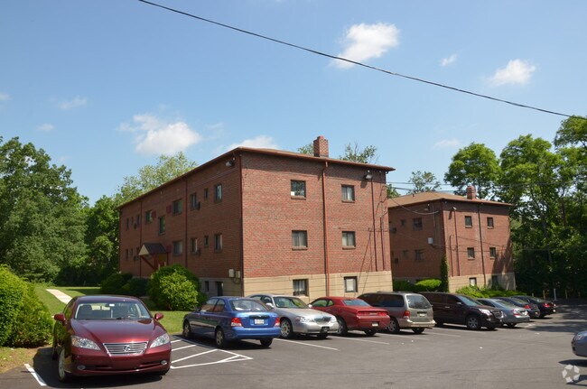
Property Detail
6700 Marshall Rd
16-01-00887-00
2 UNITS 22 APTS GDDTAKEN
Apartment
Delaware
B and X Area of moderate flood hazard, usually the area between the limits of the 100-year and 500-year floods.
Pennsylvania
2024
0.95 AC
2025
Upper Delaware County
400700
Philadelphia
15,840 SF
Philadelphia-Camden-Wilmington, PA-NJ-DE-MD
NEARBY LISTINGS FOR SALE OR LEASE
DEMOGRAPHICS near 6700 Marshall Rd
1 mile
3 mile
5 mile
2025 Total Population
61,361
373,665
815,698
2030 Population
61,190
374,281
819,892
Pop Growth 2025-2030
(0.28%)
+ 0.16%
+ 0.51%
Average Age
38
38
38
2025 Total Households
22,540
143,885
340,352
HH Growth 2025-2030
(0.41%)
+ 0.03%
+ 0.34%
Median Household Inc
$43,671
$52,171
$67,355
Avg Household Size
2.60
2.40
2.30
2025 Avg HH Vehicles
1.00
1.00
1.00
Median Home Value
$147,446
$187,998
$282,338
Median Year Built
1946
1947
1949
Nearby Places
Map Layers
Map Styles
 Street
 Aerial
Transit
 Traffic
 Biking
Places
Listings with unknown addresses are not visible on the map
- Restaurants
- Banks
- Shops
- Fitness
- Groceries
PUBLIC TRANSPORTATION
TRANSIT/SUBWAY
63rd Street (Market-Frankford Line - Southeastern Pennsylvania Transportation Authority Rapid Transit (SEPTA Subway & Trolley))
Drive
Walk
Distance
63rd Street (Market-Frankford Line - Southeastern Pennsylvania Transportation Authority Rapid Transit (SEPTA Subway & Trolley))
4 min
13 min
0.7 mi
Millbourne (Market-Frankford Line - Southeastern Pennsylvania Transportation Authority Rapid Transit (SEPTA Subway & Trolley))
Drive
Walk
Distance
Millbourne (Market-Frankford Line - Southeastern Pennsylvania Transportation Authority Rapid Transit (SEPTA Subway & Trolley))
4 min
15 min
0.8 mi
60th Street (Market-Frankford Line - Southeastern Pennsylvania Transportation Authority Rapid Transit (SEPTA Subway & Trolley))
Drive
Walk
Distance
60th Street (Market-Frankford Line - Southeastern Pennsylvania Transportation Authority Rapid Transit (SEPTA Subway & Trolley))
4 min
19 min
1.0 mi
Fairfield Avenue (Route 101 - Southeastern Pennsylvania Transportation Authority Rapid Transit (SEPTA Subway & Trolley), Route 102 - Southeastern Pennsylvania Transportation Authority Rapid Transit (SEPTA Subway & Trolley))
Drive
Walk
Distance
Fairfield Avenue (Route 101 - Southeastern Pennsylvania Transportation Authority Rapid Transit (SEPTA Subway & Trolley), Route 102 - Southeastern Pennsylvania Transportation Authority Rapid Transit (SEPTA Subway & Trolley))
4 min
19 min
1.0 mi
COMMUTER RAIL
Angora (R3 - Southeastern Pennsylvania Transportation Authority Regional Rail (SEPTA Regional Rail))
Drive
Walk
Distance
Angora (R3 - Southeastern Pennsylvania Transportation Authority Regional Rail (SEPTA Regional Rail))
5 min
1.6 mi
Fernwood-Yeadon (R3 - Southeastern Pennsylvania Transportation Authority Regional Rail (SEPTA Regional Rail))
Drive
Walk
Distance
Fernwood-Yeadon (R3 - Southeastern Pennsylvania Transportation Authority Regional Rail (SEPTA Regional Rail))
6 min
2.1 mi
AIRPORT
Philadelphia International
Drive
Walk
Distance
Philadelphia International
21 min
8.5 mi
Trenton Mercer
Drive
Walk
Distance
Trenton Mercer
61 min
39.0 mi
Freight Ports
South Jersey Port
Drive
Walk
Distance
South Jersey Port
21 min
9.5 mi
Nearby Properties
Address
Land Use
TOTAL SIZE
Lot Size
Zoning
Address
Land Use
TOTAL SIZE
Lot Size
Zoning
26,690 SF
500 AC
SPINS
Address
Land Use
TOTAL SIZE
Lot Size
Zoning
696,920 SF
10.55 AC
SPINS
Address
Land Use
TOTAL SIZE
Lot Size
Zoning
385,000 SF
2.49 AC
SPINS
Address
Land Use
TOTAL SIZE
Lot Size
Zoning
376,874 SF
3.14 AC
SPINS
Address
Land Use
TOTAL SIZE
Lot Size
Zoning
375,500 SF
1.40 AC
CMX5
Address
Land Use
TOTAL SIZE
Lot Size
Zoning
428,400 SF
1.02 AC
CMX4
Address
Land Use
TOTAL SIZE
Lot Size
Zoning
373,040 SF
4.17 AC
SPINS
Address
Land Use
TOTAL SIZE
Lot Size
Zoning
400,000 SF
3.32 AC
CMX5
Address
Land Use
TOTAL SIZE
Lot Size
Zoning
303,750 SF
1.36 AC
SPINS
Address
Land Use
TOTAL SIZE
Lot Size
Zoning
239,760 SF
5.51 AC
SPINS
Address
Land Use
TOTAL SIZE
Lot Size
Zoning
2,178,860 SF
48.65 AC
R3
Address
Land Use
TOTAL SIZE
Lot Size
Zoning
Address
Land Use
TOTAL SIZE
Lot Size
Zoning
158,496 SF
Address
Land Use
TOTAL SIZE
Lot Size
Zoning
269,171 SF
2.64 AC
SPINS
Address
Land Use
TOTAL SIZE
Lot Size
Zoning
295,293 SF
0.72 AC
CMX4
Address
Land Use
TOTAL SIZE
Lot Size
Zoning
415,239 SF
0.03 AC
CMX4
Address
Land Use
TOTAL SIZE
Lot Size
Zoning
Address
Land Use
TOTAL SIZE
Lot Size
Zoning
251,000 SF
0.78 AC
SPINS
Address
Land Use
TOTAL SIZE
Lot Size
Zoning
413,808 SF
0.76 AC
RM4
Address
Land Use
TOTAL SIZE
Lot Size
Zoning
374,706 SF
21.26 AC
CMX3
Address
Land Use
TOTAL SIZE
Lot Size
Zoning
300,000 SF
0.37 AC
CMX4
Address
Land Use
TOTAL SIZE
Lot Size
Zoning
175,069 SF
2.20 AC
CMX3
Address
Land Use
TOTAL SIZE
Lot Size
Zoning
206,365 SF
3.40 AC
RSA5
Address
Land Use
TOTAL SIZE
Lot Size
Zoning
473,841 SF
CMX4
Address
Land Use
TOTAL SIZE
Lot Size
Zoning
304,552 SF
1 AC
SPINS
Address
Land Use
TOTAL SIZE
Lot Size
Zoning
76,614 SF
1.53 AC
CMX3
Address
Land Use
TOTAL SIZE
Lot Size
Zoning
175,000 SF
0.90 AC
SPINS
Address
Land Use
TOTAL SIZE
Lot Size
Zoning
172,000 SF
0.55 AC
CMX4
Address
Land Use
TOTAL SIZE
Lot Size
Zoning
1,188,574 SF
12.58 AC
CMX4
Address
Land Use
TOTAL SIZE
Lot Size
Zoning
162,000 SF
8.16 AC
SPPOA
The World's #1 Commercial Real Estate Marketplace
Connect with us
© 2026 CoStar Group
The information above has been obtained from sources believed reliable. While we do not doubt its accuracy we have not verified it and make no guarantee, warranty or representation about it. It is your responsibility to independently confirm its accuracy and completeness. Any projections, opinions, assumptions, or estimates used are for example only and do not represent the current or future performance of the property. The value of this transaction to you depends on tax and other factors which should be evaluated by your tax, financial, and legal advisors. You and your advisors should conduct a careful, independent investigation of the property to determine to your satisfaction the suitability of the property for your needs.