Property Record
6700 S Dairy Ashford Rd, Houston, TX 77072
NEARBY LISTINGS FOR SALE OR LEASE
Property Detail
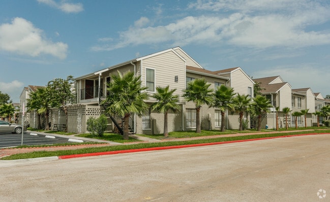
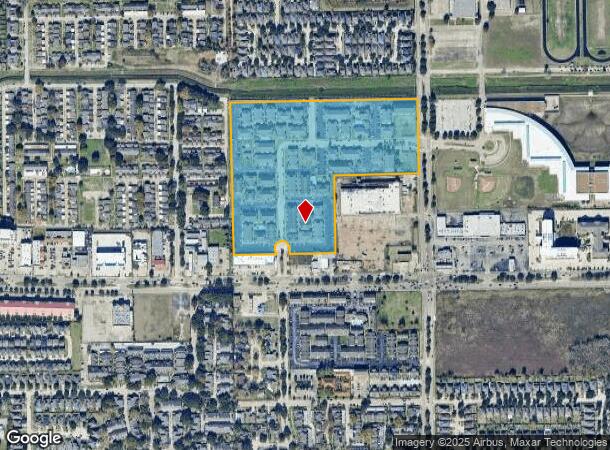
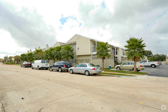
6700 S Dairy Ashford Rd
1145060000003
Rodeo Square
Apartment
RES B1 & C THRU I & TR A (ABANDONED ROW) RODEO SQUARE
X
Harris
48157C0175L
Texas
2024
23.05 AC
2025
Alief
452502
Houston
526,945 SF
Houston-The Woodlands-Sugar Land, TX
DEMOGRAPHICS near 6700 S Dairy Ashford Rd
1 Mile
3 Mile
5 Mile
2024 Total Population
24,897
198,544
495,966
2029 Population
25,302
203,073
519,893
Pop Growth 2024-2029
+ 1.63%
+ 2.28%
+ 4.82%
Average Age
37
37
37
2024 Total Households
8,532
70,796
181,185
HH Growth 2024-2029
+ 1.66%
+ 2.23%
+ 4.54%
Median Household Inc
$37,694
$48,306
$50,774
Avg Household Size
2.80
2.70
2.70
2024 Avg HH Vehicles
2.00
2.00
2.00
Median Home Value
$153,862
$185,961
$217,530
Median Year Built
1982
1985
1984
Nearby Places
Map Layers
Map Styles
 Street
 Aerial
- Restaurants
- Banks
- Shops
- Fitness
- Groceries
PUBLIC TRANSPORTATION
AIRPORT
William P Hobby
DRIVE
WALK
Distance
William P Hobby
41 min
27.5 mi
George Bush Intcntl/Houston
DRIVE
WALK
Distance
George Bush Intcntl/Houston
44 min
35.7 mi
Freight Ports
Port of Houston
DRIVE
WALK
Distance
Port of Houston
39 min
26.4 mi
Nearby Properties
Address
Land Use
TOTAL SIZE
Lot Size
Zoning
Address
Land Use
TOTAL SIZE
Lot Size
Zoning
1,376,776 SF
113.43 AC
Address
Land Use
TOTAL SIZE
Lot Size
Zoning
430,096 SF
18.99 AC
Address
Land Use
TOTAL SIZE
Lot Size
Zoning
638,248 SF
23.38 AC
Address
Land Use
TOTAL SIZE
Lot Size
Zoning
526,410 SF
20.43 AC
Address
Land Use
TOTAL SIZE
Lot Size
Zoning
367,309 SF
14.72 AC
Address
Land Use
TOTAL SIZE
Lot Size
Zoning
497,267 SF
24.69 AC
Address
Land Use
TOTAL SIZE
Lot Size
Zoning
380,423 SF
15.14 AC
Address
Land Use
TOTAL SIZE
Lot Size
Zoning
771,720 SF
19.28 AC
Address
Land Use
TOTAL SIZE
Lot Size
Zoning
489,192 SF
23.11 AC
Address
Land Use
TOTAL SIZE
Lot Size
Zoning
344,088 SF
13.77 AC
Address
Land Use
TOTAL SIZE
Lot Size
Zoning
362,473 SF
15.65 AC
Address
Land Use
TOTAL SIZE
Lot Size
Zoning
126,308 SF
16.95 AC
Address
Land Use
TOTAL SIZE
Lot Size
Zoning
288,868 SF
9.37 AC
Address
Land Use
TOTAL SIZE
Lot Size
Zoning
309,704 SF
8.84 AC
Address
Land Use
TOTAL SIZE
Lot Size
Zoning
325,312 SF
13.66 AC
Address
Land Use
TOTAL SIZE
Lot Size
Zoning
423,596 SF
17.16 AC
Address
Land Use
TOTAL SIZE
Lot Size
Zoning
283,782 SF
11.57 AC
Address
Land Use
TOTAL SIZE
Lot Size
Zoning
323,438 SF
8.24 AC
Address
Land Use
TOTAL SIZE
Lot Size
Zoning
690,119 SF
23 AC
Address
Land Use
TOTAL SIZE
Lot Size
Zoning
143,028 SF
14.95 AC
Address
Land Use
TOTAL SIZE
Lot Size
Zoning
425,887 SF
26.70 AC
Address
Land Use
TOTAL SIZE
Lot Size
Zoning
425,069 SF
25.14 AC
Address
Land Use
TOTAL SIZE
Lot Size
Zoning
286,285 SF
11.78 AC
Address
Land Use
TOTAL SIZE
Lot Size
Zoning
419,988 SF
13.09 AC
Address
Land Use
TOTAL SIZE
Lot Size
Zoning
232,922 SF
17.53 AC
Address
Land Use
TOTAL SIZE
Lot Size
Zoning
409,078 SF
14.65 AC
Address
Land Use
TOTAL SIZE
Lot Size
Zoning
443,209 SF
25.13 AC
Address
Land Use
TOTAL SIZE
Lot Size
Zoning
260,581 SF
9.42 AC
Address
Land Use
TOTAL SIZE
Lot Size
Zoning
429,915 SF
14.33 AC
The World's #1 Commercial Real Estate Marketplace
Connect with us
© 2026 CoStar Group
The information above has been obtained from sources believed reliable. While we do not doubt its accuracy we have not verified it and make no guarantee, warranty or representation about it. It is your responsibility to independently confirm its accuracy and completeness. Any projections, opinions, assumptions, or estimates used are for example only and do not represent the current or future performance of the property. The value of this transaction to you depends on tax and other factors which should be evaluated by your tax, financial, and legal advisors. You and your advisors should conduct a careful, independent investigation of the property to determine to your satisfaction the suitability of the property for your needs.