Property Record
6731 Federal Blvd, Denver, CO 80221


NEARBY LISTINGS FOR SALE OR LEASE
Property Detail
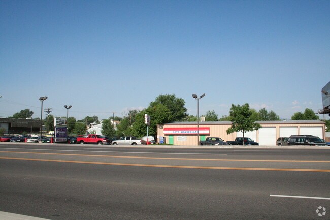
6731 Federal Blvd
Denver-Aurora-Lakewood, CO
Coyle Subdivision No 1
1825-05-3-01-022
SUB:COYLE SUBDIVISION NO 1 LOT:1
Warehouse
Adams
X
Colorado
08059C0209F
1
2024
0.44 AC
2024
Northwest Denver
009606
Denver
5,000 SF
DEMOGRAPHICS near 6731 Federal Blvd
1 Mile
3 Mile
5 Mile
2024 Total Population
14,596
125,725
378,403
2029 Population
15,169
128,694
385,256
Pop Growth 2024-2029
+ 3.93%
+ 2.36%
+ 1.81%
Average Age
36
38
38
2024 Total Households
5,321
46,410
156,896
HH Growth 2024-2029
+ 4.00%
+ 2.28%
+ 1.74%
Median Household Inc
$60,763
$69,114
$79,746
Avg Household Size
2.70
2.60
2.30
2024 Avg HH Vehicles
2.00
2.00
2.00
Median Home Value
$453,314
$418,650
$452,731
Median Year Built
1968
1970
1976
Nearby Places
Map Layers
Map Styles
 Street
 Aerial
- Restaurants
- Banks
- Shops
- Fitness
- Groceries
PUBLIC TRANSPORTATION
COMMUTER RAIL
DRIVE
WALK
Distance
2 min
8 min
0.4 mi
DRIVE
WALK
Distance
5 min
9 min
0.5 mi
AIRPORT
Denver International
DRIVE
WALK
Distance
Denver International
35 min
26.6 mi
Nearby Properties
Address
Land Use
TOTAL SIZE
Lot Size
Zoning
Address
Land Use
TOTAL SIZE
Lot Size
Zoning
860,132 SF
68.50 AC
R-5
Address
Land Use
TOTAL SIZE
Lot Size
Zoning
398,180 SF
33.31 AC
R1C
Address
Land Use
TOTAL SIZE
Lot Size
Zoning
551,915 SF
25.76 AC
Address
Land Use
TOTAL SIZE
Lot Size
Zoning
305,110 SF
16.87 AC
Address
Land Use
TOTAL SIZE
Lot Size
Zoning
470,539 SF
23.59 AC
Address
Land Use
TOTAL SIZE
Lot Size
Zoning
419,745 SF
24.75 AC
Address
Land Use
TOTAL SIZE
Lot Size
Zoning
727,307 SF
38.44 AC
I-B
Address
Land Use
TOTAL SIZE
Lot Size
Zoning
390,764 SF
20.19 AC
Address
Land Use
TOTAL SIZE
Lot Size
Zoning
290,655 SF
24.41 AC
I-B
Address
Land Use
TOTAL SIZE
Lot Size
Zoning
283,572 SF
17.76 AC
Address
Land Use
TOTAL SIZE
Lot Size
Zoning
345,752 SF
15.28 AC
I-B
Address
Land Use
TOTAL SIZE
Lot Size
Zoning
376,598 SF
19.28 AC
Address
Land Use
TOTAL SIZE
Lot Size
Zoning
6,731 SF
80.77 AC
Address
Land Use
TOTAL SIZE
Lot Size
Zoning
370,741 SF
19.53 AC
I3
Address
Land Use
TOTAL SIZE
Lot Size
Zoning
277,200 SF
16.43 AC
Address
Land Use
TOTAL SIZE
Lot Size
Zoning
350,400 SF
19.31 AC
Address
Land Use
TOTAL SIZE
Lot Size
Zoning
281,777 SF
24.89 AC
I2
Address
Land Use
TOTAL SIZE
Lot Size
Zoning
277,869 SF
12.76 AC
Address
Land Use
TOTAL SIZE
Lot Size
Zoning
436,238 SF
13.94 AC
Address
Land Use
TOTAL SIZE
Lot Size
Zoning
201,025 SF
12.18 AC
Address
Land Use
TOTAL SIZE
Lot Size
Zoning
195,600 SF
11.18 AC
Address
Land Use
TOTAL SIZE
Lot Size
Zoning
147,009 SF
36.94 AC
I3
Address
Land Use
TOTAL SIZE
Lot Size
Zoning
338,400 SF
33.45 AC
Address
Land Use
TOTAL SIZE
Lot Size
Zoning
76,078 SF
6.64 AC
U-SU-C
Address
Land Use
TOTAL SIZE
Lot Size
Zoning
176,800 SF
8.72 AC
I-MX-3
Address
Land Use
TOTAL SIZE
Lot Size
Zoning
176,800 SF
8.81 AC
I-MX-3
Address
Land Use
TOTAL SIZE
Lot Size
Zoning
177,298 SF
10.83 AC
Address
Land Use
TOTAL SIZE
Lot Size
Zoning
210,500 SF
11.14 AC
I2
Address
Land Use
TOTAL SIZE
Lot Size
Zoning
169,310 SF
10.17 AC
Address
Land Use
TOTAL SIZE
Lot Size
Zoning
40,131 SF
4.85 AC
I-MX-3
The World's #1 Commercial Real Estate Marketplace
Connect with us
© 2025 CoStar Group
The information above has been obtained from sources believed reliable. While we do not doubt its accuracy we have not verified it and make no guarantee, warranty or representation about it. It is your responsibility to independently confirm its accuracy and completeness. Any projections, opinions, assumptions, or estimates used are for example only and do not represent the current or future performance of the property. The value of this transaction to you depends on tax and other factors which should be evaluated by your tax, financial, and legal advisors. You and your advisors should conduct a careful, independent investigation of the property to determine to your satisfaction the suitability of the property for your needs.