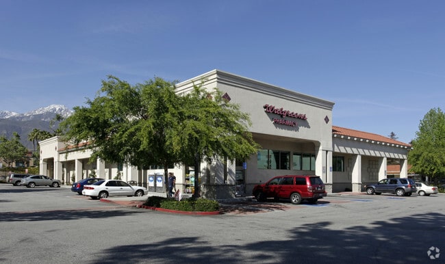
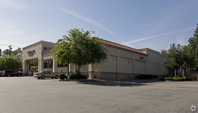
Property Record
6701 Carnelian St, Rancho Cucamonga, CA 91701

NEARBY LISTINGS FOR SALE OR LEASE
Property Detail
6701 Carnelian St
Riverside-San Bernardino-Ontario, CA
Parcel Map 6882
0202-541-61
PM 6882 PAR 5 TOGETHER WITH THAT PTN NLY 13.62 FT PAR 3 SD PM 6882 LYING WLY OF SLY PROLONGATION ELY LI SD PAR 5 EX ST
Storebuilding
San Bernardino
X
California
06071C7890J
5
2024
1.04 AC
2025
Airport Area
002015
Inland Empire (California)
16,288 SF
DEMOGRAPHICS near 6701 Carnelian St
1 Mile
3 Mile
5 Mile
2024 Total Population
16,533
130,563
299,420
2029 Population
16,833
132,420
303,952
Pop Growth 2024-2029
+ 1.81%
+ 1.42%
+ 1.51%
Average Age
42
40
38
2024 Total Households
5,641
45,478
100,751
HH Growth 2024-2029
+ 1.79%
+ 1.46%
+ 1.56%
Median Household Inc
$113,701
$94,062
$91,289
Avg Household Size
2.80
2.80
2.90
2024 Avg HH Vehicles
2.00
2.00
2.00
Median Home Value
$702,893
$665,935
$648,848
Median Year Built
1976
1979
1981
Nearby Places
Map Layers
Map Styles
 Street
 Aerial
- Restaurants
- Banks
- Shops
- Fitness
- Groceries
PUBLIC TRANSPORTATION
COMMUTER RAIL
Upland (San Bernardino Line - Southern California Regional Rail Authority (Metrolink))
DRIVE
WALK
Distance
Upland (San Bernardino Line - Southern California Regional Rail Authority (Metrolink))
9 min
4.5 mi
Rancho Cucamonga (San Bernardino Line - Southern California Regional Rail Authority (Metrolink))
DRIVE
WALK
Distance
Rancho Cucamonga (San Bernardino Line - Southern California Regional Rail Authority (Metrolink))
11 min
7.0 mi
AIRPORT
Ontario International
DRIVE
WALK
Distance
Ontario International
11 min
5.8 mi
Freight Ports
Port of Long Beach
DRIVE
WALK
Distance
Port of Long Beach
68 min
55.3 mi
Nearby Properties
Address
Land Use
TOTAL SIZE
Lot Size
Zoning
Address
Land Use
TOTAL SIZE
Lot Size
Zoning
376,610 SF
25.22 AC
Address
Land Use
TOTAL SIZE
Lot Size
Zoning
190,724 SF
10.69 AC
Address
Land Use
TOTAL SIZE
Lot Size
Zoning
174,092 SF
4.42 AC
Address
Land Use
TOTAL SIZE
Lot Size
Zoning
251,645 SF
4.50 AC
Address
Land Use
TOTAL SIZE
Lot Size
Zoning
340,104 SF
8.95 AC
Address
Land Use
TOTAL SIZE
Lot Size
Zoning
249,672 SF
13.80 AC
Address
Land Use
TOTAL SIZE
Lot Size
Zoning
122,563 SF
5.76 AC
Address
Land Use
TOTAL SIZE
Lot Size
Zoning
324,131 SF
19.81 AC
Address
Land Use
TOTAL SIZE
Lot Size
Zoning
161,555 SF
8.25 AC
Address
Land Use
TOTAL SIZE
Lot Size
Zoning
95,240 SF
8.42 AC
Address
Land Use
TOTAL SIZE
Lot Size
Zoning
99,345 SF
5.15 AC
Address
Land Use
TOTAL SIZE
Lot Size
Zoning
63,862 SF
4.77 AC
Address
Land Use
TOTAL SIZE
Lot Size
Zoning
171,446 SF
10.88 AC
Address
Land Use
TOTAL SIZE
Lot Size
Zoning
133,847 SF
7.52 AC
Address
Land Use
TOTAL SIZE
Lot Size
Zoning
79,319 SF
4.47 AC
Address
Land Use
TOTAL SIZE
Lot Size
Zoning
54,166 SF
4.60 AC
Address
Land Use
TOTAL SIZE
Lot Size
Zoning
54,444 SF
4.71 AC
Address
Land Use
TOTAL SIZE
Lot Size
Zoning
175,624 SF
8.20 AC
Address
Land Use
TOTAL SIZE
Lot Size
Zoning
59,690 SF
3.32 AC
Address
Land Use
TOTAL SIZE
Lot Size
Zoning
87,386 SF
3.90 AC
Address
Land Use
TOTAL SIZE
Lot Size
Zoning
108,000 SF
8.78 AC
Address
Land Use
TOTAL SIZE
Lot Size
Zoning
187,841 SF
6.14 AC
Address
Land Use
TOTAL SIZE
Lot Size
Zoning
54,366 SF
4.95 AC
Address
Land Use
TOTAL SIZE
Lot Size
Zoning
139,921 SF
8.72 AC
Address
Land Use
TOTAL SIZE
Lot Size
Zoning
75,755 SF
3.23 AC
Address
Land Use
TOTAL SIZE
Lot Size
Zoning
145,880 SF
9.76 AC
Address
Land Use
TOTAL SIZE
Lot Size
Zoning
56,467 SF
8.78 AC
Address
Land Use
TOTAL SIZE
Lot Size
Zoning
293,200 SF
17.06 AC
Address
Land Use
TOTAL SIZE
Lot Size
Zoning
171,835 SF
10.44 AC
Address
Land Use
TOTAL SIZE
Lot Size
Zoning
165,969 SF
11.80 AC
The World's #1 Commercial Real Estate Marketplace
Connect with us
© 2025 CoStar Group
The information above has been obtained from sources believed reliable. While we do not doubt its accuracy we have not verified it and make no guarantee, warranty or representation about it. It is your responsibility to independently confirm its accuracy and completeness. Any projections, opinions, assumptions, or estimates used are for example only and do not represent the current or future performance of the property. The value of this transaction to you depends on tax and other factors which should be evaluated by your tax, financial, and legal advisors. You and your advisors should conduct a careful, independent investigation of the property to determine to your satisfaction the suitability of the property for your needs.