Property Record
6701 Dorr St, Toledo, OH 43615
NEARBY LISTINGS FOR SALE OR LEASE
-
-
View all Toledo listings for sale on LoopNet.com
Property Detail
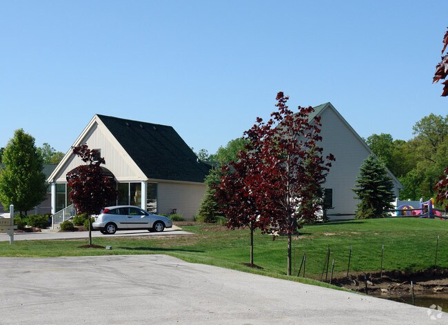
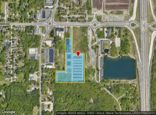
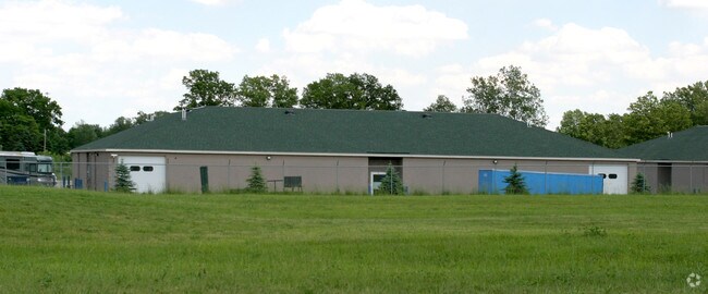
6701 Dorr St
Toledo, OH
Garden Land
65-46181
GARDEN LAND LOT 79 EXC E 281.01 FT NLY650 FT & LOT 80 EXC
Warehouse
Lucas
X
Ohio
39095C0064F
79,80
0
9.95 AC
2025
West/Sylvania
008701
Toledo
92,955 SF
DEMOGRAPHICS near 6701 Dorr St
1 mile
3 mile
5 mile
2024 Total Population
10,331
55,428
145,547
2029 Population
10,521
54,636
143,096
Pop Growth 2024-2029
+ 1.84%
(1.43%)
(1.68%)
Average Age
41
42
41
2024 Total Households
4,994
24,225
62,617
HH Growth 2024-2029
+ 2.20%
(1.30%)
(1.64%)
Median Household Inc
$63,071
$64,830
$63,606
Avg Household Size
2.00
2.20
2.20
2024 Avg HH Vehicles
2.00
2.00
2.00
Median Home Value
$137,020
$172,407
$184,457
Median Year Built
1987
1981
1976
Nearby Places
Map Layers
Map Styles
 Street
 Aerial
Transit
 Traffic
 Biking
Places
Listings with unknown addresses are not visible on the map
- Restaurants
- Banks
- Shops
- Fitness
- Groceries
PUBLIC TRANSPORTATION
AIRPORT
Eugene F Kranz Toledo Express
Drive
Walk
Distance
Eugene F Kranz Toledo Express
28 min
13.6 mi
Freight Ports
Port of Toledo
Drive
Walk
Distance
Port of Toledo
31 min
17.9 mi
Nearby Properties
Address
Land Use
TOTAL SIZE
Lot Size
Zoning
Address
Land Use
TOTAL SIZE
Lot Size
Zoning
329,064 SF
69.74 AC
10-RS6
Address
Land Use
TOTAL SIZE
Lot Size
Zoning
173,943 SF
59.70 AC
10-IP
Address
Land Use
TOTAL SIZE
Lot Size
Zoning
186,190 SF
14 AC
19-C2
Address
Land Use
TOTAL SIZE
Lot Size
Zoning
275,113 SF
21 AC
10-MX
Address
Land Use
TOTAL SIZE
Lot Size
Zoning
211,140 SF
28.92 AC
10-IC
Address
Land Use
TOTAL SIZE
Lot Size
Zoning
209,351 SF
49.06 AC
31-R1
Address
Land Use
TOTAL SIZE
Lot Size
Zoning
90,056 SF
10.17 AC
20-C2
Address
Land Use
TOTAL SIZE
Lot Size
Zoning
78,678 SF
10.20 AC
31-R1
Address
Land Use
TOTAL SIZE
Lot Size
Zoning
89,031 SF
15.83 AC
31-M2
Address
Land Use
TOTAL SIZE
Lot Size
Zoning
51,129 SF
460.05 AC
20-S1
Address
Land Use
TOTAL SIZE
Lot Size
Zoning
212,664 SF
21.43 AC
24-B3
Address
Land Use
TOTAL SIZE
Lot Size
Zoning
203,839 SF
16.39 AC
24-SUP
Address
Land Use
TOTAL SIZE
Lot Size
Zoning
169,580 SF
8.98 AC
20-C2
Address
Land Use
TOTAL SIZE
Lot Size
Zoning
67,713 SF
10.24 AC
20-C2
Address
Land Use
TOTAL SIZE
Lot Size
Zoning
59 AC
10-IP
Address
Land Use
TOTAL SIZE
Lot Size
Zoning
130,387 SF
8.50 AC
20-R5
Address
Land Use
TOTAL SIZE
Lot Size
Zoning
217,992 SF
39.78 AC
20-C2
Address
Land Use
TOTAL SIZE
Lot Size
Zoning
156,420 SF
12 AC
19-R3
Address
Land Use
TOTAL SIZE
Lot Size
Zoning
137,081 SF
12 AC
20-C2
Address
Land Use
TOTAL SIZE
Lot Size
Zoning
111,195 SF
13.64 AC
19-C2
Address
Land Use
TOTAL SIZE
Lot Size
Zoning
214,400 SF
13.07 AC
20-C2
Address
Land Use
TOTAL SIZE
Lot Size
Zoning
90,782 SF
18.24 AC
20-RA
Address
Land Use
TOTAL SIZE
Lot Size
Zoning
119,804 SF
5.02 AC
31-R4
Address
Land Use
TOTAL SIZE
Lot Size
Zoning
140,008 SF
10 AC
19-R3
Address
Land Use
TOTAL SIZE
Lot Size
Zoning
63,445 SF
5.72 AC
20-C4
Address
Land Use
TOTAL SIZE
Lot Size
Zoning
70,550 SF
8.25 AC
31-B1
Address
Land Use
TOTAL SIZE
Lot Size
Zoning
36,153 SF
4.43 AC
20-C2
Address
Land Use
TOTAL SIZE
Lot Size
Zoning
113,835 SF
216.19 AC
10-RS6
Address
Land Use
TOTAL SIZE
Lot Size
Zoning
1,704 SF
74 AC
19-MX
Address
Land Use
TOTAL SIZE
Lot Size
Zoning
103,406 SF
7.55 AC
24-SUP
The World's #1 Commercial Real Estate Marketplace
Connect with us
© 2026 CoStar Group
The information above has been obtained from sources believed reliable. While we do not doubt its accuracy we have not verified it and make no guarantee, warranty or representation about it. It is your responsibility to independently confirm its accuracy and completeness. Any projections, opinions, assumptions, or estimates used are for example only and do not represent the current or future performance of the property. The value of this transaction to you depends on tax and other factors which should be evaluated by your tax, financial, and legal advisors. You and your advisors should conduct a careful, independent investigation of the property to determine to your satisfaction the suitability of the property for your needs.