Property Record
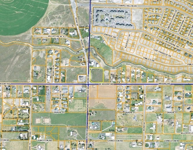
6701 W Argent Rd, Pasco, WA 99301

NEARBY LISTINGS FOR SALE OR LEASE
Property Detail
6701 W Argent Rd
Other Market Areas
2006-6 Bsp
Kennewick-Richland, WA
BINDING SITE PLAN 2006-06 LOT 1
117-430-022
Franklin
Multifamilydwelling
Washington
2025
1
2025
2.38 AC
020503
Yakima/Kennewick
76,356 SF
DEMOGRAPHICS near 6701 W Argent Rd
1 Mile
3 Mile
5 Mile
2024 Total Population
7,057
65,875
159,767
2029 Population
7,676
71,403
172,464
Pop Growth 2024-2029
+ 8.77%
+ 8.39%
+ 7.95%
Average Age
34
35
36
2024 Total Households
2,327
22,038
55,844
HH Growth 2024-2029
+ 8.81%
+ 8.40%
+ 7.94%
Median Household Inc
$99,806
$90,367
$73,468
Avg Household Size
3.00
2.90
2.80
2024 Avg HH Vehicles
2.00
2.00
2.00
Median Home Value
$372,068
$319,585
$318,987
Median Year Built
2005
2001
1989
Nearby Places
Map Layers
Map Styles
 Street
 Aerial
- Restaurants
- Banks
- Shops
- Fitness
- Groceries
PUBLIC TRANSPORTATION
COMMUTER RAIL
Pasco Amtrak Station (Empire Builder - Amtrak)
DRIVE
WALK
Distance
Pasco Amtrak Station (Empire Builder - Amtrak)
10 min
6.1 mi
AIRPORT
Tri-Cities
DRIVE
WALK
Distance
Tri-Cities
7 min
3.6 mi
Freight Ports
Port of Tacoma
DRIVE
WALK
Distance
Port of Tacoma
268 min
234.1 mi
SALE & LEASE HISTORY
LISTING DATE
SALE/LEASE

Sep 24, 2016
For Sale
Nearby Properties
Address
Land Use
TOTAL SIZE
Lot Size
Zoning
Address
Land Use
TOTAL SIZE
Lot Size
Zoning
277,530 SF
14.99 AC
Address
Land Use
TOTAL SIZE
Lot Size
Zoning
254,856 SF
10.47 AC
Address
Land Use
TOTAL SIZE
Lot Size
Zoning
232,463 SF
31.54 AC
Address
Land Use
TOTAL SIZE
Lot Size
Zoning
Address
Land Use
TOTAL SIZE
Lot Size
Zoning
153,320 SF
7.37 AC
Address
Land Use
TOTAL SIZE
Lot Size
Zoning
183,266 SF
10 AC
Address
Land Use
TOTAL SIZE
Lot Size
Zoning
76,783 SF
4 AC
Address
Land Use
TOTAL SIZE
Lot Size
Zoning
67,893 SF
3.28 AC
Address
Land Use
TOTAL SIZE
Lot Size
Zoning
144,723 SF
6.88 AC
Address
Land Use
TOTAL SIZE
Lot Size
Zoning
118,412 SF
9.91 AC
KENNEWICK
Address
Land Use
TOTAL SIZE
Lot Size
Zoning
114,673 SF
6.58 AC
Address
Land Use
TOTAL SIZE
Lot Size
Zoning
72,220 SF
2.62 AC
Address
Land Use
TOTAL SIZE
Lot Size
Zoning
213,654 SF
21.01 AC
Address
Land Use
TOTAL SIZE
Lot Size
Zoning
64,936 SF
Address
Land Use
TOTAL SIZE
Lot Size
Zoning
132,060 SF
6.74 AC
35
Address
Land Use
TOTAL SIZE
Lot Size
Zoning
67,635 SF
5.95 AC
Address
Land Use
TOTAL SIZE
Lot Size
Zoning
85,104 SF
3 AC
Address
Land Use
TOTAL SIZE
Lot Size
Zoning
89,903 SF
3.89 AC
Address
Land Use
TOTAL SIZE
Lot Size
Zoning
75,210 SF
4.70 AC
Address
Land Use
TOTAL SIZE
Lot Size
Zoning
32,808 SF
2.45 AC
Address
Land Use
TOTAL SIZE
Lot Size
Zoning
72,085 SF
1.75 AC
Address
Land Use
TOTAL SIZE
Lot Size
Zoning
59,838 SF
5.47 AC
Address
Land Use
TOTAL SIZE
Lot Size
Zoning
98,491 SF
16.15 AC
Address
Land Use
TOTAL SIZE
Lot Size
Zoning
121,964 SF
13.90 AC
Address
Land Use
TOTAL SIZE
Lot Size
Zoning
91,608 SF
6.60 AC
Address
Land Use
TOTAL SIZE
Lot Size
Zoning
42,246 SF
4.29 AC
Address
Land Use
TOTAL SIZE
Lot Size
Zoning
107,964 SF
10.98 AC
Address
Land Use
TOTAL SIZE
Lot Size
Zoning
55,948 SF
5.56 AC
Address
Land Use
TOTAL SIZE
Lot Size
Zoning
199,964 SF
9.52 AC
Address
Land Use
TOTAL SIZE
Lot Size
Zoning
35,000 SF
13.82 AC
The World's #1 Commercial Real Estate Marketplace
Connect with us
© 2025 CoStar Group
The information above has been obtained from sources believed reliable. While we do not doubt its accuracy we have not verified it and make no guarantee, warranty or representation about it. It is your responsibility to independently confirm its accuracy and completeness. Any projections, opinions, assumptions, or estimates used are for example only and do not represent the current or future performance of the property. The value of this transaction to you depends on tax and other factors which should be evaluated by your tax, financial, and legal advisors. You and your advisors should conduct a careful, independent investigation of the property to determine to your satisfaction the suitability of the property for your needs.