Property Record
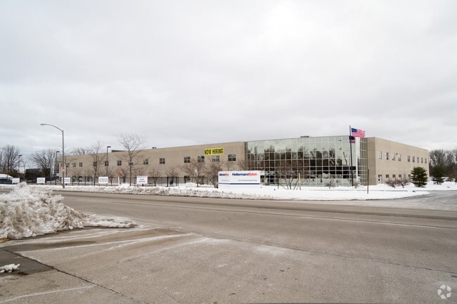
6701 W Good Hope Rd, Milwaukee, WI 53223


NEARBY LISTINGS FOR SALE OR LEASE
Property Detail
6701 W Good Hope Rd
120-9996-110-2
LANDS IN NE 1/4 SEC 22-8-21 W 1/4 OF N 1/2 OF SD 1/4 SEC SUBJ TO WEP CO EASMT & EXC N 80 FOR ST BID #31,TID #77
Industrialgeneral
Milwaukee
X
Wisconsin
55089C0265G
19.02 AC
2024
Milwaukee NW
2024
Milwaukee/Madison
000600
Milwaukee-Waukesha, WI
92,303 SF
DEMOGRAPHICS near 6701 W Good Hope Rd
1 Mile
3 Mile
5 Mile
2024 Total Population
8,360
97,726
229,388
2029 Population
8,132
95,766
225,806
Pop Growth 2024-2029
(2.73%)
(2.01%)
(1.56%)
Average Age
37
36
38
2024 Total Households
3,130
37,429
91,685
HH Growth 2024-2029
(2.91%)
(2.13%)
(1.62%)
Median Household Inc
$51,905
$50,272
$52,125
Avg Household Size
2.50
2.50
2.40
2024 Avg HH Vehicles
2.00
1.00
1.00
Median Home Value
$138,611
$149,287
$171,513
Median Year Built
1969
1964
1958
Nearby Places
Map Layers
Map Styles
 Street
 Aerial
- Restaurants
- Banks
- Shops
- Fitness
- Groceries
PUBLIC TRANSPORTATION
AIRPORT
General Mitchell International
DRIVE
WALK
Distance
General Mitchell International
33 min
19.1 mi
Freight Ports
Port Milwaukee
DRIVE
WALK
Distance
Port Milwaukee
25 min
14.9 mi
Nearby Properties
Address
Land Use
TOTAL SIZE
Lot Size
Zoning
Address
Land Use
TOTAL SIZE
Lot Size
Zoning
Address
Land Use
TOTAL SIZE
Lot Size
Zoning
33.49 AC
TL
Address
Land Use
TOTAL SIZE
Lot Size
Zoning
145,218 SF
10.23 AC
Address
Land Use
TOTAL SIZE
Lot Size
Zoning
391,696 SF
36.33 AC
PD
Address
Land Use
TOTAL SIZE
Lot Size
Zoning
197,426 SF
26.34 AC
PD
Address
Land Use
TOTAL SIZE
Lot Size
Zoning
206,529 SF
7.88 AC
PD
Address
Land Use
TOTAL SIZE
Lot Size
Zoning
298,666 SF
5.09 AC
PD
Address
Land Use
TOTAL SIZE
Lot Size
Zoning
12.49 AC
TL
Address
Land Use
TOTAL SIZE
Lot Size
Zoning
104,365 SF
9.85 AC
PD
Address
Land Use
TOTAL SIZE
Lot Size
Zoning
4.70 AC
Address
Land Use
TOTAL SIZE
Lot Size
Zoning
66.42 AC
IL1
Address
Land Use
TOTAL SIZE
Lot Size
Zoning
4.26 AC
Address
Land Use
TOTAL SIZE
Lot Size
Zoning
Address
Land Use
TOTAL SIZE
Lot Size
Zoning
Address
Land Use
TOTAL SIZE
Lot Size
Zoning
18.54 AC
RS6
Address
Land Use
TOTAL SIZE
Lot Size
Zoning
17.91 AC
RS5
Address
Land Use
TOTAL SIZE
Lot Size
Zoning
10.98 AC
Address
Land Use
TOTAL SIZE
Lot Size
Zoning
297,894 SF
19.67 AC
IL1
Address
Land Use
TOTAL SIZE
Lot Size
Zoning
238,129 SF
54.57 AC
PD
Address
Land Use
TOTAL SIZE
Lot Size
Zoning
333,971 SF
16.93 AC
IL1
Address
Land Use
TOTAL SIZE
Lot Size
Zoning
166,245 SF
55 AC
PD
Address
Land Use
TOTAL SIZE
Lot Size
Zoning
28.12 AC
RM1
Address
Land Use
TOTAL SIZE
Lot Size
Zoning
161,350 SF
12.33 AC
PD
Address
Land Use
TOTAL SIZE
Lot Size
Zoning
173,090 SF
15.83 AC
RB1
Address
Land Use
TOTAL SIZE
Lot Size
Zoning
116,862 SF
14.39 AC
RM1
Address
Land Use
TOTAL SIZE
Lot Size
Zoning
23.38 AC
RS6
Address
Land Use
TOTAL SIZE
Lot Size
Zoning
13.08 AC
Address
Land Use
TOTAL SIZE
Lot Size
Zoning
49.03 AC
PK
Address
Land Use
TOTAL SIZE
Lot Size
Zoning
88,259 SF
14.70 AC
PD
Address
Land Use
TOTAL SIZE
Lot Size
Zoning
20.40 AC
The World's #1 Commercial Real Estate Marketplace
Connect with us
© 2026 CoStar Group
The information above has been obtained from sources believed reliable. While we do not doubt its accuracy we have not verified it and make no guarantee, warranty or representation about it. It is your responsibility to independently confirm its accuracy and completeness. Any projections, opinions, assumptions, or estimates used are for example only and do not represent the current or future performance of the property. The value of this transaction to you depends on tax and other factors which should be evaluated by your tax, financial, and legal advisors. You and your advisors should conduct a careful, independent investigation of the property to determine to your satisfaction the suitability of the property for your needs.