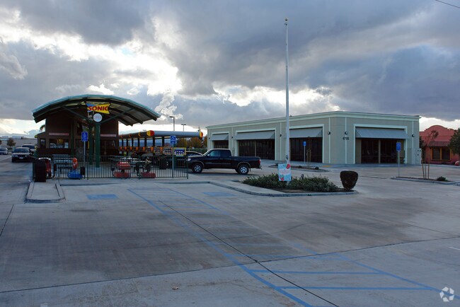
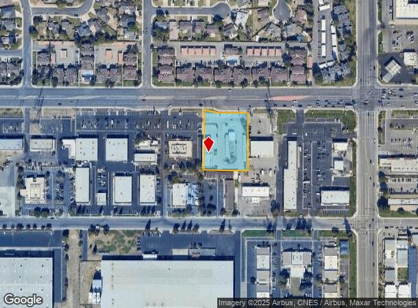
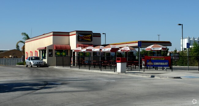
Property Record
6701 White Ln, Bakersfield, CA 93309
NEARBY LISTINGS FOR SALE OR LEASE
Property Detail
6701 White Ln
385-420-19-00-4
PARCEL MAP 9290 , LOT 2
Commercialnec
Kern
X
California
06029C2300E
2
2024
1.27 AC
2025
Southwest Bakersfield
003131
Bakersfield
1,370 SF
Bakersfield-Delano, CA
DEMOGRAPHICS near 6701 White Ln
1 mile
3 mile
5 mile
2024 Total Population
15,464
142,961
281,780
2029 Population
15,405
142,884
282,006
Pop Growth 2024-2029
(0.38%)
(0.05%)
+ 0.08%
Average Age
35
36
35
2024 Total Households
5,269
46,913
88,425
HH Growth 2024-2029
(0.46%)
(0.12%)
+ 0.03%
Median Household Inc
$65,218
$70,743
$68,244
Avg Household Size
2.90
3.00
3.10
2024 Avg HH Vehicles
2.00
2.00
2.00
Median Home Value
$266,002
$289,718
$289,452
Median Year Built
1983
1984
1984
Nearby Places
Map Layers
Map Styles
 Street
 Aerial
Transit
 Traffic
 Biking
Places
Listings with unknown addresses are not visible on the map
- Restaurants
- Banks
- Shops
- Fitness
- Groceries
PUBLIC TRANSPORTATION
COMMUTER RAIL
Drive
Walk
Distance
15 min
8.4 mi
AIRPORT
Meadows Field
Drive
Walk
Distance
Meadows Field
23 min
11.9 mi
Nearby Properties
Address
Land Use
TOTAL SIZE
Lot Size
Zoning
Address
Land Use
TOTAL SIZE
Lot Size
Zoning
587,976 SF
40.01 AC
M-2
Address
Land Use
TOTAL SIZE
Lot Size
Zoning
23,615 SF
39.38 AC
C2
Address
Land Use
TOTAL SIZE
Lot Size
Zoning
114,500 SF
12.02 AC
C-2
Address
Land Use
TOTAL SIZE
Lot Size
Zoning
5,850 SF
10.96 AC
C2
Address
Land Use
TOTAL SIZE
Lot Size
Zoning
354,000 SF
20 AC
M2
Address
Land Use
TOTAL SIZE
Lot Size
Zoning
14,529 SF
27.73 AC
R-2
Address
Land Use
TOTAL SIZE
Lot Size
Zoning
241,051 SF
18.48 AC
CO
Address
Land Use
TOTAL SIZE
Lot Size
Zoning
14,500 SF
33.82 AC
C2
Address
Land Use
TOTAL SIZE
Lot Size
Zoning
253,532 SF
14.69 AC
Address
Land Use
TOTAL SIZE
Lot Size
Zoning
185,181 SF
14.67 AC
C2
Address
Land Use
TOTAL SIZE
Lot Size
Zoning
269,429 SF
12.71 AC
R-2
Address
Land Use
TOTAL SIZE
Lot Size
Zoning
138,559 SF
11.92 AC
C-2 PCD
Address
Land Use
TOTAL SIZE
Lot Size
Zoning
15,027 SF
17.72 AC
C-2
Address
Land Use
TOTAL SIZE
Lot Size
Zoning
218,345 SF
19.54 AC
PCD
Address
Land Use
TOTAL SIZE
Lot Size
Zoning
37,760 SF
12.16 AC
R3
Address
Land Use
TOTAL SIZE
Lot Size
Zoning
99,368 SF
6.95 AC
CO
Address
Land Use
TOTAL SIZE
Lot Size
Zoning
233,512 SF
9.19 AC
R-3
Address
Land Use
TOTAL SIZE
Lot Size
Zoning
214,746 SF
14.91 AC
Address
Land Use
TOTAL SIZE
Lot Size
Zoning
210,432 SF
13.52 AC
R-2
Address
Land Use
TOTAL SIZE
Lot Size
Zoning
93,274 SF
6.20 AC
R-2
Address
Land Use
TOTAL SIZE
Lot Size
Zoning
223,557 SF
21.31 AC
PCD
Address
Land Use
TOTAL SIZE
Lot Size
Zoning
83,388 SF
3.15 AC
Address
Land Use
TOTAL SIZE
Lot Size
Zoning
192,500 SF
11.48 AC
R-2
Address
Land Use
TOTAL SIZE
Lot Size
Zoning
62,941 SF
8.79 AC
M-1
Address
Land Use
TOTAL SIZE
Lot Size
Zoning
79,325 SF
7.77 AC
C-2
Address
Land Use
TOTAL SIZE
Lot Size
Zoning
83,936 SF
4.39 AC
R-2
Address
Land Use
TOTAL SIZE
Lot Size
Zoning
88,988 SF
9.82 AC
C-2
Address
Land Use
TOTAL SIZE
Lot Size
Zoning
24,888 SF
5.75 AC
WM-R2
Address
Land Use
TOTAL SIZE
Lot Size
Zoning
115,267 SF
9.14 AC
C-2
Address
Land Use
TOTAL SIZE
Lot Size
Zoning
23,600 SF
8.17 AC
C2
The World's #1 Commercial Real Estate Marketplace
Connect with us
© 2026 CoStar Group
The information above has been obtained from sources believed reliable. While we do not doubt its accuracy we have not verified it and make no guarantee, warranty or representation about it. It is your responsibility to independently confirm its accuracy and completeness. Any projections, opinions, assumptions, or estimates used are for example only and do not represent the current or future performance of the property. The value of this transaction to you depends on tax and other factors which should be evaluated by your tax, financial, and legal advisors. You and your advisors should conduct a careful, independent investigation of the property to determine to your satisfaction the suitability of the property for your needs.