Property Record
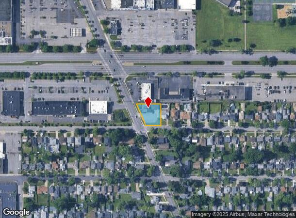
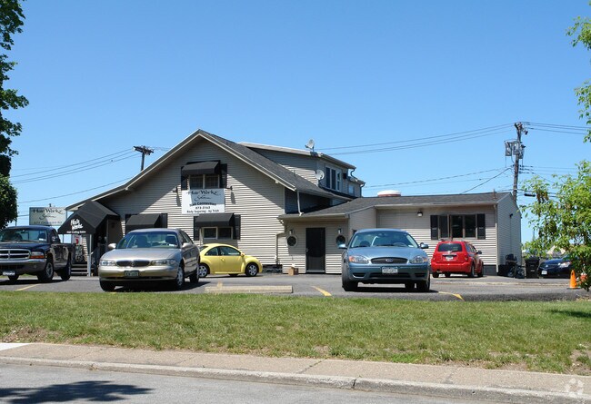
671 Delaware Rd, Buffalo, NY 14223

NEARBY LISTINGS FOR SALE OR LEASE
Property Detail
671 Delaware Rd
146489-066-390-0002-021-000
COR N GLENCOVE RD 871 BL 5 1 PTS 2 4 137.43 X 144.89
Commercialofficeresidentialmixeduse
Erie
X
New York
36029C0205H
21.000
2025
0.46 AC
2024
North
008102
Buffalo/Niagara Falls
3,790 SF
Buffalo-Cheektowaga-Niagara Falls, NY
DEMOGRAPHICS near 671 Delaware Rd
1 Mile
3 Mile
5 Mile
2024 Total Population
19,244
139,119
307,662
2029 Population
19,046
136,773
302,654
Pop Growth 2024-2029
(1.03%)
(1.69%)
(1.63%)
Average Age
44
41
39
2024 Total Households
8,908
62,922
131,093
HH Growth 2024-2029
(1.11%)
(1.73%)
(1.68%)
Median Household Inc
$67,251
$60,490
$56,987
Avg Household Size
2.10
2.10
2.20
2024 Avg HH Vehicles
2.00
1.00
1.00
Median Home Value
$171,225
$167,382
$174,920
Median Year Built
1950
1950
1949
Nearby Places
- Restaurants
- Banks
- Shops
- Fitness
- Groceries
PUBLIC TRANSPORTATION
AIRPORT
Buffalo Niagara International
DRIVE
WALK
Distance
Buffalo Niagara International
18 min
8.9 mi
Niagara Falls International
DRIVE
WALK
Distance
Niagara Falls International
21 min
10.6 mi
Freight Ports
Port of Toledo
DRIVE
WALK
Distance
Port of Toledo
373 min
314.0 mi
Nearby Properties
Address
Land Use
TOTAL SIZE
Lot Size
Zoning
Address
Land Use
TOTAL SIZE
Lot Size
Zoning
139,224 SF
13.72 AC
WID
Address
Land Use
TOTAL SIZE
Lot Size
Zoning
409,925 SF
36.41 AC
CTR-5
Address
Land Use
TOTAL SIZE
Lot Size
Zoning
239,735 SF
17.73 AC
TND
Address
Land Use
TOTAL SIZE
Lot Size
Zoning
70,261 SF
14.63 AC
CTR-5
Address
Land Use
TOTAL SIZE
Lot Size
Zoning
100,737 SF
21.10 AC
CTR-5
Address
Land Use
TOTAL SIZE
Lot Size
Zoning
94,680 SF
175.90 AC
D-OG
Address
Land Use
TOTAL SIZE
Lot Size
Zoning
117,980 SF
14.40 AC
CTR-5
Address
Land Use
TOTAL SIZE
Lot Size
Zoning
181,897 SF
15.30 AC
CTR-2.5
Address
Land Use
TOTAL SIZE
Lot Size
Zoning
17,778 SF
14 AC
GB
Address
Land Use
TOTAL SIZE
Lot Size
Zoning
197,430 SF
8.20 AC
Address
Land Use
TOTAL SIZE
Lot Size
Zoning
197,430 SF
7.35 AC
Address
Land Use
TOTAL SIZE
Lot Size
Zoning
3,456 SF
6.90 AC
MFR-5
Address
Land Use
TOTAL SIZE
Lot Size
Zoning
7,753 SF
1 AC
N-1C
Address
Land Use
TOTAL SIZE
Lot Size
Zoning
122,669 SF
7.94 AC
CTR-2.5
Address
Land Use
TOTAL SIZE
Lot Size
Zoning
109,461 SF
7.90 AC
CTR-5
Address
Land Use
TOTAL SIZE
Lot Size
Zoning
113,316 SF
12.25 AC
CTR-5
Address
Land Use
TOTAL SIZE
Lot Size
Zoning
650,000 SF
42.15 AC
G-1
Address
Land Use
TOTAL SIZE
Lot Size
Zoning
3,200 SF
4.96 AC
SC-3
Address
Land Use
TOTAL SIZE
Lot Size
Zoning
67,666 SF
17.43 AC
G-1
Address
Land Use
TOTAL SIZE
Lot Size
Zoning
2,112 SF
15.60 AC
Address
Land Use
TOTAL SIZE
Lot Size
Zoning
11,808 SF
11.93 AC
N-3R
Address
Land Use
TOTAL SIZE
Lot Size
Zoning
2,474 SF
24.84 AC
Address
Land Use
TOTAL SIZE
Lot Size
Zoning
67,000 SF
6.50 AC
Address
Land Use
TOTAL SIZE
Lot Size
Zoning
120,954 SF
9.74 AC
D-S
Address
Land Use
TOTAL SIZE
Lot Size
Zoning
99,488 SF
3.20 AC
Address
Land Use
TOTAL SIZE
Lot Size
Zoning
384,825 SF
39.95 AC
CTR-2.5
Address
Land Use
TOTAL SIZE
Lot Size
Zoning
6,862 SF
14.28 AC
CTR-5
Address
Land Use
TOTAL SIZE
Lot Size
Zoning
356,891 SF
21.33 AC
B
Address
Land Use
TOTAL SIZE
Lot Size
Zoning
16 AC
G-1
Address
Land Use
TOTAL SIZE
Lot Size
Zoning
90,888 SF
9.13 AC
CTR-2.5
The World's #1 Commercial Real Estate Marketplace
Connect with us
© 2025 CoStar Group
The information above has been obtained from sources believed reliable. While we do not doubt its accuracy we have not verified it and make no guarantee, warranty or representation about it. It is your responsibility to independently confirm its accuracy and completeness. Any projections, opinions, assumptions, or estimates used are for example only and do not represent the current or future performance of the property. The value of this transaction to you depends on tax and other factors which should be evaluated by your tax, financial, and legal advisors. You and your advisors should conduct a careful, independent investigation of the property to determine to your satisfaction the suitability of the property for your needs.