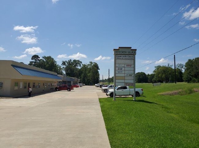
Property Record
671 Highway 171, Stonewall, LA 71078


Current Lease Availabilities
Property Detail
671 Highway 171
Shreveport-Bossier City, LA
COMM AT THE NE COR NW SE, SEC 17 T15 R14, DESOTO PARISH, LA; TH RUN S 58'29'21 W 1547.04 FT; TH S 00'07'02 E 200.00 FT; TH S 89'52'58 W 300.00 FT; TH S 16'28'10 E 85.15 FT; TH S 22'26'12 E 482.35 FT TO THE POB; TH S 89'41'03 E 298.86 FT; TH S 89'41'0
0200140905B
De Soto
Commercialnec
Louisiana
B and X Area of moderate flood hazard, usually the area between the limits of the 100-year and 500-year floods.
25
2025
5 AC
2025
DeSoto Parish
950103
Shreveport/Bossier City
NEARBY LISTINGS FOR SALE OR LEASE
-
-
4755 Stonewall-Frierson Road, Stonewall, Ln
Stonewall, LA 71078
$35.00 SF/YR
1,000 - 4,988 SF
Retail
-
View all Stonewall listings for lease on LoopNet.com
DEMOGRAPHICS near 671 Highway 171
1 mile
3 mile
5 mile
2025 Total Population
336
4,510
11,619
2030 Population
336
4,521
11,525
Pop Growth 2025-2030
0.00%
+ 0.24%
(0.81%)
Average Age
39
40
42
2025 Total Households
121
1,665
4,451
HH Growth 2025-2030
0.00%
+ 0.12%
(1.01%)
Median Household Inc
$80,682
$69,291
$59,304
Avg Household Size
2.70
2.70
2.60
2025 Avg HH Vehicles
2.00
2.00
2.00
Median Home Value
$332,857
$287,068
$214,115
Median Year Built
2003
2000
1995
Nearby Places
Map Layers
Map Styles
 Street
 Aerial
Layers
 Traffic
 Biking
Places
Listings with unknown addresses are not visible on the map
- Restaurants
- Banks
- Shops
- Fitness
- Groceries
PUBLIC TRANSPORTATION
AIRPORT
Shreveport Regional
Drive
Walk
Distance
Shreveport Regional
24 min
12.5 mi
Freight Ports
Port of Shreveport
Drive
Walk
Distance
Port of Shreveport
31 min
21.7 mi
Nearby Properties
Address
Land Use
TOTAL SIZE
Lot Size
Zoning
Address
Land Use
TOTAL SIZE
Lot Size
Zoning
100 SF
16.90 AC
Address
Land Use
TOTAL SIZE
Lot Size
Zoning
Address
Land Use
TOTAL SIZE
Lot Size
Zoning
Address
Land Use
TOTAL SIZE
Lot Size
Zoning
Address
Land Use
TOTAL SIZE
Lot Size
Zoning
Address
Land Use
TOTAL SIZE
Lot Size
Zoning
Address
Land Use
TOTAL SIZE
Lot Size
Zoning
Address
Land Use
TOTAL SIZE
Lot Size
Zoning
Address
Land Use
TOTAL SIZE
Lot Size
Zoning
Address
Land Use
TOTAL SIZE
Lot Size
Zoning
Address
Land Use
TOTAL SIZE
Lot Size
Zoning
Address
Land Use
TOTAL SIZE
Lot Size
Zoning
Address
Land Use
TOTAL SIZE
Lot Size
Zoning
2.08 AC
Address
Land Use
TOTAL SIZE
Lot Size
Zoning
Address
Land Use
TOTAL SIZE
Lot Size
Zoning
Address
Land Use
TOTAL SIZE
Lot Size
Zoning
100 SF
1.50 AC
Address
Land Use
TOTAL SIZE
Lot Size
Zoning
Address
Land Use
TOTAL SIZE
Lot Size
Zoning
Address
Land Use
TOTAL SIZE
Lot Size
Zoning
100 SF
2.45 AC
Address
Land Use
TOTAL SIZE
Lot Size
Zoning
Address
Land Use
TOTAL SIZE
Lot Size
Zoning
Address
Land Use
TOTAL SIZE
Lot Size
Zoning
Address
Land Use
TOTAL SIZE
Lot Size
Zoning
100 SF
1.56 AC
Address
Land Use
TOTAL SIZE
Lot Size
Zoning
Address
Land Use
TOTAL SIZE
Lot Size
Zoning
Address
Land Use
TOTAL SIZE
Lot Size
Zoning
Address
Land Use
TOTAL SIZE
Lot Size
Zoning
Address
Land Use
TOTAL SIZE
Lot Size
Zoning
The World's #1 Commercial Real Estate Marketplace
Connect with us
© 2026 CoStar Group
The information above has been obtained from sources believed reliable. While we do not doubt its accuracy we have not verified it and make no guarantee, warranty or representation about it. It is your responsibility to independently confirm its accuracy and completeness. Any projections, opinions, assumptions, or estimates used are for example only and do not represent the current or future performance of the property. The value of this transaction to you depends on tax and other factors which should be evaluated by your tax, financial, and legal advisors. You and your advisors should conduct a careful, independent investigation of the property to determine to your satisfaction the suitability of the property for your needs.