Property Record
6710 Arapahoe Rd, Boulder, CO 80303


NEARBY LISTINGS FOR SALE OR LEASE
-
-
View all Boulder listings for lease on LoopNet.com
Property Detail
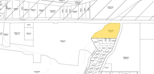
6710 Arapahoe Rd
1463351-00-005
Tr South Central Nbr 145 820
Religious
TR 2313 LESS LETTERS 35-1N-70 PER DEED 1030483 3/1/90 BCR & LESS CDOT ROW PER 3145031-2 4/20/11 FULLY EXEMPT PER DPT 07-01949-01 TOTAL 5.165 ACS M/L PER LS-19-0232
X
Boulder
08013C0414L
Colorado
0
5.16 AC
2025
Boulder
012710
Denver
4,255 SF
Boulder, CO
DEMOGRAPHICS near 6710 Arapahoe Rd
1 Mile
3 Mile
5 Mile
2024 Total Population
1,025
24,721
146,355
2029 Population
1,010
24,515
145,488
Pop Growth 2024-2029
(1.46%)
(0.83%)
(0.59%)
Average Age
47
42
38
2024 Total Households
412
10,788
59,668
HH Growth 2024-2029
(1.46%)
(0.88%)
(0.56%)
Median Household Inc
$141,818
$102,008
$89,105
Avg Household Size
2.40
2.20
2.20
2024 Avg HH Vehicles
2.00
2.00
2.00
Median Home Value
$1,052,010
$816,666
$827,861
Median Year Built
1978
1980
1980
Nearby Places
Map Layers
Map Styles
 Street
 Aerial
- Restaurants
- Banks
- Shops
- Fitness
- Groceries
PUBLIC TRANSPORTATION
AIRPORT
Denver International
DRIVE
WALK
Distance
Denver International
48 min
39.5 mi
Freight Ports
Tulsa Port Of Catoosa
DRIVE
WALK
Distance
Tulsa Port Of Catoosa
754 min
728.4 mi
SALE & LEASE HISTORY
LISTING DATE
SALE/LEASE

Aug 25, 2022
For Lease
Nearby Properties
Address
Land Use
TOTAL SIZE
Lot Size
Zoning
Address
Land Use
TOTAL SIZE
Lot Size
Zoning
30.08 AC
Address
Land Use
TOTAL SIZE
Lot Size
Zoning
14.66 AC
Address
Land Use
TOTAL SIZE
Lot Size
Zoning
171.91 AC
Address
Land Use
TOTAL SIZE
Lot Size
Zoning
329,080 SF
16.41 AC
Address
Land Use
TOTAL SIZE
Lot Size
Zoning
244,999 SF
2.24 AC
Address
Land Use
TOTAL SIZE
Lot Size
Zoning
520,605 SF
42.57 AC
C
Address
Land Use
TOTAL SIZE
Lot Size
Zoning
385,761 SF
19.07 AC
Address
Land Use
TOTAL SIZE
Lot Size
Zoning
161,616 SF
8 AC
Address
Land Use
TOTAL SIZE
Lot Size
Zoning
186.43 AC
RR
Address
Land Use
TOTAL SIZE
Lot Size
Zoning
25.41 AC
GI
Address
Land Use
TOTAL SIZE
Lot Size
Zoning
38.79 AC
RR
Address
Land Use
TOTAL SIZE
Lot Size
Zoning
48.98 AC
A
Address
Land Use
TOTAL SIZE
Lot Size
Zoning
69.99 AC
ER
Address
Land Use
TOTAL SIZE
Lot Size
Zoning
161,761 SF
4.79 AC
Address
Land Use
TOTAL SIZE
Lot Size
Zoning
161,711 SF
20.40 AC
MH
Address
Land Use
TOTAL SIZE
Lot Size
Zoning
27.92 AC
RR
Address
Land Use
TOTAL SIZE
Lot Size
Zoning
107.63 AC
A
Address
Land Use
TOTAL SIZE
Lot Size
Zoning
29.20 AC
RR
Address
Land Use
TOTAL SIZE
Lot Size
Zoning
234,050 SF
30.93 AC
Address
Land Use
TOTAL SIZE
Lot Size
Zoning
1,008 SF
16.27 AC
Address
Land Use
TOTAL SIZE
Lot Size
Zoning
103,400 SF
21.82 AC
Address
Land Use
TOTAL SIZE
Lot Size
Zoning
1,002 SF
16.71 AC
Address
Land Use
TOTAL SIZE
Lot Size
Zoning
165.77 AC
A
Address
Land Use
TOTAL SIZE
Lot Size
Zoning
117,336 SF
4.61 AC
Address
Land Use
TOTAL SIZE
Lot Size
Zoning
86.39 AC
Address
Land Use
TOTAL SIZE
Lot Size
Zoning
148,711 SF
6.65 AC
Address
Land Use
TOTAL SIZE
Lot Size
Zoning
42.12 AC
ER
Address
Land Use
TOTAL SIZE
Lot Size
Zoning
86.70 AC
A
Address
Land Use
TOTAL SIZE
Lot Size
Zoning
176,033 SF
15.23 AC
Address
Land Use
TOTAL SIZE
Lot Size
Zoning
20.51 AC
GI
The World's #1 Commercial Real Estate Marketplace
Connect with us
© 2026 CoStar Group
The information above has been obtained from sources believed reliable. While we do not doubt its accuracy we have not verified it and make no guarantee, warranty or representation about it. It is your responsibility to independently confirm its accuracy and completeness. Any projections, opinions, assumptions, or estimates used are for example only and do not represent the current or future performance of the property. The value of this transaction to you depends on tax and other factors which should be evaluated by your tax, financial, and legal advisors. You and your advisors should conduct a careful, independent investigation of the property to determine to your satisfaction the suitability of the property for your needs.