Property Record
6710 E William Cannon Dr, Austin, TX 78744
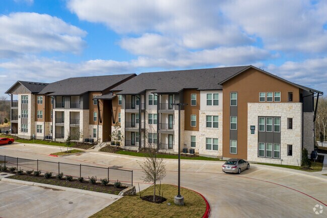
Property Detail
6710 E William Cannon Dr
Austin-Round Rock-San Marcos, TX
LOT 1 BLK A SPRINGFIELD MULTIFAMILY AMD
298099
TRAVIS
Vacantlandnec
Texas
AE The base floodplain where base flood elevations are provided. AE Zones are now used on new format FIRMs instead of A1-A30 Zones.
1
2025
4.67 AC
2025
Southeast Austin
002430
Austin
NEARBY LISTINGS FOR SALE OR LEASE
-
-
View all Austin listings for sale on LoopNet.com
DEMOGRAPHICS near 6710 E William Cannon Dr
1 mile
3 mile
5 mile
2025 Total Population
8,436
66,839
191,166
2030 Population
9,052
70,790
201,815
Pop Growth 2025-2030
+ 7.30%
+ 5.91%
+ 5.57%
Average Age
36
35
36
2025 Total Households
2,806
23,073
77,601
HH Growth 2025-2030
+ 8.45%
+ 6.84%
+ 6.25%
Median Household Inc
$110,025
$81,138
$77,905
Avg Household Size
2.90
2.80
2.30
2025 Avg HH Vehicles
2.00
2.00
2.00
Median Home Value
$450,164
$411,814
$441,881
Median Year Built
2010
2008
2003
Nearby Places
Map Layers
Map Styles
 Street
 Aerial
Transit
 Traffic
 Biking
Places
Listings with unknown addresses are not visible on the map
- Restaurants
- Banks
- Shops
- Fitness
- Groceries
PUBLIC TRANSPORTATION
AIRPORT
Austin-Bergstrom International
Drive
Walk
Distance
Austin-Bergstrom International
17 min
7.6 mi
Freight Ports
Calhoun Port
Drive
Walk
Distance
Calhoun Port
178 min
146.9 mi
Nearby Properties
Address
Land Use
TOTAL SIZE
Lot Size
Zoning
Address
Land Use
TOTAL SIZE
Lot Size
Zoning
454,740 SF
27.77 AC
Address
Land Use
TOTAL SIZE
Lot Size
Zoning
290,643 SF
13.59 AC
Address
Land Use
TOTAL SIZE
Lot Size
Zoning
335,913 SF
13.83 AC
Address
Land Use
TOTAL SIZE
Lot Size
Zoning
390,384 SF
34.08 AC
Address
Land Use
TOTAL SIZE
Lot Size
Zoning
287,925 SF
9.92 AC
Address
Land Use
TOTAL SIZE
Lot Size
Zoning
314,325 SF
29.53 AC
Address
Land Use
TOTAL SIZE
Lot Size
Zoning
288,174 SF
18.91 AC
Address
Land Use
TOTAL SIZE
Lot Size
Zoning
333,746 SF
53.90 AC
Address
Land Use
TOTAL SIZE
Lot Size
Zoning
422,500 SF
30.52 AC
Address
Land Use
TOTAL SIZE
Lot Size
Zoning
323,360 SF
20.93 AC
Address
Land Use
TOTAL SIZE
Lot Size
Zoning
318,962 SF
31.88 AC
Address
Land Use
TOTAL SIZE
Lot Size
Zoning
239,376 SF
30.04 AC
Address
Land Use
TOTAL SIZE
Lot Size
Zoning
352,450 SF
20.88 AC
Address
Land Use
TOTAL SIZE
Lot Size
Zoning
326,400 SF
26.12 AC
Address
Land Use
TOTAL SIZE
Lot Size
Zoning
292,257 SF
33.21 AC
Address
Land Use
TOTAL SIZE
Lot Size
Zoning
350,171 SF
26.64 AC
Address
Land Use
TOTAL SIZE
Lot Size
Zoning
244,830 SF
27.43 AC
Address
Land Use
TOTAL SIZE
Lot Size
Zoning
351,255 SF
12.45 AC
Address
Land Use
TOTAL SIZE
Lot Size
Zoning
242,550 SF
13.02 AC
Address
Land Use
TOTAL SIZE
Lot Size
Zoning
237,600 SF
17.79 AC
Address
Land Use
TOTAL SIZE
Lot Size
Zoning
249,216 SF
20.19 AC
Address
Land Use
TOTAL SIZE
Lot Size
Zoning
272,824 SF
15.83 AC
Address
Land Use
TOTAL SIZE
Lot Size
Zoning
267,300 SF
17.53 AC
Address
Land Use
TOTAL SIZE
Lot Size
Zoning
287,740 SF
14.87 AC
Address
Land Use
TOTAL SIZE
Lot Size
Zoning
323,659 SF
12.03 AC
Address
Land Use
TOTAL SIZE
Lot Size
Zoning
248,784 SF
10.55 AC
Address
Land Use
TOTAL SIZE
Lot Size
Zoning
264,765 SF
23.37 AC
Address
Land Use
TOTAL SIZE
Lot Size
Zoning
4,111 SF
90.12 AC
Address
Land Use
TOTAL SIZE
Lot Size
Zoning
285,616 SF
10.81 AC
Address
Land Use
TOTAL SIZE
Lot Size
Zoning
177,375 SF
26.20 AC
The World's #1 Commercial Real Estate Marketplace
Connect with us
© 2026 CoStar Group
The information above has been obtained from sources believed reliable. While we do not doubt its accuracy we have not verified it and make no guarantee, warranty or representation about it. It is your responsibility to independently confirm its accuracy and completeness. Any projections, opinions, assumptions, or estimates used are for example only and do not represent the current or future performance of the property. The value of this transaction to you depends on tax and other factors which should be evaluated by your tax, financial, and legal advisors. You and your advisors should conduct a careful, independent investigation of the property to determine to your satisfaction the suitability of the property for your needs.