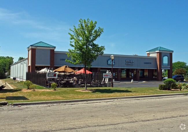
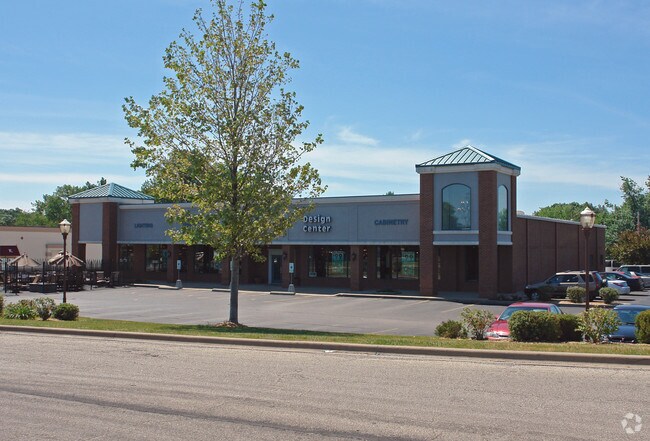
Property Record
6710 N Big Hollow Rd, Peoria, IL 61615
NEARBY LISTINGS FOR SALE OR LEASE
Property Detail
6710 N Big Hollow Rd
Peoria, IL
SW 1/4 SEC 12-9-7E 1.45 AC BEG 1479.2 W OF SE COR SW 1/4 SEC 12: TH W 169.83 NW ALG E LN BIG HOLLOW RD 185.14 & 37.04 E 139.37 SE 73.17 S 310.23 TO
13-12-354-006
Peoria
Commercialnec
Illinois
2024
1.45 AC
2024
South Peoria
003101
Peoria
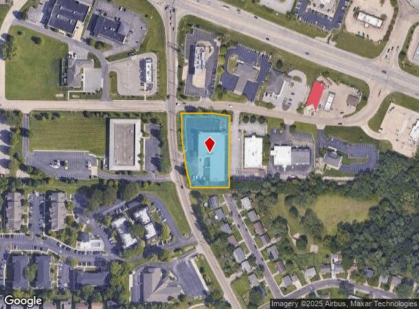
DEMOGRAPHICS near 6710 N Big Hollow Rd
1 Mile
3 Mile
5 Mile
2024 Total Population
6,432
35,372
86,033
2029 Population
6,216
34,371
83,584
Pop Growth 2024-2029
(3.36%)
(2.83%)
(2.85%)
Average Age
40
41
40
2024 Total Households
2,835
15,767
37,074
HH Growth 2024-2029
(3.60%)
(2.96%)
(3.02%)
Median Household Inc
$63,023
$62,549
$61,155
Avg Household Size
2.20
2.10
2.20
2024 Avg HH Vehicles
2.00
2.00
2.00
Median Home Value
$164,461
$164,568
$155,055
Median Year Built
1977
1976
1971
Nearby Places
Map Layers
Map Styles
 Street
 Aerial
- Restaurants
- Banks
- Shops
- Fitness
- Groceries
PUBLIC TRANSPORTATION
AIRPORT
General Downing - Peoria International
DRIVE
WALK
Distance
General Downing - Peoria International
16 min
10.7 mi
Freight Ports
Port Milwaukee
DRIVE
WALK
Distance
Port Milwaukee
264 min
222.8 mi
Nearby Properties
Address
Land Use
TOTAL SIZE
Lot Size
Zoning
Address
Land Use
TOTAL SIZE
Lot Size
Zoning
7.75 AC
Address
Land Use
TOTAL SIZE
Lot Size
Zoning
47.89 AC
Address
Land Use
TOTAL SIZE
Lot Size
Zoning
8.17 AC
Address
Land Use
TOTAL SIZE
Lot Size
Zoning
20.08 AC
Address
Land Use
TOTAL SIZE
Lot Size
Zoning
22.10 AC
Address
Land Use
TOTAL SIZE
Lot Size
Zoning
28.05 AC
Address
Land Use
TOTAL SIZE
Lot Size
Zoning
17.65 AC
Address
Land Use
TOTAL SIZE
Lot Size
Zoning
6.05 AC
Address
Land Use
TOTAL SIZE
Lot Size
Zoning
12.22 AC
Address
Land Use
TOTAL SIZE
Lot Size
Zoning
18.07 AC
Address
Land Use
TOTAL SIZE
Lot Size
Zoning
21.78 AC
Address
Land Use
TOTAL SIZE
Lot Size
Zoning
20.51 AC
Address
Land Use
TOTAL SIZE
Lot Size
Zoning
10.41 AC
Address
Land Use
TOTAL SIZE
Lot Size
Zoning
43.09 AC
Address
Land Use
TOTAL SIZE
Lot Size
Zoning
7.02 AC
Address
Land Use
TOTAL SIZE
Lot Size
Zoning
Address
Land Use
TOTAL SIZE
Lot Size
Zoning
17.21 AC
Address
Land Use
TOTAL SIZE
Lot Size
Zoning
17.08 AC
Address
Land Use
TOTAL SIZE
Lot Size
Zoning
8.74 AC
Address
Land Use
TOTAL SIZE
Lot Size
Zoning
Address
Land Use
TOTAL SIZE
Lot Size
Zoning
16.70 AC
Address
Land Use
TOTAL SIZE
Lot Size
Zoning
Address
Land Use
TOTAL SIZE
Lot Size
Zoning
20.51 AC
Address
Land Use
TOTAL SIZE
Lot Size
Zoning
26.61 AC
Address
Land Use
TOTAL SIZE
Lot Size
Zoning
2.42 AC
Address
Land Use
TOTAL SIZE
Lot Size
Zoning
14.34 AC
Address
Land Use
TOTAL SIZE
Lot Size
Zoning
Address
Land Use
TOTAL SIZE
Lot Size
Zoning
19.50 AC
Address
Land Use
TOTAL SIZE
Lot Size
Zoning
16.70 AC
Address
Land Use
TOTAL SIZE
Lot Size
Zoning
7.31 AC
The World's #1 Commercial Real Estate Marketplace
Connect with us
© 2025 CoStar Group
The information above has been obtained from sources believed reliable. While we do not doubt its accuracy we have not verified it and make no guarantee, warranty or representation about it. It is your responsibility to independently confirm its accuracy and completeness. Any projections, opinions, assumptions, or estimates used are for example only and do not represent the current or future performance of the property. The value of this transaction to you depends on tax and other factors which should be evaluated by your tax, financial, and legal advisors. You and your advisors should conduct a careful, independent investigation of the property to determine to your satisfaction the suitability of the property for your needs.