Property Record
6710 N Catlin Ave, Portland, OR 97203
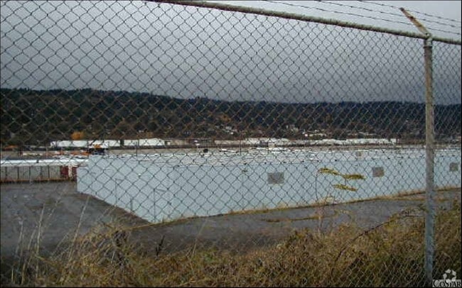

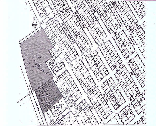
Property Detail
6710 N Catlin Ave
R125061
BYARS ADD, BLOCK 3&6 TL 17600, LAND & IMPS SEE R567946 (R123400441) FOR OTHER IMPS & R646106 (R123400442) FOR MACH & EQUIP
Industrialgeneral
Multnomah
IG2
Oregon
B and X Area of moderate flood hazard, usually the area between the limits of the 100-year and 500-year floods.
4-15
2025
4.33 AC
2025
Rivergate
004200
Portland
62,450 SF
Portland-Vancouver-Hillsboro, OR-WA
NEARBY LISTINGS FOR SALE OR LEASE
DEMOGRAPHICS near 6710 N Catlin Ave
1 mile
3 mile
5 mile
2025 Total Population
9,285
34,506
126,709
2030 Population
9,130
33,980
127,396
Pop Growth 2025-2030
(1.67%)
(1.52%)
+ 0.54%
Average Age
39
37
39
2025 Total Households
4,238
12,974
48,807
HH Growth 2025-2030
(1.70%)
(1.85%)
+ 0.51%
Median Household Inc
$73,532
$82,168
$119,008
Avg Household Size
2.10
2.40
2.50
2025 Avg HH Vehicles
2.00
2.00
2.00
Median Home Value
$470,372
$486,971
$683,985
Median Year Built
1970
1963
1988
Nearby Places
Map Layers
Map Styles
 Street
 Aerial
Transit
 Traffic
 Biking
Places
Listings with unknown addresses are not visible on the map
- Restaurants
- Banks
- Shops
- Fitness
- Groceries
PUBLIC TRANSPORTATION
COMMUTER RAIL
Drive
Walk
Distance
18 min
7.7 mi
Drive
Walk
Distance
20 min
8.2 mi
AIRPORT
Portland International
Drive
Walk
Distance
Portland International
28 min
11.7 mi
Freight Ports
Port of Portland
Drive
Walk
Distance
Port of Portland
12 min
5.6 mi
Nearby Properties
Address
Land Use
TOTAL SIZE
Lot Size
Zoning
Address
Land Use
TOTAL SIZE
Lot Size
Zoning
200,109 SF
70.44 AC
IH
Address
Land Use
TOTAL SIZE
Lot Size
Zoning
882,480 SF
80.73 AC
CI1
Address
Land Use
TOTAL SIZE
Lot Size
Zoning
890,408 SF
22.48 AC
IH
Address
Land Use
TOTAL SIZE
Lot Size
Zoning
Address
Land Use
TOTAL SIZE
Lot Size
Zoning
262,045 SF
17.10 AC
R5
Address
Land Use
TOTAL SIZE
Lot Size
Zoning
Address
Land Use
TOTAL SIZE
Lot Size
Zoning
Address
Land Use
TOTAL SIZE
Lot Size
Zoning
335.31 AC
OS
Address
Land Use
TOTAL SIZE
Lot Size
Zoning
191,506 SF
10.43 AC
IH
Address
Land Use
TOTAL SIZE
Lot Size
Zoning
918,400 SF
48.13 AC
IH
Address
Land Use
TOTAL SIZE
Lot Size
Zoning
75.20 AC
IH
Address
Land Use
TOTAL SIZE
Lot Size
Zoning
318,562 SF
33.59 AC
CI1
Address
Land Use
TOTAL SIZE
Lot Size
Zoning
Address
Land Use
TOTAL SIZE
Lot Size
Zoning
100 SF
82.93 AC
IH
Address
Land Use
TOTAL SIZE
Lot Size
Zoning
73,657 SF
1.90 AC
CI1
Address
Land Use
TOTAL SIZE
Lot Size
Zoning
963,658 SF
64.43 AC
IH
Address
Land Use
TOTAL SIZE
Lot Size
Zoning
37,770 SF
6.90 AC
EG2
Address
Land Use
TOTAL SIZE
Lot Size
Zoning
Address
Land Use
TOTAL SIZE
Lot Size
Zoning
Address
Land Use
TOTAL SIZE
Lot Size
Zoning
Address
Land Use
TOTAL SIZE
Lot Size
Zoning
200 SF
50.40 AC
IH
Address
Land Use
TOTAL SIZE
Lot Size
Zoning
523,196 SF
21.97 AC
IHH
Address
Land Use
TOTAL SIZE
Lot Size
Zoning
Address
Land Use
TOTAL SIZE
Lot Size
Zoning
425,395 SF
16.65 AC
IHH
Address
Land Use
TOTAL SIZE
Lot Size
Zoning
309,393 SF
14.87 AC
IH
Address
Land Use
TOTAL SIZE
Lot Size
Zoning
459,662 SF
19.41 AC
IHH
Address
Land Use
TOTAL SIZE
Lot Size
Zoning
385,275 SF
25.29 AC
IH
Address
Land Use
TOTAL SIZE
Lot Size
Zoning
24.90 AC
IG2
Address
Land Use
TOTAL SIZE
Lot Size
Zoning
573,020 SF
27.30 AC
IH
Address
Land Use
TOTAL SIZE
Lot Size
Zoning
96,513 SF
1.74 AC
CI1
The World's #1 Commercial Real Estate Marketplace
Connect with us
© 2026 CoStar Group
The information above has been obtained from sources believed reliable. While we do not doubt its accuracy we have not verified it and make no guarantee, warranty or representation about it. It is your responsibility to independently confirm its accuracy and completeness. Any projections, opinions, assumptions, or estimates used are for example only and do not represent the current or future performance of the property. The value of this transaction to you depends on tax and other factors which should be evaluated by your tax, financial, and legal advisors. You and your advisors should conduct a careful, independent investigation of the property to determine to your satisfaction the suitability of the property for your needs.