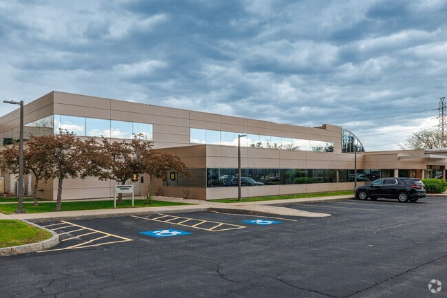
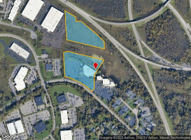
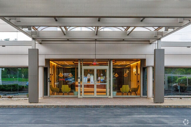
Property Record
6711 Towpath Rd, East Syracuse, NY 13057
NEARBY LISTINGS FOR SALE OR LEASE
Property Detail
6711 Towpath Rd
312689-053-000-0002-002-001-0000
FL 51
Officebuilding
Onondaga
X
New York
36067C0241F
2.001
2025
12.94 AC
2024
SE Outer Onondaga County
014600
Syracuse
63,692 SF
Syracuse, NY
DEMOGRAPHICS near 6711 Towpath Rd
1 Mile
3 Mile
5 Mile
2024 Total Population
1,448
48,312
142,944
2029 Population
1,426
47,181
139,726
Pop Growth 2024-2029
(1.52%)
(2.34%)
(2.25%)
Average Age
40
42
39
2024 Total Households
604
20,502
58,341
HH Growth 2024-2029
(1.49%)
(2.47%)
(2.28%)
Median Household Inc
$66,355
$68,690
$53,666
Avg Household Size
2.20
2.20
2.20
2024 Avg HH Vehicles
2.00
2.00
1.00
Median Home Value
$170,277
$170,798
$169,991
Median Year Built
1963
1957
1955
Nearby Places
Map Layers
Map Styles
 Street
 Aerial
- Restaurants
- Banks
- Shops
- Fitness
- Groceries
PUBLIC TRANSPORTATION
COMMUTER RAIL
Syracuse Regional Transportation Center (Empire Service - Amtrak, Lake Shore Limited - Amtrak, Maple Leaf - Amtrak)
DRIVE
WALK
Distance
Syracuse Regional Transportation Center (Empire Service - Amtrak, Lake Shore Limited - Amtrak, Maple Leaf - Amtrak)
13 min
7.6 mi
Syracuse (Toronto - New York - VIA Rail)
DRIVE
WALK
Distance
Syracuse (Toronto - New York - VIA Rail)
14 min
7.6 mi
AIRPORT
Syracuse Hancock International
DRIVE
WALK
Distance
Syracuse Hancock International
20 min
12.2 mi
Freight Ports
Albany, NY Port
DRIVE
WALK
Distance
Albany, NY Port
172 min
143.4 mi
SALE & LEASE HISTORY
LISTING DATE
SALE/LEASE

Oct 01, 2019
For Lease
Jul 05, 2022
For Lease
Nearby Properties
Address
Land Use
TOTAL SIZE
Lot Size
Zoning
Address
Land Use
TOTAL SIZE
Lot Size
Zoning
38,693 SF
102.34 AC
05 - COMME
Address
Land Use
TOTAL SIZE
Lot Size
Zoning
175,424 SF
7.85 AC
RA
Address
Land Use
TOTAL SIZE
Lot Size
Zoning
569,463 SF
94.77 AC
06 - INDUS
Address
Land Use
TOTAL SIZE
Lot Size
Zoning
12,836 SF
148.95 AC
06 - INDUS
Address
Land Use
TOTAL SIZE
Lot Size
Zoning
876,645 SF
51.07 AC
05 - COMME
Address
Land Use
TOTAL SIZE
Lot Size
Zoning
217,709 SF
34.53 AC
01 - NOT Z
Address
Land Use
TOTAL SIZE
Lot Size
Zoning
174,750 SF
10.40 AC
06 - INDUS
Address
Land Use
TOTAL SIZE
Lot Size
Zoning
104,400 SF
12.84 AC
06 - INDUS
Address
Land Use
TOTAL SIZE
Lot Size
Zoning
17,388 SF
26.51 AC
07 - MIXED
Address
Land Use
TOTAL SIZE
Lot Size
Zoning
157,497 SF
14.56 AC
06 - INDUS
Address
Land Use
TOTAL SIZE
Lot Size
Zoning
240,800 SF
23.01 AC
05 - COMME
Address
Land Use
TOTAL SIZE
Lot Size
Zoning
145,588 SF
75.45 AC
RA
Address
Land Use
TOTAL SIZE
Lot Size
Zoning
163,518 SF
19.24 AC
07 - MIXED
Address
Land Use
TOTAL SIZE
Lot Size
Zoning
47,122 SF
42.77 AC
06 - INDUS
Address
Land Use
TOTAL SIZE
Lot Size
Zoning
141,151 SF
20.23 AC
06 - INDUS
Address
Land Use
TOTAL SIZE
Lot Size
Zoning
102,883 SF
23.29 AC
02 - SINGL
Address
Land Use
TOTAL SIZE
Lot Size
Zoning
115,150 SF
13.32 AC
RS
Address
Land Use
TOTAL SIZE
Lot Size
Zoning
95.24 AC
05 - COMME
Address
Land Use
TOTAL SIZE
Lot Size
Zoning
160,767 SF
20.52 AC
05 - COMME
Address
Land Use
TOTAL SIZE
Lot Size
Zoning
110,976 SF
42.31 AC
06 - INDUS
Address
Land Use
TOTAL SIZE
Lot Size
Zoning
165,954 SF
10.66 AC
06 - INDUS
Address
Land Use
TOTAL SIZE
Lot Size
Zoning
150,216 SF
50.42 AC
RA
Address
Land Use
TOTAL SIZE
Lot Size
Zoning
38,595 SF
0.67 AC
06 - INDUS
Address
Land Use
TOTAL SIZE
Lot Size
Zoning
21,882 SF
13.56 AC
05 - COMME
Address
Land Use
TOTAL SIZE
Lot Size
Zoning
110,811 SF
11.46 AC
06 - INDUS
Address
Land Use
TOTAL SIZE
Lot Size
Zoning
78,950 SF
14.52 AC
NS
Address
Land Use
TOTAL SIZE
Lot Size
Zoning
122,122 SF
10.03 AC
05 - COMME
Address
Land Use
TOTAL SIZE
Lot Size
Zoning
116,224 SF
13.08 AC
05 - COMME
Address
Land Use
TOTAL SIZE
Lot Size
Zoning
24.71 AC
RA
Address
Land Use
TOTAL SIZE
Lot Size
Zoning
207,675 SF
8.23 AC
02 - SINGL
The World's #1 Commercial Real Estate Marketplace
Connect with us
© 2026 CoStar Group
The information above has been obtained from sources believed reliable. While we do not doubt its accuracy we have not verified it and make no guarantee, warranty or representation about it. It is your responsibility to independently confirm its accuracy and completeness. Any projections, opinions, assumptions, or estimates used are for example only and do not represent the current or future performance of the property. The value of this transaction to you depends on tax and other factors which should be evaluated by your tax, financial, and legal advisors. You and your advisors should conduct a careful, independent investigation of the property to determine to your satisfaction the suitability of the property for your needs.