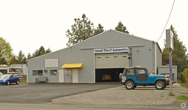
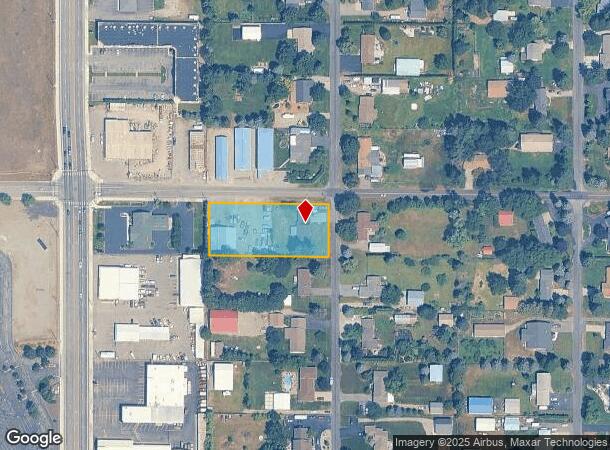
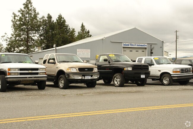
Property Record
6719 N Rude St, Dalton Gardens, ID 83815
NEARBY LISTINGS FOR SALE OR LEASE
Property Detail
6719 N Rude St
Coeur d'Alene, ID
Rude 3Rd Add
D70000010010
RUDE 3RD ADD, LT 1 BLOCK 1 2551N04W
Multipleuses
Kootenai
X
Idaho
16055C0410E
1
2025
1 AC
2025
Hayden/Dalton Gardens
001100
Coeur D'Alene
3,840 SF
DEMOGRAPHICS near 6719 N Rude St
1 Mile
3 Mile
5 Mile
2024 Total Population
5,496
63,717
92,585
2029 Population
6,446
75,235
109,616
Pop Growth 2024-2029
+ 17.29%
+ 18.08%
+ 18.39%
Average Age
43
41
42
2024 Total Households
2,205
25,363
37,467
HH Growth 2024-2029
+ 16.96%
+ 17.74%
+ 18.05%
Median Household Inc
$76,417
$64,679
$65,138
Avg Household Size
2.40
2.40
2.40
2024 Avg HH Vehicles
2.00
2.00
2.00
Median Home Value
$438,271
$424,669
$451,787
Median Year Built
1996
1996
1994
Nearby Places
Map Layers
Map Styles
 Street
 Aerial
- Restaurants
- Banks
- Shops
- Fitness
- Groceries
Nearby Properties
Address
Land Use
TOTAL SIZE
Lot Size
Zoning
Address
Land Use
TOTAL SIZE
Lot Size
Zoning
411,826 SF
15.25 AC
Address
Land Use
TOTAL SIZE
Lot Size
Zoning
103,560 SF
17.30 AC
Address
Land Use
TOTAL SIZE
Lot Size
Zoning
103,531 SF
13.75 AC
COM
Address
Land Use
TOTAL SIZE
Lot Size
Zoning
214,479 SF
36.82 AC
Address
Land Use
TOTAL SIZE
Lot Size
Zoning
231,330 SF
14.55 AC
Address
Land Use
TOTAL SIZE
Lot Size
Zoning
931 SF
16.15 AC
Address
Land Use
TOTAL SIZE
Lot Size
Zoning
138,614 SF
12.25 AC
Address
Land Use
TOTAL SIZE
Lot Size
Zoning
67,668 SF
3.63 AC
Address
Land Use
TOTAL SIZE
Lot Size
Zoning
105,390 SF
6.78 AC
Address
Land Use
TOTAL SIZE
Lot Size
Zoning
230,083 SF
38.41 AC
COM
Address
Land Use
TOTAL SIZE
Lot Size
Zoning
96,132 SF
8.13 AC
Address
Land Use
TOTAL SIZE
Lot Size
Zoning
144,970 SF
11.39 AC
Address
Land Use
TOTAL SIZE
Lot Size
Zoning
154,743 SF
14.27 AC
Address
Land Use
TOTAL SIZE
Lot Size
Zoning
104,752 SF
3.75 AC
Address
Land Use
TOTAL SIZE
Lot Size
Zoning
208,980 SF
18.77 AC
Address
Land Use
TOTAL SIZE
Lot Size
Zoning
66,856 SF
10.75 AC
Address
Land Use
TOTAL SIZE
Lot Size
Zoning
62,840 SF
8.20 AC
Address
Land Use
TOTAL SIZE
Lot Size
Zoning
167,143 SF
15.32 AC
Address
Land Use
TOTAL SIZE
Lot Size
Zoning
227,906 SF
16.45 AC
Address
Land Use
TOTAL SIZE
Lot Size
Zoning
33,300 SF
85.77 AC
COM
Address
Land Use
TOTAL SIZE
Lot Size
Zoning
65,187 SF
3.84 AC
COM
Address
Land Use
TOTAL SIZE
Lot Size
Zoning
52,139 SF
26.19 AC
Address
Land Use
TOTAL SIZE
Lot Size
Zoning
49,294 SF
4.66 AC
COM
Address
Land Use
TOTAL SIZE
Lot Size
Zoning
98,397 SF
4.70 AC
Address
Land Use
TOTAL SIZE
Lot Size
Zoning
99,645 SF
24 AC
Address
Land Use
TOTAL SIZE
Lot Size
Zoning
115,041 SF
4 AC
Address
Land Use
TOTAL SIZE
Lot Size
Zoning
104,769 SF
19.70 AC
Address
Land Use
TOTAL SIZE
Lot Size
Zoning
139,184 SF
13.21 AC
Address
Land Use
TOTAL SIZE
Lot Size
Zoning
291,260 SF
3.15 AC
Address
Land Use
TOTAL SIZE
Lot Size
Zoning
75,694 SF
3.68 AC
The World's #1 Commercial Real Estate Marketplace
Connect with us
© 2025 CoStar Group
The information above has been obtained from sources believed reliable. While we do not doubt its accuracy we have not verified it and make no guarantee, warranty or representation about it. It is your responsibility to independently confirm its accuracy and completeness. Any projections, opinions, assumptions, or estimates used are for example only and do not represent the current or future performance of the property. The value of this transaction to you depends on tax and other factors which should be evaluated by your tax, financial, and legal advisors. You and your advisors should conduct a careful, independent investigation of the property to determine to your satisfaction the suitability of the property for your needs.