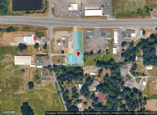
Property Record
6719 Ne 219Th St, Battle Ground, WA 98604

NEARBY LISTINGS FOR SALE OR LEASE
-
-
View all Battle Ground listings for sale on LoopNet.com
Property Detail
6719 Ne 219Th St
193112-000
#83 SEC 6 T3N R2EWM 1.12A FOR ASSESSOR USE ONLY E 100 FT & E 80 FT OF W 230 FT OF S 140 FT OF FOLL: THT PTN NEQ SEC 6-3-2E DAF: BAAP THT IS 2153.25 FT N & 990 FT W OF SE COR OF NEQ SD SEC SD PT BG SE COR OF WEINMAN TT PER F179 31 BK 348 PG 424 TH W 3
Auditorium
Clark
X
Washington
53011C0238D
1.12 AC
2025
Clark County Outlying
2025
Portland
040403
Portland-Vancouver-Hillsboro, OR-WA
8,204 SF
DEMOGRAPHICS near 6719 Ne 219Th St
1 Mile
3 Mile
5 Mile
2024 Total Population
880
19,073
62,364
2029 Population
958
20,636
67,709
Pop Growth 2024-2029
+ 8.86%
+ 8.19%
+ 8.57%
Average Age
42
40
41
2024 Total Households
293
6,337
22,042
HH Growth 2024-2029
+ 8.87%
+ 8.30%
+ 8.78%
Median Household Inc
$107,065
$102,710
$100,661
Avg Household Size
3.00
3.00
2.80
2024 Avg HH Vehicles
3.00
3.00
2.00
Median Home Value
$702,830
$486,016
$535,966
Median Year Built
1992
2000
1997
Nearby Places
Map Layers
Map Styles
 Street
 Aerial
- Restaurants
- Banks
- Shops
- Fitness
- Groceries
PUBLIC TRANSPORTATION
AIRPORT
Portland International
DRIVE
WALK
Distance
Portland International
29 min
18.3 mi
Freight Ports
Port of Vancouver
DRIVE
WALK
Distance
Port of Vancouver
26 min
15.4 mi
Nearby Properties
Address
Land Use
TOTAL SIZE
Lot Size
Zoning
Address
Land Use
TOTAL SIZE
Lot Size
Zoning
173,174 SF
7.18 AC
OR-22
Address
Land Use
TOTAL SIZE
Lot Size
Zoning
196,625 SF
2.05 AC
MU-R
Address
Land Use
TOTAL SIZE
Lot Size
Zoning
166,003 SF
15.45 AC
RC
Address
Land Use
TOTAL SIZE
Lot Size
Zoning
114,689 SF
19.39 AC
RC
Address
Land Use
TOTAL SIZE
Lot Size
Zoning
129,044 SF
18.81 AC
R7
Address
Land Use
TOTAL SIZE
Lot Size
Zoning
150,874 SF
15.65 AC
RC
Address
Land Use
TOTAL SIZE
Lot Size
Zoning
84,614 SF
10 AC
RC
Address
Land Use
TOTAL SIZE
Lot Size
Zoning
47,476 SF
4.15 AC
RC
Address
Land Use
TOTAL SIZE
Lot Size
Zoning
138,825 SF
5.92 AC
OR-22
Address
Land Use
TOTAL SIZE
Lot Size
Zoning
136,286 SF
5 AC
RC
Address
Land Use
TOTAL SIZE
Lot Size
Zoning
69,785 SF
4.32 AC
RC
Address
Land Use
TOTAL SIZE
Lot Size
Zoning
42,162 SF
4.28 AC
RC
Address
Land Use
TOTAL SIZE
Lot Size
Zoning
39,320 SF
8.59 AC
RC
Address
Land Use
TOTAL SIZE
Lot Size
Zoning
76,626 SF
4.69 AC
RC-1
Address
Land Use
TOTAL SIZE
Lot Size
Zoning
60,996 SF
1.83 AC
R10
Address
Land Use
TOTAL SIZE
Lot Size
Zoning
48,930 SF
3.16 AC
R10
Address
Land Use
TOTAL SIZE
Lot Size
Zoning
32,553 SF
11.84 AC
BP
Address
Land Use
TOTAL SIZE
Lot Size
Zoning
107,826 SF
1.98 AC
R1-20
Address
Land Use
TOTAL SIZE
Lot Size
Zoning
23,598 SF
12.24 AC
R1-20
Address
Land Use
TOTAL SIZE
Lot Size
Zoning
103,329 SF
2.71 AC
RC
Address
Land Use
TOTAL SIZE
Lot Size
Zoning
44.87 AC
R1-20
Address
Land Use
TOTAL SIZE
Lot Size
Zoning
27,458 SF
2.75 AC
RC
Address
Land Use
TOTAL SIZE
Lot Size
Zoning
25,675 SF
1.93 AC
RC
Address
Land Use
TOTAL SIZE
Lot Size
Zoning
37,998 SF
2.50 AC
R16
Address
Land Use
TOTAL SIZE
Lot Size
Zoning
57,220 SF
4.73 AC
RC
Address
Land Use
TOTAL SIZE
Lot Size
Zoning
24,195 SF
5 AC
R-5
Address
Land Use
TOTAL SIZE
Lot Size
Zoning
36,416 SF
5.48 AC
R3
Address
Land Use
TOTAL SIZE
Lot Size
Zoning
28,855 SF
3.49 AC
R7
Address
Land Use
TOTAL SIZE
Lot Size
Zoning
21,442 SF
5 AC
RC
The World's #1 Commercial Real Estate Marketplace
Connect with us
© 2025 CoStar Group
The information above has been obtained from sources believed reliable. While we do not doubt its accuracy we have not verified it and make no guarantee, warranty or representation about it. It is your responsibility to independently confirm its accuracy and completeness. Any projections, opinions, assumptions, or estimates used are for example only and do not represent the current or future performance of the property. The value of this transaction to you depends on tax and other factors which should be evaluated by your tax, financial, and legal advisors. You and your advisors should conduct a careful, independent investigation of the property to determine to your satisfaction the suitability of the property for your needs.