Property Record
672 Long Point Rd, Mount Pleasant, SC 29464

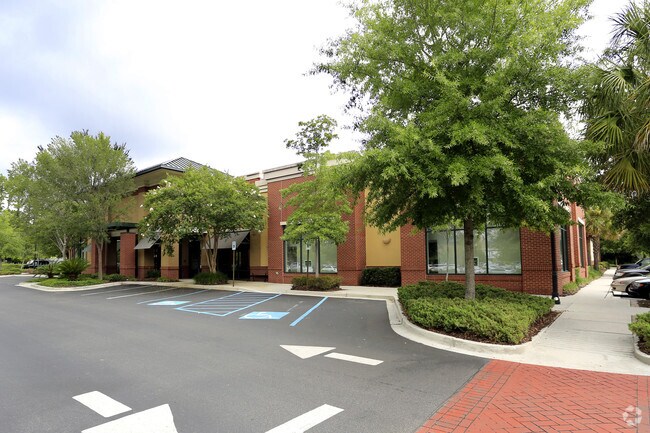
Property Detail
672 Long Point Rd
Charleston-North Charleston, SC
SITE NAME -BELLE HALL SHOPPING CTR
540-00-00-109
Charleston
Marshland
South Carolina
C and X Area of minimal flood hazard, usually depicted on FIRMs as above the 500-year flood level.
0.07 AC
2025
East Islands/Mt Pleasant
2024
Charleston/N Charleston
004612
NEARBY LISTINGS FOR SALE OR LEASE
DEMOGRAPHICS near 672 Long Point Rd
1 mile
3 mile
5 mile
2025 Total Population
6,807
41,213
88,723
2030 Population
6,930
42,371
93,039
Pop Growth 2025-2030
+ 1.81%
+ 2.81%
+ 4.86%
Average Age
41
42
42
2025 Total Households
2,691
17,521
37,303
HH Growth 2025-2030
+ 1.75%
+ 2.88%
+ 5.10%
Median Household Inc
$123,513
$114,944
$118,691
Avg Household Size
2.50
2.30
2.30
2025 Avg HH Vehicles
2.00
2.00
2.00
Median Home Value
$720,717
$744,321
$794,777
Median Year Built
1992
1993
1998
Nearby Places
Map Layers
Map Styles
 Street
 Aerial
Layers
 Traffic
 Biking
Places
Listings with unknown addresses are not visible on the map
- Restaurants
- Banks
- Shops
- Fitness
- Groceries
PUBLIC TRANSPORTATION
AIRPORT
Charleston AFB/International
Drive
Walk
Distance
Charleston AFB/International
26 min
17.1 mi
Freight Ports
Wando Welch Terminal
Drive
Walk
Distance
Wando Welch Terminal
4 min
1.7 mi
SALE & LEASE HISTORY
LISTING DATE
SALE/LEASE

Jun 14, 2017
For Lease
Nearby Properties
Address
Land Use
TOTAL SIZE
Lot Size
Zoning
Address
Land Use
TOTAL SIZE
Lot Size
Zoning
247,883 SF
16.26 AC
Address
Land Use
TOTAL SIZE
Lot Size
Zoning
Address
Land Use
TOTAL SIZE
Lot Size
Zoning
18,316 SF
14.16 AC
Address
Land Use
TOTAL SIZE
Lot Size
Zoning
15,957 SF
3.80 AC
Address
Land Use
TOTAL SIZE
Lot Size
Zoning
3,462 SF
24.85 AC
Address
Land Use
TOTAL SIZE
Lot Size
Zoning
6,572 SF
23.28 AC
Address
Land Use
TOTAL SIZE
Lot Size
Zoning
Address
Land Use
TOTAL SIZE
Lot Size
Zoning
37,472 SF
9.04 AC
Address
Land Use
TOTAL SIZE
Lot Size
Zoning
19,994 SF
2.04 AC
Address
Land Use
TOTAL SIZE
Lot Size
Zoning
1,064 SF
20.39 AC
Address
Land Use
TOTAL SIZE
Lot Size
Zoning
70,052 SF
14.67 AC
Address
Land Use
TOTAL SIZE
Lot Size
Zoning
11.29 AC
Address
Land Use
TOTAL SIZE
Lot Size
Zoning
10,948 SF
1.94 AC
Address
Land Use
TOTAL SIZE
Lot Size
Zoning
10,165 SF
1.38 AC
Address
Land Use
TOTAL SIZE
Lot Size
Zoning
16.96 AC
Address
Land Use
TOTAL SIZE
Lot Size
Zoning
Address
Land Use
TOTAL SIZE
Lot Size
Zoning
Address
Land Use
TOTAL SIZE
Lot Size
Zoning
1,898 SF
11.80 AC
Address
Land Use
TOTAL SIZE
Lot Size
Zoning
648 SF
19.68 AC
Address
Land Use
TOTAL SIZE
Lot Size
Zoning
4,351 SF
29.03 AC
Address
Land Use
TOTAL SIZE
Lot Size
Zoning
63,836 SF
2.76 AC
Address
Land Use
TOTAL SIZE
Lot Size
Zoning
80,395 SF
15.24 AC
Address
Land Use
TOTAL SIZE
Lot Size
Zoning
Address
Land Use
TOTAL SIZE
Lot Size
Zoning
5,884 SF
6.56 AC
Address
Land Use
TOTAL SIZE
Lot Size
Zoning
5,884 SF
8.02 AC
Address
Land Use
TOTAL SIZE
Lot Size
Zoning
10.05 AC
Address
Land Use
TOTAL SIZE
Lot Size
Zoning
8,388 SF
2.01 AC
Address
Land Use
TOTAL SIZE
Lot Size
Zoning
Address
Land Use
TOTAL SIZE
Lot Size
Zoning
Address
Land Use
TOTAL SIZE
Lot Size
Zoning
92,236 SF
14.46 AC
The World's #1 Commercial Real Estate Marketplace
Connect with us
© 2026 CoStar Group
The information above has been obtained from sources believed reliable. While we do not doubt its accuracy we have not verified it and make no guarantee, warranty or representation about it. It is your responsibility to independently confirm its accuracy and completeness. Any projections, opinions, assumptions, or estimates used are for example only and do not represent the current or future performance of the property. The value of this transaction to you depends on tax and other factors which should be evaluated by your tax, financial, and legal advisors. You and your advisors should conduct a careful, independent investigation of the property to determine to your satisfaction the suitability of the property for your needs.