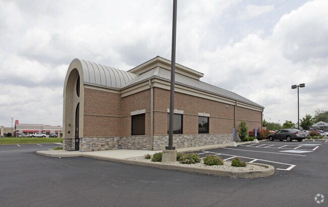
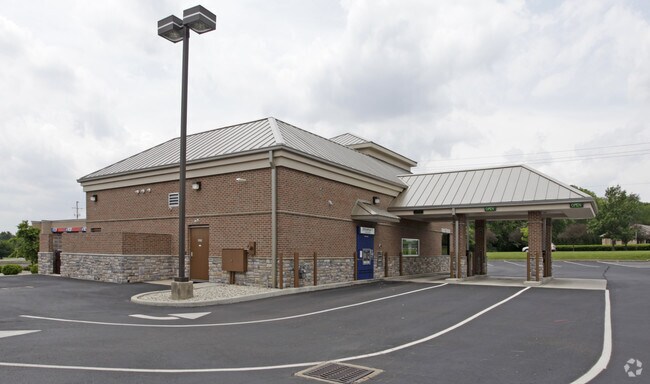
Property Record
6720 Wilmington Pike, Dayton, OH 45459

NEARBY LISTINGS FOR SALE OR LEASE
Property Detail
6720 Wilmington Pike
Dayton, OH
Replat Center Point Plaza
L32-0001-0003-0-0215-00
REPLAT CENTER POINT PLAZA LOT 2A 0.856AC 6270 WILMINGTON PKE
Financialbuilding
Greene
X
Ohio
39113C0288F
2a
2024
0.86 AC
2024
Southeast Dayton
040103
Cincinnati/Dayton
3,344 SF
DEMOGRAPHICS near 6720 Wilmington Pike
1 Mile
3 Mile
5 Mile
2024 Total Population
6,474
50,627
120,440
2029 Population
6,486
50,525
119,601
Pop Growth 2024-2029
+ 0.19%
(0.20%)
(0.70%)
Average Age
43
43
43
2024 Total Households
2,826
21,410
51,492
HH Growth 2024-2029
+ 0.04%
(0.22%)
(0.77%)
Median Household Inc
$110,973
$87,795
$84,878
Avg Household Size
2.30
2.30
2.30
2024 Avg HH Vehicles
2.00
2.00
2.00
Median Home Value
$254,118
$245,905
$236,322
Median Year Built
1985
1975
1973
Nearby Places
Map Layers
Map Styles
 Street
 Aerial
- Restaurants
- Banks
- Shops
- Fitness
- Groceries
PUBLIC TRANSPORTATION
AIRPORT
James M Cox Dayton International
DRIVE
WALK
Distance
James M Cox Dayton International
37 min
22.2 mi
Freight Ports
Port of Toledo
DRIVE
WALK
Distance
Port of Toledo
193 min
162.4 mi
Nearby Properties
Address
Land Use
TOTAL SIZE
Lot Size
Zoning
Address
Land Use
TOTAL SIZE
Lot Size
Zoning
508,366 SF
114.86 AC
Address
Land Use
TOTAL SIZE
Lot Size
Zoning
42.40 AC
Address
Land Use
TOTAL SIZE
Lot Size
Zoning
462,864 SF
38.86 AC
Address
Land Use
TOTAL SIZE
Lot Size
Zoning
191,667 SF
35.98 AC
Address
Land Use
TOTAL SIZE
Lot Size
Zoning
490,354 SF
60 AC
Address
Land Use
TOTAL SIZE
Lot Size
Zoning
59,658 SF
74.94 AC
Address
Land Use
TOTAL SIZE
Lot Size
Zoning
5,461 SF
10.35 AC
Address
Land Use
TOTAL SIZE
Lot Size
Zoning
1,180 SF
23.28 AC
Address
Land Use
TOTAL SIZE
Lot Size
Zoning
203,122 SF
4.63 AC
Address
Land Use
TOTAL SIZE
Lot Size
Zoning
9,233 SF
22.26 AC
Address
Land Use
TOTAL SIZE
Lot Size
Zoning
38,832 SF
30.51 AC
R-PUD 03-7
Address
Land Use
TOTAL SIZE
Lot Size
Zoning
161,615 SF
23.20 AC
Address
Land Use
TOTAL SIZE
Lot Size
Zoning
81,787 SF
45.38 AC
Address
Land Use
TOTAL SIZE
Lot Size
Zoning
198,030 SF
22.32 AC
Address
Land Use
TOTAL SIZE
Lot Size
Zoning
187,824 SF
27.52 AC
Address
Land Use
TOTAL SIZE
Lot Size
Zoning
10.33 AC
Address
Land Use
TOTAL SIZE
Lot Size
Zoning
137,948 SF
4.60 AC
Address
Land Use
TOTAL SIZE
Lot Size
Zoning
70,754 SF
75.48 AC
Address
Land Use
TOTAL SIZE
Lot Size
Zoning
119,701 SF
71.85 AC
Address
Land Use
TOTAL SIZE
Lot Size
Zoning
109,775 SF
1.25 AC
Address
Land Use
TOTAL SIZE
Lot Size
Zoning
24.77 AC
Address
Land Use
TOTAL SIZE
Lot Size
Zoning
9,344 SF
9.08 AC
Address
Land Use
TOTAL SIZE
Lot Size
Zoning
124,197 SF
13.72 AC
Address
Land Use
TOTAL SIZE
Lot Size
Zoning
342,352 SF
20 AC
Address
Land Use
TOTAL SIZE
Lot Size
Zoning
20,832 SF
12.65 AC
Address
Land Use
TOTAL SIZE
Lot Size
Zoning
47,376 SF
15.67 AC
Address
Land Use
TOTAL SIZE
Lot Size
Zoning
3,200 SF
39.23 AC
Address
Land Use
TOTAL SIZE
Lot Size
Zoning
Address
Land Use
TOTAL SIZE
Lot Size
Zoning
184,770 SF
14.37 AC
Address
Land Use
TOTAL SIZE
Lot Size
Zoning
211,007 SF
114.86 AC
The World's #1 Commercial Real Estate Marketplace
Connect with us
© 2025 CoStar Group
The information above has been obtained from sources believed reliable. While we do not doubt its accuracy we have not verified it and make no guarantee, warranty or representation about it. It is your responsibility to independently confirm its accuracy and completeness. Any projections, opinions, assumptions, or estimates used are for example only and do not represent the current or future performance of the property. The value of this transaction to you depends on tax and other factors which should be evaluated by your tax, financial, and legal advisors. You and your advisors should conduct a careful, independent investigation of the property to determine to your satisfaction the suitability of the property for your needs.